Interstate 40
Interstate 40 (I-40) is an east–west Interstate Highway in southern California, northern Arizona, central New Mexico, northern Texas, and central Oklahoma in American Truck Simulator. It runs from Interstate 15 in Barstow to US 59 in Sallisaw.
In real life, Interstate 40 spans a total length of 2,556 miles (4,114 km) from Barstow, California to Wilmington, North Carolina. It is the third-longest Interstate Highway in the United States, following Interstate 90 and Interstate 80.
Course
Interstate 40 begins in Barstow, at a junction with Interstate 15. It proceeds through the sparse Mojave Desert, where the highway features eastbound and westbound Weigh Stations and some notable elevation changes. At Needles there are eastbound and westbound Rest Stops, and it is there that US 95 meets the highway.
After crossing the Colorado River, the highway enters Arizona, and immediately climbs up to Kingman, where access to AZ 66 is provided and a short concurrency with US 93 begins. After the 93 breaks from the highway, I-40 climbs up a notable grade onto the Colorado Plateau, where it meets back with AZ 66 at Seligman. At Ash Fork there is a truck stop on the north side of the highway, while on the south side, AZ 89 provides access to Camp Verde. From there, the highway enters the pine forests of the Coconino Plateau, where it reaches its highest point at the Arizona Divide at 7,335 ft. Shortly afterwards, the highway reaches Interstate 17 and the city of Flagstaff; above the city are the San Francisco Peaks, prominent landmarks that include Humphreys Peak, the highest point of Arizona. The highway then descends into the red desert of the Colorado Plateau, where it crosses the Diablo Canyon, another notable landmark. Past Holbrook, the highway passes Petrified Forest National Park, and intersects with US 191 at Sanders, where there is a westbound Weigh Station and the Painted Cliffs Rest Area.
At the border with New Mexico, the land around the highway rises into high red cliffs. After crossing the state line, there is an eastbound weigh station, and shortly thereafter the city of Gallup is reached. East of Gallup, one can see Pyramid Rock, a colorful mountain that stands near where the highway crosses the Great Continental Divide. On the descent down the Colorado Plateau into the Rio Grande Rift, travel services are offered at North Acomita Village, around the Sky City Casino. After crossing the Rio Grande, the highway reaches Albuquerque, the largest city in New Mexico, where it intersects with Interstate 25. In the eastern limits of town, access to old Route 66 is provided; the segment of the historic road featured here is known as the Musical Highway, and terminates with a ramp onto the eastbound lanes of I-40. East of Albuquerque, I-40 climbs over an unnamed pass between the Sandia Mountains to the north and the Manzanos to the south. Proceeding eastward, the Anton Chico and Route 66W Rest Areas are provided, and US 84 offers access to Interstate 25. Shortly thereafter, the town of Santa Rosa is reached, and with it are numerous travel services. East of Santa Rosa, the highway passes through Tucumcari.
The surrounding landscape of the highway transitions into the Great Plains as it passes the westbound Glenrio Welcome Center, approaching the border with Texas and the town of Glenrio. After passing through Adrian, the highway enters the city of Amarillo, and south of the downtown area intersects Interstate 27, US 60, US 87, and US 287, the latter of which joins I-40 as a concurrency. At the east end of the city, the 287 splits off, and the 40 continues east, descending from the Llano Estacado to Shamrock and US 83; between Amarillo and Shamrock are east and westbound rest areas.
East of Shamrock, I-40 enters Oklahoma, where it is greeted by an eastbound weigh station and an eastbound rest area. Soon after, the highway passes to the south of the city of Clinton, where it intersects with US 183. East of Clinton, I-40 crosses the South Canadian River as it travels across the Anadarko Basin. The highway runs through Oklahoma City, where it follows a concurrency with US 270, and intersects Interstate 44, Interstate 35 (as a concurrency for a short distance, along with US 62), and Interstate 235. After breaking away from I-35, I-40 passes through Midwest City and past Tinker Air Force Base. After crossing the North Canadian River into the Seminole Nation, I-40 intersects US 377 and SH-99, which features services and access to the hidden town of Prague. Continuing across the woodlands of eastern Oklahoma and into the Muskogee Nation, I-40 intersects with US 75 and SH-375 at Henryetta. The highway then travels across the rolling hills of the Arkoma Basin and crosses the northern part of Lake Eufaula. Soon afterwards, I-40 intersects US 59 in Checotah and enters the Cherokee Nation. After crossing the Arkansas River, I-40 reaches its current eastern terminus at Sallisaw, where it meets US 59 and will in time continue to Arkansas.
Cities
California
Scenery towns
Arizona
New Mexico
Scenery towns
Texas
Oklahoma
Scenery towns
Exit list
California
| Location | mi | km | Exit | Destinations | Facilities | Notes |
|---|---|---|---|---|---|---|
| Barstow | 0 | 0 | 1 | Western terminus | ||
| 62 | 100 | ---- | Weigh station | |||
| Needles | 122 | 197 | ---- | Aron Truck Stop | ||
| 126 | 203 | 144 | Eastern terminus in base game |
Arizona
| Location | mi | km | Exit | Destinations | Facilities | Notes |
|---|---|---|---|---|---|---|
| 147 | 237 | 1 | Topock Road – Business Park, Golden Shores, Oatman | Western terminus in Arizona DLC; access to Kingman HMS Machinery depot | ||
| Kingman | 169 | 273 | 48 | Western terminus of US 93 concurrency | ||
| 182 | 294 | 53 | Western terminus of SR 66 | |||
| 209 | 337 | 71 | Eastern terminus of US 93 concurrency | |||
| Seligman | 242 | 390 | 121 | Eastern terminus of SR 66 | ||
| Ash Fork | 276 | 444 | 146 | |||
| Flagstaff | 312 | 502 | 195 | Northern terminus of I-17; I-17 exits 340 A–B; also serves US 180 to Grand Canyon | ||
| 333 | 536 | 201 | Western terminus of US 180 concurrency | |||
| Holbrook | 420 | 676 | 286 | Northern terminus of AZ 77; eastern terminus of US 180 concurrency | ||
| 442 | 712 | 311 | Petrified Forest National Park | |||
| Sanders | 461 | 742 | 333 | Eastern terminus in Arizona DLC | ||
| 472 | 761 | ---- | Weigh Station | Westbound only | ||
| 479 | 771 | 359 | Grants Road | Access to westbound rest area |
New Mexico
| Location | mi | km | Exit | Destinations | Facilities | Notes |
|---|---|---|---|---|---|---|
| 491 | 790 | ---- | Weigh station | Eastbound only | ||
| Gallup | 501 | 806 | 20 | Western terminus in New Mexico DLC; southern terminus of US 491 | ||
| 509 | 819 | 26 | ||||
| North Acomita Village | 579 | 932 | 102 | Acomita, Acoma Sky City | ||
| Albuquerque | 623 | 1,003 | 157 | 12th Street | ||
| 632 | 1,017 | 159 A | East Frontage Road | Eastbound exit and westbound entrance | ||
| 636 | 1,024 | 158 | West Frontage Road | Westbound exit and eastbound entrance; Inaccessible | ||
| 638 | 1,027 | 159 B-C | I-25 exits 226 A–B | |||
| 649 | 1,045 | 159 D | West Frontage Road | Westbound exit and eastbound entrance | ||
| 652 | 1,050 | 162 | Louisiana Boulevard | |||
| 670 | 1,078 | 167 | Secret road; Historic US 66 joins I-40 some miles later to the east; no entry back to I-40 | |||
| 721 | 1,160 | ---- | Anton Chico Rest Area | |||
| 736 | 1,184 | 256 | Western terminus of US 84 concurrency | |||
| Santa Rosa | 749 | 1,206 | 273 | |||
| 766 | 1,233 | 275 | Santa Rosa | Western terminus of US 54 concurrency | ||
| 770 | 1,240 | 277 | Eastern terminus of US 84 concurrency | |||
| 789 | 1,270 | ---- | Pajarito Rest Area | |||
| Tucumcari | 816 | 1,313 | 332 | |||
| 822 | 1,324 | 333 | Eastern terminus of US 54 concurrency | |||
| 828 | 1,332 | 335 | Eastern terminus in New Mexico DLC | |||
| 862 | 1,387 | ---- | Glenrio Welcome Center | Westbound only |
Texas
| Location | mi | km | Exit | Destinations | Facilities | Notes |
|---|---|---|---|---|---|---|
| Adrian | 879 | 1,416 | 22 | Western terminus in Texas DLC | ||
| Amarillo | 910 | 1,466 | 68 | Georgia Street | ||
| 923 | 1,486 | 70 | I-27 exit 123, western terminus of US 287 concurrency | |||
| 937 | 1,508 | 75 | ||||
| 949 | 1,528 | 78 | Eastern terminus of US 287 concurrency; Eastbound exit and westbound entrance | |||
| 981 | 1,579 | ---- | Donley County Safety Rest Area | Eastbound only | ||
| 989 | 1,592 | ---- | Gray County Safety Rest Area | Westbound only | ||
| Shamrock | 1,009 | 1,624 | 161 | Eastbound exit only | ||
| 1,019 | 1,640 | 163 | Eastern terminus in Texas DLC |
Oklahoma
| Location | mi | km | Exit | Destinations | Facilities | Notes |
|---|---|---|---|---|---|---|
| 1,052 | 1,693 | ---- | Weigh Station | Eastbound only | ||
| 1,070 | 1,722 | ---- | Oklahoma Welcome Center | Eastbound only | ||
| Clinton | 1,092 | 1,757 | 65 | Western terminus in Oklahoma DLC; eastern terminus of I-40 BL | ||
| 1,106 | 1,780 | 66 | ||||
| Oklahoma City | 1,160 | 1,867 | 144 | MacArthur Boulevard | Western terminus of US 270 concurrency | |
| 1,172 | 1,886 | 147 A-B | I-44 exits 120 A-B; I-44 eastbound and SH-3 are inaccessible | |||
| 1,183 | 1,904 | 151 A | Western terminus of I-35 and US 62 concurrencies; exits 151 A-B eastbound | |||
| 1,187 | 1,910 | 126 151B |
Exit 126 westbound due to I-35 concurrency; exit 151B eastbound | |||
| 1,195 | 1,923 | 127 | Eastern Avenue / Martin Luther King Avenue | Westbound exit and eastbound entrance | ||
| 1,203 | 1,936 | 153 | Eastern terminus of I-35 and US 62 concurrencies | |||
| Midwest City | 1,210 | 1,947 | 157 | Air Depot Boulevard / Tinker Gate | Eastern terminus of US 270 concurrency | |
| 1,239 | 1,994 | 200 | US 377 and SH-99 northbound is a secret road | |||
| Henryetta | 1,262 | 2,031 | 240 A-B | |||
| Checotah | 1,314 | 2,115 | 264 A-B | |||
| Sallisaw | 1,343 | 2,161 | 308 | Eastern terminus in-game; eastern terminus of I-40 BL |
Business Routes

- Main article: Business routes of Interstate 40
Interstate 40 has several business routes along its route in Arizona, New Mexico, Texas and Oklahoma, respectively in the cities of Flagstaff, Holbrook, Gallup, Tucumcari and Clinton, as well as in the scenery towns of Seligman, Santa Rosa, Glenrio, Adrian, Shamrock and Sallisaw.
History
- In the initial version of American Truck Simulator, Interstate 40 began at Interstate 15 in Barstow and ended at an at-grade three-way junction with an unnamed road to Interstate 10 just east of Barstow.
- In the initial version of the Arizona map expansion DLC, the section of Interstate 40 from the unnamed road east of Barstow to a diamond interchange south of Bushnell Farms in Holbrook was added.
- In update 1.5, as part of the 1:35 to 1:20 map rescale, new sections, including the exit to Petrified Forest National Park, were added to the existing route to accommodate the new map scale. The trumpet interchange with Interstate 15 and the diamond interchange with US 95 were rebuilt, while the diamond interchange with SR 66 and SR 89 was separated into two separate diamond interchanges for each route. The at-grade three-way junction with the unnamed road to Interstate 10 and the diamond interchange south of Bushnell Farms in Holbrook were removed, which truncated the eastern terminus to US 191 in Holbrook.
- In update 1.29, the trumpet interchange with US 93 and Ash Fork were added.
- In the initial version of the New Mexico map expansion DLC, the section of Interstate 40 from US 191 in Holbrook to Tucumcari was added.
- In update 1.31, the cloverstack interchange with Interstate 17 in Flagstaff was partially rebuilt.
- In update 1.35, the truck stop west of Holbrook was removed as a new one was added by the junction with US 180 and SR 77 in Holbrook.
- In the initial version of the Texas map expansion DLC, the section of Interstate 40 from Tucumcari to US 287 east of Amarillo was added.
- In update 1.48, the section of Interstate 40 from US 287 east of Amarillo to US 83 in Shamrock was added.
Gallery
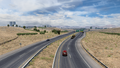
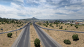
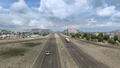
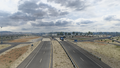
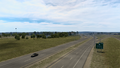
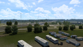
Barstow
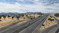
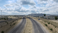
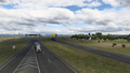
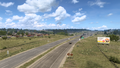
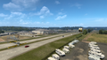
Needles
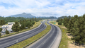
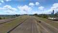
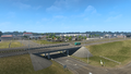
Kingman
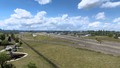
Seligman
Ash Fort
Flagstaff
Holbrook
Sanders
Gallup
North Acomita Village
Albuquerque
Santa Rosa
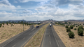
Tucumcari
Glenrio
Adrian
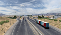
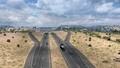
Amarillo
Shamrock
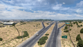
Clinton
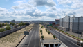
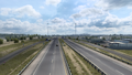
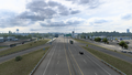
Oklahoma City
Midwest City
Henryetta
Checotah
Sallisaw


See also
| Cities |
| ||||||
|---|---|---|---|---|---|---|---|
| Highways |
| ||||||
| See also | |||||||
| Cities | |
|---|---|
| Highways | Interstate 8 • Interstate 10 • Interstate 15 • Interstate 17 • Interstate 19 • Interstate 40 • US 60 • US 64 • US 70 • US 89 • US 89A • US 93 • US 95 • US 160 • US 163 • US 180 • US 191 • SR 51 • SR 61 • SR 64 • SR 66 • SR 77 • SR 85 • SR 89 • SR 90 • SR 92 • SR 98 • SR 260 • SR 303 • SR 389 |
| See also | |
| Cities | Alamogordo • Albuquerque • Artesia • Carlsbad • Clovis • Farmington • Gallup • Hobbs • Las Cruces • Raton • Roswell • Santa Fe • Socorro • Tucumcari |
|---|---|
| Highways | |
| See also | |
| Cities | |
|---|---|
| Highways | Interstate 35 • Interstate 40 • Interstate 44 • Interstate 235 • Interstate 244 • US 54 • US 56 • US 59 • US 60 • US 62 • US 64 • US 69 • US 70 • US 75 • US 77 • US 81 • US 83 • US 183 • US 259 • US 270 • US 271 • US 277 • US 281 • US 287 • US 377 • US 385 • US 412 • SH-1 • SH-3 • SH-7 • SH-8 • SH-9 • SH-15 • SH-31 • SH-34 • SH-66 • SH-99 • SH-136 • SH-142 • SH-259A • SH-375 |
| See also | List of scenery towns in Oklahoma • List of landmarks in Oklahoma - List of Truck Stops in Oklahoma |