US 67
U.S. Route 67 (US 67) is a north–south United States Highway in Texas in American Truck Simulator. The route is separated into three sections: The first section runs from US 90 in Marfa to Alpine, concurrent with US 90. The second section runs from Interstate 10 in western Fort Stockton to Interstate 35W in Alvarado. The third section runs from Interstate 20, Interstate 35E, and US 77 in Dallas to Interstate 30 and FM 275 in Cumby, partially concurrent with Interstate 35E and mostly concurrent with Interstate 30.
In real life, US 67 spans a total length of 1,560 miles (2,511 km) from the Mexican border in Presidio, Texas, to Sabula, Iowa, near the state line with Illinois.
Course
US 67 begins at a junction with US 90 and SH 17 in Marfa and follows a concurrency with US 90 to the east. The highway passes by a rest stop, where it is also the "official" viewing area of the Marfa Lights observed near the highway at Mitchell Flats between Marfa and Mexico, which has gained some fame to onlookers attributing the paranormal phenomenon of ghosts, UFOs, or will-o'-the-wisp. Winding around Paisano Pass, the highway traces to the north and back east once again as it traces through the Trans-Pecos Volcanic Field, passing by Paisano Peak to the south, which formally functioned as a volcano until around 17 million years ago. As the highway enters Alpine, a section of the designated highway ends here, while US 90 continues east-southeast to Sanders and Del Rio. US 67 resumes at exit 256 of Interstate 10 in western Fort Stockton, following the latter as a concurrency and bypassing the city to the north. As it continues to bypass the city, it intersects US 285 and US 385, the latter of which joins US 67. Leaving Fort Stockton from the east, I-10 splits off of US 67 and US 385, which heads to San Antonio to the east. The highway continues to follow the 385 until it reaches McCamey; there, US 385 heads north to Odessa. The surrounding terrain of the highway changes as it traverses into the Edwards Plateau as it makes its way pass a wind farm and reaches San Angelo, where it intersects with US 87 and 277. Just northeast of San Angelo, US 277 breaks away from US 67 in real life; however, this concurrency is not in the game. Shortly afterwards, the highway follows a concurrency with US 83 through Ballinger, where it also intersects FM 382 in the middle of the highway's concurrency. Trending southeast, the highway reaches Early, where a truck stop is passed and intersects US 84, US 183, and US 377. From here, the 377 follows the highway as it traverses to the northeast through the southernmost portion of the Cross Timbers region, a strip of land that runs from southeastern Kansas across Oklahoma to Central Texas. The highway enters Comanche, and shortly afterwards, it enters Stephenville, where the 377 brances off of US 67 to the northeast inaccessibly. Trending east once again, the highway traverses through farmlands, passes by The Chisholm Trail Outdoor Museum next to Lake Pat Cleyburne, which was formed by damming the Nolan River, and intersects Interstate 35W in Alvarado; it is here that the second section of US 67 ends here. The highway resumes at the four-way stacked interchange serving Interstates 20 and 35E; the highway follows I-35E toward downtown Dallas, where it branches off of the 35E and follows Interstate 30, intersecting Interstate 45 shortly afterwards. The 67 travels through Garland before it crosses Lake Ray Hubbard into the towns of Rockwall and Greenville, where it intersects US 69. Upon entering Cumby, US 67 terminates at FM 275 in the said settlement, while I-30 continues east towards Texarkana and Arkansas.
Cities
Scenery towns
Junction list
| Location | mi | km | Destinations | Facilities | Notes | |
|---|---|---|---|---|---|---|
| Marfa | 0 | 0 | Southern terminus in-game; southern terminus of US 90 concurrency; US 67 continues south inaccessibly | |||
| 7 | 11 | Rest Stop | ||||
| 11 | 18 | Picnic Area / Marfa Lights | ||||
| 40 | 64 | Parking Area | ||||
| Alpine | 51 | 82 | Mosley Lane | Eastern terminus of US 90 concurrency; road continues as US 90; inaccessible | ||
| End first section; start second section | ||||||
| Fort Stockton | 51 | 82 | Southern terminus; southern terminus of I-10 concurrency; road continues as I-10; I-10 exit 256 | |||
| 59 | 95 | I-10 exit 257 | ||||
| 83 | 134 | Southern terminus of US 385 concurrency; I-10 exit 261 | ||||
| 95 | 154 | TOTSO; northern terminus of I-10 concurrency; I-10 exit 273 | ||||
| 103 | 166 | I-10 Frontage Road | Access to I-10 eastbound (and westbound picnic area), US 190, and FM 305 | |||
| 113 | 182 | Rest Stop | ||||
| McCamey | 127 | 205 | FM 305 is inaccessible | |||
| 166 | 268 | San Angelo Petrolucent Oil Well | ||||
| 188 | 304 | San Angelo Vitas Power Construction Site, Rest Stop | ||||
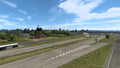
| 190 | 306 | Wind power plants | ||||
| San Angelo | 249 | 400 | ||||
| Ballinger | 287 | 462 | Southern terminus of US 83 concurrency | |||
| 295 | 475 | FM 382's direction is mislabeled as South on northbound signage | ||||
| 299 | 481 | TOTSO; northern terminus of US 83 concurrency | ||||
| Early | 352 | 566 | Aron Truck Stop | Southern terminus of US 84, US 183, and US 377 concurrencies | ||
| 355 | 572 | Northern terminus of US 84 and US 183 concurrencies | ||||
| 369 | 595 | Picnic Area | Northbound only | |||
| Comanche | 396 | 638 | Inaccessible | |||
| Stephenville | 411 | 661 | Rest Stop | |||
| 413 | 665 | Northwest Loop | Inaccessible | |||
| 416 | 670 | TOTSO; northern terminus of US 377 concurrency; US 377 northbound is inaccessible | ||||
| 427 | 687 | Fort Worth Grand Pastures Farm | ||||
| Alvarado | 480 | 773 | I-35W exit 26; US 67 continues east inaccessibly | |||
| End second section; start third section | ||||||
| Dallas | 480 | 773 | Northern terminus of I-35E concurrency; road continues as I-35E; I-20 exits 467 A-B; I-35E exits 418 A-B | |||
| 495 | 797 | TOTSO; northern terminus of I-35E concurrency; southern terminus of I-30 concurrency; I-30 exits 45 and 46; I-35E exits 427 A-B; US 67 northbound follows exit 427 A; US 67 southbound follows exit 46 | ||||
| See | ||||||
| Cumby | 569 | 916 | Northern terminus in-game; northern terminus of I-30 concurrency; road continues as I-30; I-30 exit 110 | |||
History
- In the intial version of the Texas map expansion DLC, US 67 was separated into three sections: The first section began at US 90 in Marfa and ended at Alpine, concurrent with US 90. The second section began at Interstate 10 in western Fort Stockton and ended at Interstate 35W in Alvarado. The third section began at Interstate 20 and US 77 and ended at Interstate 45 and US 75, entirely within Dallas, concurrent with Interstates 35E and 30.
- In update 1.48, the section of US 67 from Interstate 30, Interstate 45, and US 75 in Dallas to Interstate 30 and FM 275 in Cumby, concurrent with Interstate 30, was added.
Gallery
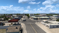
Marfa
Alpine
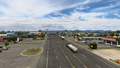
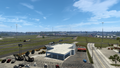
Fort Stockton
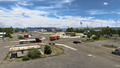
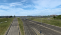
McCamey
San Angelo
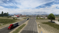
Ballinger
Early
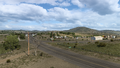
Comanche
Stephenville
Alvarado
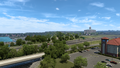
Garland
Rockwall
Greenville
Cumby


