US 62
U.S. Route 62 (US 62) is an east–west United States Highway in western Texas, southeastern New Mexico, northern Texas, and central Oklahoma in American Truck Simulator. The route is separated into five sections: The first section runs from El Paso to US 82 and SH 114 east of Lubbock. The second section runs from US 83 and FM 164 in Childress to Interstate 44, US 277, and US 281 in Lawton. The third section runs entirely within Oklahoma City, concurrent with Interstate 35 and Interstate 40. The fourth section runs entirely within Prague as a secret road. The fifth section runs from Interstate 40, US 75 and SH-375 in Henryetta to US 75 between Henryetta and Tulsa, concurrent with US 75. The highway, along with US 54 and US 180, also travels through two portions of Texas, separated by the portion in New Mexico.
In real life, US 62 spans a total length of 2,248 miles (3,618 km) from El Paso, Texas to Niagara Falls, New York. It is the only east–west US highway to connect Mexico and Canada.
Course
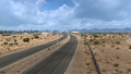
US 62 begins at Airway Boulevard in eastern El Paso, where it also begins its concurrency with US 180. The highway runs east, leaving the city after passing by El Paso International Airport to the south, and traces across the northwestern portion of the Trans-Pecos region in the Chihuahuan Desert, where the portion of Texas lies west of the Pecos River; this portion is also synonymous with "Far West Texas", a subdivision of West Texas. The highway passes by a Border Patrol Interior Checkpoint, and soon afterwards, it crosses the salt flats, historically known as the site of the San Elizario Salt War, which occurred between 1877 and 1878. After crossing the salt flats, US 62 winds through the Guadalupe Mountains. As it traverses across the mountain range, the highway passes by El Capitan to the west, where a rest stop and a viewpoint are provided here, and the Pinery Butterfield Stage ruins, where a second rest stop is provided; shortly afterwards, the highway passes by a third rest stop.
A little while after tracing through the Guadalupe Mountains, US 62 enters New Mexico in the southeast. The highway heads northeast to the resort town of Whites City nearby Carlsbad Caverns National Park; soon afterwards, it enters the city of Carlsbad from the south, where it follows a short concurrency with US 285 within the southern limits of the city, and then it turns to the east, crossing the Pecos River before leaving downtown. As it continues to trace across the Chihuahuan Desert, the highway intersects NM 529 approximately half-way across its course from Carlsbad to Hobbs, which is the next city the highway enters within its course in New Mexico. In Hobbs, the highway intersects NM 18 and NM 218 as it runs through the city.
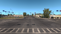
US 62 re-enters Texas in the northwestern part of the state and continues to run eastward as it traces through the cotton fields into Seminole, where it intersects US 385 and heads northeast, leaving its long-run concurrency with US 180 from its western terminus in El Paso. The highway traverses several farmlands as it approaches Lubbock, where it begins its concurrency with US 82 in the western limits of the city. Here, the highway also intersects US 84, and the overlapped highway of Interstate 27 and US 87. The highway then approaches an access road to an oil drilling site operated by Petrolucent; it is here that a section of US 62 ends here, while US 82 continues to run towards the escarpment of the Llano Estacado and Wichita Falls. The highway resumes at an intersection with FM 164 south of Childress, where it begins to follow US 83 within the city and beyond, intersecting US 287 and into the southeastern part of the Texas panhandle. US 62 crosses the Red River before turning east, branching off of the 83, and then it crosses Buck Creek.
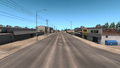
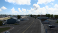
US 62 passes by a Mary's Cotton plant (shown as part of Lawton) as soon as it enters Oklahoma in the southwest, paralleling the state line with Texas to the south. The highway traces onto the Wichta Uplift and through the town of Altus. Soon after crossing the North Fork Red River, the 62 intersects US 183, which serves the city of Clinton to the north, and then it crosses Blue Beaver Creek before entering Lawton. US 62 bypasses Lawton to the north, following Rogers Lane to intersect Interstate 44, US 271, and US 281; here, another gap in the route begins, and the 62 resumes at Interstate 35 in Oklahoma City, the state capital of Oklahoma. The highway follows several concurrencies with the latter route, Interstate 40, US 77, and US 270 as it travels through the city and around the downtown district to the south and east; soon afterwards, another gap in the route begins at Interstate 44, northeast of Oklahoma City. The highway resumes as a short section through the secret town of Prague as well as being functioned as a secret road; here, it intersects US 377 and SH-99 (both of which are also secret roads). Once again, US 62 resumes at a cloverleaf interchange serving Interstate 40, US 75 (as a concurrency), and SH-375 in Henryetta. The current eastern terminus of US 62 ends at an intermediate interchange on US 75 between Henryetta to the south and Tulsa to the north.
Cities
West Texas
New Mexico
Scenery towns
North Texas
Oklahoma
- Lawton
- Oklahoma City
- Tulsa (via US 75)
Junction list
West Texas
| Location | mi | km | Destinations | Facilities | Notes |
|---|---|---|---|---|---|
| El Paso | 0 | 0 | Airway Boulevard | Western terminus in-game; western terminus of US 180 concurrency; access to I-10 in-game; US 62 and US 180 continue west inaccessibly | |
| 0 | 1 | El Paso Wallbert Warehouse | |||
| 1 | 2 | Inaccessible; I-10 is accessed by Airway Boulevard in-game | |||
| 2 | 4 | Global Reach Drive / Yarbrough Drive | Access to El Paso Freight depot; Yarbrough Drive is inaccessible | ||
| 30 | 48 | Inspection Station | Eastbound only; closed | ||
| 46 | 74 | Picnic Area | |||
| 49 | 80 | The Salt Flats | |||
| 80 | 129 | Picnic Area / El Capitan | |||
| 101 | 162 | Butterfield Stage Station | |||
| 104 | 168 | Picnic Area |
New Mexico
| Location | mi | km | Destinations | Facilities | Notes |
|---|---|---|---|---|---|
| Whites City | 136 | 218 | Carlsbad Caverns National Park | Inaccessible | |
| Carlsbad | 153 | 247 | Western terminus of US 285 concurrency | ||
| 161 | 259 | Lea Street | |||
| 161 | 260 | Fusion Travel Plaza | |||
| 161 | 260 | TOTSO; eastern terminus of US 285 concurrency | |||
| 161 | 260 | Canyon Street | |||
| 162 | 260 | Carlsbad Tidbit Market | |||
| 169 | 272 | Relief Route | |||
| 195 | 314 | Eastern terminus of NM 529 | |||
| Hobbs | 203 | 328 | Grimes Street | ||
| 204 | 329 | Turner Street | |||
| 205 | 330 | Southern terminus of NM 18 | |||
| 212 | 342 | Eastern terminus of NM 218 |
North Texas
| Location | mi | km | Destinations | Facilities | Notes |
|---|---|---|---|---|---|
| 220 | 354 | Odessa Mary's Cotton Plant | |||
| Seminole | 233 | 375 | TOTSO; eastern terminus of US 180 concurrency | ||
| Lubbock | 285 | 459 | Texas Tech Parkway | Eastbound exit and westbound entrance; western terminus of US 82 concurrency; inaccessible | |
| 307 | 494 | US 84 eastbound is inaccessible | |||
| 320 | 515 | I-27 exit 4 | |||
| 338 | 545 | Lubbock Petrolucent Drilling Site | Eastern terminus of US 82 concurrency; road continues as US 82 and SH 114 | ||
| End first section; start second section | |||||
| 338 | 545 | Western terminus of US 83 concurrency; road continues as US 83; FM 164 is inaccessible | |||
| Childress | 350 | 563 | |||
| 352 | 566 | Gallon Oil Truck Stop | |||
| 388 | 625 | TOTSO; eastern terminus in Texas DLC; eastern terminus of US 83 concurrency | |||
| 396 | 638 | Inaccessible | |||
Oklahoma
| Location | mi | km | Destinations | Facilities | Notes |
|---|---|---|---|---|---|
| 401 | 645 | Lawton Mary's Cotton Plant | Western terminus in Oklahoma DLC | ||
| Altus | 423 | 681 | Hudson Street | Inaccessible | |
| 425 | 684 | Inaccessible | |||
| 429 | 690 | Park Lane | Inaccessible | ||
| 453 | 729 | US 183 southbound is inaccessible | |||
| Lawton | 477 | 767 | Quanah Parker Trailway | Eastbound exit and westbound entrance | |
| 486 | 783 | Northwest 82nd Street | |||
| 511 | 822 | Northern terminus of US 277 and US 281; road continues as I-44; I-44 exits 40 A-B-C | |||
| End second section; start third section | |||||
| Oklahoma City | 511 | 822 | Southeast 15th Street | Western terminus of I-35 and US 77 concurrencies; road continues as I-35; I-35 exit 125 | |
| See | |||||
| Oklahoma City | 549 | 883 | Eastern terminus of I-35 concurrency; road continues as I-35; I-44 westbound is inaccessible | ||
| End third section; start fourth section | |||||
| Prague | 549 | 883 | Minor road | Western terminus of secret road; US 62 continues west inaccessibly | |
| 550 | 886 | Eastern terminus of secret road; US 62 continues east inaccessibly; US 377 and SH-99 northbound are inaccessible | |||
| End fourth section; start fifth section | |||||
| Henryetta | 550 | 886 | Northern terminus of SH-375; western terminus of US 75 concurrency; I-40 exits 240 A-B | ||
| 565 | 909 | Eastern terminus in-game; road continues as US 75 | |||
History
- In the initial version of the New Mexico map expansion DLC, US 62 began at an intersection with US 285 in Carlsbad and ended at an intersection with NM 218 in Hobbs.
- In the initial version of the Texas map expansion DLC, the sections of US 62 from El Paso to Carlsbad, from NM 218 in Hobbs to US 82 and SH 114 east of Lubbock, and from US 83 and FM 164 to due north of US 287, concurrent with US 83, within Childress were added.
- In update 1.48, the section of US 62 from Childress to the end of the concurrency with US 83 between Childress and Shamrock was added.
- In the initial version of the Oklahoma map expansion DLC, the sections of US 62 from US 83 between Childress and Shamrock to Interstate 44, US 277, and US 281 in Lawton, in Oklahoma City, concurrent with Interstate 35 and Interstate 40, in Prague, as a secret road, and from Interstate 40, US 75 and SH-375 in Henryetta to US 75 between Henryetta and Tulsa were added.
Gallery
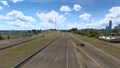
El Paso
Carlsbad
Hobbs
Seminole
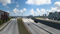
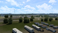
Lubbock
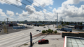
Childress
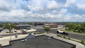
Altus
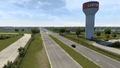
Lawton
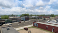
Oklahoma City
Prague
Henryetta


See also
| Cities | Alamogordo • Albuquerque • Artesia • Carlsbad • Clovis • Farmington • Gallup • Hobbs • Las Cruces • Raton • Roswell • Santa Fe • Socorro • Tucumcari |
|---|---|
| Highways | |
| See also | |
| Cities | |
|---|---|
| Highways | Interstate 35 • Interstate 40 • Interstate 44 • Interstate 235 • Interstate 244 • US 54 • US 56 • US 59 • US 60 • US 62 • US 64 • US 69 • US 70 • US 75 • US 77 • US 81 • US 83 • US 183 • US 259 • US 270 • US 271 • US 277 • US 281 • US 287 • US 377 • US 385 • US 412 • SH-1 • SH-3 • SH-7 • SH-8 • SH-9 • SH-15 • SH-31 • SH-34 • SH-66 • SH-99 • SH-136 • SH-142 • SH-259A • SH-375 |
| See also | List of scenery towns in Oklahoma • List of landmarks in Oklahoma - List of Truck Stops in Oklahoma |