Interstate 69E
Interstate 69E (I-69E) is a north–south Interstate Highway in southern Texas in American Truck Simulator. The route is separated into two sections: The first section runs from SH 4 in Brownsville to US 77 north of Interstate 2. The second section runs from US 77 north of Riviera to Interstate 37 in Corpus Christi. Both sections run concurrently with US 77, while it also partially runs concurrent with US 83 between Brownsville and Interstate 2.
Along with Interstate 2, the section of I-69E at Brownsville is disconnected from the rest of the Interstate Highway System, as well as in real life. The route is also disconnected from its parent route, Interstate 69, along with Interstate 69W (which connects with the rest of the Interstate Highway System, only serving I-35) and Interstate 369 (similarly with I-69W but only serving I-30). In real life, I-69E is planned to be connected with the rest of the system in the future, and it will extend northward and terminate near Victoria as both I-69E and I-69W merge into I-69 toward Houston.
Course
Interstate 69E begins at SH 4 in Brownsville and runs to the north, concurrent with US 77 and US 83. As it leaves Brownsville, I-69E intersects SH 48 and enters Harlingen soon afterwards. There, it intersects FM 801 and then Interstate 2, where US 83 leaves I-69E. I-69E leaves the Brownsville–Harlingen metropolitan area and continues north for an approximate of 10-20 miles until reaching the highway's gap in the route. North of Riviera, the 69E resumes and enters Corpus Christi. It intersects FM 624, and then it reaches its northern terminus at Interstate 37.
Cities
Scenery towns
Exit List
| Location | mi | km | Exit | Destinations | Facilities | Notes |
|---|---|---|---|---|---|---|
| Brownsville | 0 | 0 | 1 | Southern terminus in-game; southern terminus of US 77 concurrency; southern terminus of US 83 concurrency; SH 4 westbound is inaccessible | ||
| 6 | 10 | 2 | SH 48 westbound is inaccessible | |||
| Harlingen | 23 | 37 | 25 | Southbound exit and northbound entrance; Loop 499 is inaccessible | ||
| 25 | 40 | 26 | Eastern terminus of I-2; northern terminus of US 83 concurrency; I-2 exit 176 | |||
| 58 | 94 | 32 | Sid Jones Road | Southbound exit and northbound entrance; Inaccessible | ||
| Road continues as US 77; northern terminus of US 77 concurrency | ||||||
| End first section; start second section | ||||||
| 58 | 94 | Road continues as US 77; southern terminus of US 77 concurrency | ||||
| Corpus Christi | 64 | 103 | ---- | Eastern terminus of FM 624 | ||
| 78 | 126 | ---- | Northern terminus; northern terminus of US 77 concurrency; I-37 exit 14 | |||
Gallery
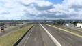
Brownsville
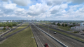
Harlingen
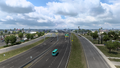
Corpus Christi


Trivia
- Most route markers (except for guide signs) at the section in Corpus Christi mislabel the highway as "Interstate 69". The mislabeling of the Interstate is actually the same as to in real life. Example 1 and Example 2; note that these locations are in or nearby Corpus Christi.