Interstate 80

|
This article needs a clean-up.
You can help Truck Simulator Wiki by re-organizing parts of the article, checking grammar / spelling, and doing other helpful things to correct the article.
|
Interstate 80 (I-80) is an east–west Interstate Highway in northern California, Nevada, and Utah, and southern Wyoming in American Truck Simulator. It runs the long distance from The Embarcadero in San Francisco to Interstate 180 and US 85 in Cheyenne.
In real life, Interstate 80 runs from San Francisco to Teaneck, New Jersey. It is the second-longest Interstate Highway in the United States and the tenth longest highway in the world, after Interstate 90.
There is one toll gate on Interstate 80, charging vehicles crossing from Oakland to San Francisco over the San Francisco–Oakland Bay Bridge. This toll costs $25 to go through. There is no toll to leave San Francisco.
Course
Interstate 80 begins at US 101 in Mission outside of San Francisco at an interchange called The Stacks. The freeway enters the Bayshore Viaduct and goes half a mile to its former terminus at Exit 1 which connects to Fremont Street and The Embarcadero Eastbound drivers can exit onto Bryant and head to the port while westbound drivers get off at Fremont at Exit 2C Exit 2B connects to Harrison Street and a return to the freeway. Interstate 80 then starts its transcontinental run by merging onto the San Francisco–Oakland Bay Bridge, which consists of two differently-designed spans separated by stacked tunnels through Yerba Buena Island (eastbound traffic travels underneath westbound traffic). On the east side of the bay, after passing the westbound toll gate in Oakland, the highway enters the McArthur Maze where it splits into three freeways Interstate 580, Interstate 880, and Interstate 80. After exiting the Maze Interstate 80 becomes the Eastshore Freeway and runs concurrent with Interstate 580 for a short distance to Richmond with concurrency terminating near SR 4 at the west end of the Richmond Parkway. Leaving the Bay area, I-80 crosses the San Andreas Fault and enters the city of Vallejo, where it crosses the Carquinez Bridge. Westbound drivers do not need to pay anything and get a free ride all the way to Oakland, but eastbound drivers have to pay a $20 toll after crossing the bridge. After intersecting with SR 37, the highway turns east into the Sacramento Valley, where it passes through the north end of the city of Sacramento and intersects with US 50 and Interstate 5. Once past the state capital, the highway progresses to the Sierra Nevada via Donner Pass (7227 ft), where it crests the summit at a rest area. On the east slope, I-80 passes through Truckee, just east of the pass' summit. Shortly after leaving Truckee, the highway passes a westbound weigh station, which also houses the California Border Protection Stations. Past the weigh station, the road bends north and south as it approaches Nevada.
After crossing the border Interstate 80 goes around a bend and enters the city of Reno, where it intersects with US 395 and Interstate 580. After leaving Reno, the highway begins its long course across the Great Basin, a route across the vast, mountainous desert that closely follows the path of the California Trail. As the highway trends north, it comes across an eastbound weigh station shortly after Reno. At the end of the long, northeast span the highway meets the first exit in 273 miles, for the town of Winnemucca and US 95. Then the highway begins running alongside the Humboldt River as it leads to Battle Mountain and SR 305, where a small gas station is provided, and soon after crosses the Humboldt twice at the Carlin Tunnels (which, in the game, are significantly further west than in reality). Continuing east, Elko and SR 225 are reached, and after east and westbound weigh stations the highway stretches towards Wells and US 93. Out of Wells the highway appears to cross the Toano Range via Silverzone Pass (5940 ft), and descends to the state-line town of West Wendover and US 93 Alternate.
At the Utah border, West Wendover becomes Wendover and, after east and westbound weigh stations, Interstate 80 crosses the white, flat expanse of the Great Salt Lake Desert, a minimalist landscape notable for the land speed records set here. Leaving these salt flats, the highway skirts the northern edge of the Cedar Mountains, where the chimney of the Kennecott Smelter (an Avalanche Steel facility) can be seen. This smokestack, at 1215 ft (370 m), is the tallest free-standing structure in the American West and the fourth-tallest chimney in the world. After passing the smelter the highway enters Salt Lake City, Utah's capital and largest city, where it intersects with Interstate 15. The highway leaves the city via Parleys Canyon, one of the few highway routes across the historically daunting Wasatch Mountains, and meets with US 40 and 189 at Silver Summit, this being the former's western terminus. Past this summit, the highway descends into the valley of the Weber River, which features overlooks by the Echo Reservoir, and meets with Interstate 84 at its eastern terminus.
Past the junction with I-84, the 80 climbs through the red-walled Echo Canyon, which features Utah's Echo Port of Entry, a weigh station that offers a rest area. Out of the canyon, the highway enters Wyoming, where there is another port of entry and the city of Evanston. Past Evanston, the 80 crosses the Bear River Divide, exiting the Great Basin; here there is a length of highway called the "Highway to Heaven," a long, straight, hilly stretch of road that, when viewed from the correct angle and under the right conditions, appears to reach into the sky. Now back in the watershed of the Pacific, the highway meets with US 30 at Little America, the 30 beginning a concurrency near the famous truck stop. Soon the 80 passes to the north of the town of Green River; here the highway begins running along the southern edge of White Mountain, a large mesa lined with dramatic cliffs and buttes, with the 80 passing through a promontory via the Twin Tunnels. Past Green River, the highway runs through Rock Springs, where it crosses paths with US 191. Out of Rock Springs, the 80 enters the Red Desert and the Great Divide Basin, a rugged, alkaline desert that makes up much of the highway between Rock Springs and Rawlins. In this desert the 80 meets WY 789, the longest state highway in Wyoming, having come up from Baggs and the Colorado state line. The 789 runs concurrent with the 80 as it exits the Red Desert and enters the Atlantic watershed, and breaks away at Rawlins, where US 287 begins a concurrency. East of Rawlins the 80 passes to the south of Sinclair, a town dominated by its refinery, a significant landmark along the 80. The highway then curves around Laramie, and rejoins with US 30; in real life, the 30 breaks from I-80 east of Sinclair and heads northeast to Medicine Bow, a segment of the highway sacrificed due to the condensed nature of the game's map. It is also at Laramie that US 287, in real life, breaks from the 80, heading south to Fort Collins. Out of Laramie, the 80 enters the forested Laramie Mountains, where it climbs to Sherman Summit, which, at an elevation of 8640 ft (2630 m), is the highest point of I-80; the summit offers a rest area, which features a bronze bust of Abraham Lincoln (16th US president), commemorating the Lincoln Highway, one of the earliest transcontinental highways, which also reached its high point in the Laramies. Descending from Sherman Summit, the 80 passes the very small town of Buford (population: 1) and soon after reaches Cheyenne, the largest city and state capital of Wyoming, and Interstate 25. I-80 currently ends at Interstate 180/US 85, and will eventually be extended into Nebraska.
It is worth noting the historical significance of I-80's route. From Sacramento to Fort Bridger (the nearest in-game town being Little America), the highway follows the route of the California Trail by way of the Hastings Cutoff, a mid-19th century wagon trail notably followed by the infamously ill-fated Donner Party, the namesake of Donner Pass. From Sacramento to Omaha, Nebraska, the highway follows the general route of the First Transcontinental Railroad, the railroad's legacy being prominent in the string of cities along the highway in Wyoming. I-80 has also, for the most part, superceded the route of the Lincoln Highway, which, dedicated in 1913, is one of the earliest transcontinental highways.
Cities
California
Nevada
Scenery towns
Utah
Scenery towns
Wyoming
Scenery towns
Exit list
California
| Location | mi | km | Exit | Destinations | Facilities | Notes |
|---|---|---|---|---|---|---|
| San Francisco | 0 | Exit 433 A and B US 101 | West terminus in game | |||
| 1 | Exit 1 Bryant Street Eastbound | The Embarcadero | ||||
| 2 | Exit 2C The Embarcadero Harrison Street Exit 2B Fremont Street Folsom Street | The Embarcadero | West terminus in game | |||
| 25 | -- | San Franciso–Oakland Bay Bridge Toll Booth | Westbound only toll | |||
| Oakland | 27 | 8 B 8 A | West end of I-580 concurrency | |||
| Berkeley | 41 | 9 | Powell Street Emeryville Berkley | |||
| Richmond | 13 | East end of I-580 concurrency Eastbound exit and westbound entrance | ||||
| Crockett | 27 | Pomona Street – Crockett | ||||
| Vallejo | ---- | Carquinez Bridge Toll Booth | Toll eastbound only | |||
| 33 | ||||||
| Sacramento | 82 | US 50 exit 1 A | ||||
| 85 | West El Camino Avenue | |||||
| 86 | I-5 exit 522 | |||||
| 174 | Soda Springs, Norden | |||||
| ---- | Rest area | |||||
| Truckee | 185 | |||||
| ---- | Border Protection Station, weigh station | Westbound only |
Nevada
| Location | mi | km | Exit | Destinations | Facilities | Notes |
|---|---|---|---|---|---|---|
| Reno | 13 | Virginia Street – Downtown | ||||
| 243 | 15 | I-580 and US 395 exits 68 A–B | ||||
| 250 | -- | Reno | ||||
| 287 | -- | Weigh Station | Eastbound only | |||
| Winnemucca | 423 | -- | Winnemucca | Access to US 95 North | ||
| Battle Mountain | 443 | -- | ||||
| Elko | 523 | 301 | ||||
| 527 | 303 | Elko East | ||||
| 542 | ---- | Weigh Station | ||||
| Wells | 562 | 352 | East terminus in base game West end of US 93 Alt. concurrency | |||
| West Wendover | 628 | 410 | East end of US 93 Alt. concurrency |
Utah
| Location | mi | km | Exit | Destinations | Facilities | Notes |
|---|---|---|---|---|---|---|
| 650 | -- | Port of Entry The Bonneville Salt Flats |
Eastbound only | |||
| Salt Lake City | 718 | 104 | ||||
| 729 | 113 | |||||
| 733 | 120 | Eastbound TOTSO West end of I-15 concurrency | ||||
| 737 | 121 | Eastbound only Inaccessible | ||||
| 749 | 123 A | Westbound only Inaccessible | ||||
| 752 | 123 B | Westbound TOTSO East end of I-15 concurrency | ||||
| Silver Summit | 770 | 146 | West end of US 189 concurrency | |||
| 784 | -- | Rest Area | ||||
| 790 | 168 | |||||
| -- | Port of Entry | Westbound only |
Wyoming
| Location | mi | km | Exit | Destinations | Facilities | Notes |
|---|---|---|---|---|---|---|
| -- | Port of Entry | Eastbound only | ||||
| Evanston | 3 | |||||
| 6 | East end of US 189 concurrency | |||||
| 66 | West end of US 30 concurrency | |||||
| Little America | 68 | Little America | Access to NAMIQ depot | |||
| Rock Springs | 99 | West end of US 191 concurrency | ||||
| 102 | Access to Wallbert depot | |||||
| 104 | East end of US 191 concurrency | |||||
| Creston Junction | 187 | West end of WYO 789 concurrency | ||||
| Rawlins | 209 | Johnson Rd | ||||
| 211 | East end of WYO 789 concurrency | |||||
| 215 | West end of US 287 concurrency | |||||
| Sinclair | 221 | Sinclair | East end of US 30 / US 287 concurrency | |||
| Laramie | 310 | |||||
| 316 | West end of US 30 concurrency | |||||
| 323 | ||||||
| Cheyenne | 357 | East end of US 30 concurrency | ||||
| 359 A, C | ||||||
| 362 | East terminus in game | |||||
Business Routes

| This page uses Creative Commons Licensed content from Wikipedia (view authors). |
Cities
Interstate 80 has business routes in 6 cities:
California
Sacramento

Interstate 80 Business is a business loop that runs through Sacramento. The entirety of the route runs a concurrency with US 50 and does not rejoin I-80 at another end of the freeway in the game. The freeway beings at exit 82 of I-80 west of the city. From west to east, the freeway has interchanges with Harbor Boulevard and I-5 until reaching its eastern terminus with SR 16 east of the city.
Major intersections and facilities
| mi | km | Exit | Destinations | Facilities | Notes |
|---|---|---|---|---|---|
| 0 | 0 | ---- | West terminus; road continues as I-80 | ||
| 1 A | Westbound exit and eastbound entrance; I-80 exit 82 | ||||
| 1 B | Harbor Boulevard | ||||
| 4 | I-5 exit 518 | ||||
| 9 | East terminus; US 50 continues east inaccessibly |
Wyoming
Evanston


Interstate 80 Business and US 189 Business are business loops that run through Evanston. The highway begins at exit 3 of I-80 and US 189; the ramp from westbound I-80 to the business route lies east of the other three ramps of the diamond interchange. The business routes heads east along Harrison Drive, which veers northeast onto 11th Street at the western edge of the city street grid. In the downtown area, I-80 Bus. turns southeast onto Front Street. At the intersection of Front Street and Sixth Street, which is the northern terminus of WYO 150 and the southern terminus of WYO 89, the business route turns north and crosses a rail line. The highway turns east onto Bear River Drive and follows that road until it rejoins with I-80 at exit 6.
Major intersections and facilities
TBA
Rock Springs


Interstate 80 Business and US 30 Business are business loops that run through Rock Springs. The highway follows the entirety of Dewar Drive from exit 102 of I-80 to its eastern terminus with Elk Street and A Street.
Major intersections and facilities
TBA
Rawlins

Interstate 80 Business and US 30 Business are business loops that run through Rawlins. The highway begins at I-80 Exit 211 on the western edge of the city and heads east concurrently with WYO 789 along Spruce Street. In downtown Rawlins, at the intersection of Spruce Street and Third Street, the business route turns south onto Third Street, WYO 789 turns north onto Third Street, and the business route begins to run concurrently with US 287. I-80 Bus. and US 287 then turn east onto Cedar Street. The highways meets the southern end of US 287 Bypass (Higley Boulevard) shortly before reaching its eastern end at I-80 Exit 215. Within the trumpet interchange on the south side of I-80, the interchange ramps meet the western end of WYO 76, which heads east toward Sinclair.
Major intersections and facilities
TBA
Laramie

Interstate 80 Business is a business loop that runs through Laramie. I-80 Bus. begins at I-80 Exit 310 and heads east along Curtis Street. The business route turns south onto Third Street, along which the highway runs concurrently with US 30 and US 287. In downtown Laramie, I-80 Bus. and US 30 turn east onto Grand Avenue. The highway curves southeast and leaves the city of Laramie just north of its end at the trumpet interchange of I-80 Exit 316.
Major intersections and facilities
TBA
Cheyenne

Interstate 80 Business is a business loop that runs through Cheyenne. The highway begins at the northern terminus of WYO 222, which is located north of I-80 Exit 357, and follows West Lincolnway to downtown. The business route ends at US 85, I-25 Bus., and the northern end of I-180.
Major intersections and facilities
TBA
History

- In the initial version of American Truck Simulator, Interstate 80 was split in two sections. The first section began at the Embarcadero in San Francisco and headed east over the San Francisco–Oakland Bay Bridge. Where Interstate 80 currently intersects with Interstate 580 and continues north, it turned to the south and continued as Interstate 580. The second section began at the junction with SR 37 between San Rafael and Sacramento and ended at US 93 in Wells.
- In update 1.5, as part of the 1:35 to 1:20 map rescale, the section of Interstate 80 from Oakland to SR 37 was added. Between Sacramento and Wells, new sections, including Donner Pass, were added to the existing route to accommodate the new map scale. In Reno, the diamond interchange with Interstate 580 and US 395 was changed to a "Spaghetti Bowl" junction.
- In update 1.32, the diamond interchange with Reed Avenue in Sacramento was changed to a folded diamond interchange, and the cloverleaf interchange with Interstate 5 was changed to a cloverstack interchange.
- In the initial version of the Utah map expansion DLC, the section of Interstate 80 from US 93 in Wells to Interstate 84 and US 189 east of Salt Lake City was added.
- In the initial version of the Wyoming map expansion DLC, the section of Interstate 80 from Interstate 84 and US 189 east of Salt Lake City to Interstate 180 and US 85 in Cheyenne was added.
- In update 1.44, as part of the second phase of the California rework, the section of Interstate 80 from Berkeley to Reno was completely reworked, including a complete rework of Sacramento and Truckee. The diamond interchange in Richmond was removed as SR 4 was removed west of Stockton, all other junctions were rebuilt, and the semi-directional T interchange with US 50 and unsigned I-80 Business in Sacramento and the diamond interchange with Donner Pass Road northwest of Truckee were added. The scenery towns of Crockett, Vallejo, and Verdi were added. The Carquinez Bridge with a toll gate, a Border Protection Station northeast of Truckee, a rest area northwest of Truckee, and a truck stop in Sacramento were added. The truck stop west of Reno was removed.
- In update 1.50, as part of Phase 3 of the California rework, The Fremont Street ramp was rebuilt and the King Street ramp onto the Embarcadero was closed. Eastbound traffic can assess the Embarcadero from Bryant Street. Interstate 80 now connects to 101 at the Mission Stack Interchange a mile away. The McArthur Maze was rebuilt but to fit it in University Ave in Berkley was taken out and Powell Street in Emeryville was put in in its place. The Bay Bridge has been completely rebuilt and all three lanes and the bike path were installed. to put it in the rest area at the toll plaza was taken out and the 580 on ramp was moved so The McArthur Maze can be put in along with Interstate 980 which is inaccessible. In real life trucks are prohibited on 980 and part of 880 because Oakland banned trucks and all truck traffic must use 580 to get around town.
Gallery
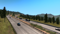
Donner Pass (before update 1.44)

See also
| Cities |
| ||||||
|---|---|---|---|---|---|---|---|
| Highways |
| ||||||
| See also | |||||||
| Cities | |
|---|---|
| Highways | Interstate 11 • Interstate 15 • Interstate 80 • Interstate 515 • Interstate 580 • US 6 • US 50 • US 93 • US 93 Alternate • US 95 • US 395 • SR 140 • SR 208 • SR 225 • SR 292 • SR 305 • SR 319 • SR 374 • SR 375 • SR 376 |
| See also | |
| Cities | Cedar City • Logan • Moab • Ogden (Roy) • Price • Provo (Mapleton, Orem, Spanish Fork) • Salina - Salt Lake City (Garfield, Herriman, Sandy, West Valley City) • St. George • Vernal |
|---|---|
| Highways | |
| See also | |
| Cities | Casper (Brookhurst, Mills) • Cheyenne (Fox Farm-College, South Greeley) • Cody • Evanston • Gillette • Jackson • Laramie • Rawlins (Sinclair) • Riverton • Rock Springs • Sheridan |
|---|---|
| Highways | Interstate 25 • Interstate 80 • Interstate 90 • Interstate 180 • US 14 • US 14 Alternate • US 16 • US 18 • US 20 • US 26 • US 30 • US 85 • US 87 • US 89 • US 189 • US 191 • US 287 • US 310 • WYO 22 • WYO 28 • WYO 50 • WYO 51 • WYO 59 • WYO 76 • WYO 89 • WYO 94 • WYO 110 • WYO 120 • WYO 135 • WYO 150 • WYO 210 • WYO 212 • WYO 220 • WYO 222 • WYO 258 • WYO 339 • WYO 351 • WYO 374 • WYO 450 • WYO 487 • WYO 789 |
| See also | |