US 180
U.S. Route 180 (US 180) is an east–west United States Highway in central Arizona, southwestern New Mexico, western Texas, southeastern New Mexico, and northwestern Texas in American Truck Simulator. The route is separated into four sections: The beginning of the first section is uncertain and ends at Interstate 40 Business and SR 77 in Holbrook, mostly concurrent with Interstate 40. The second section runs from St. Johns to a rest stop on US 191 south of Springerville, concurrent with US 191. The third section runs from NM 418 in Deming to US 54 in El Paso, concurrent with Interstate 10. The fourth section runs from El Paso, northeast of the junction with Interstate 10 and US 54, to US 87 in Lamesa, mostly concurrent with US 62. The highway also travels through two portions of New Mexico and Texas respectively. It is one of few routes, along with US 54 and US 62, to have two portions in at least one state.
In real life, US 180 spans at least 1,000 mi (1,609 km). Due to its uncertainty of its western terminus between Valle and the Grand Canyon in Arizona, the exact length of the highway is completely unknown; however, the measurement as of 2020 yielded 1,111.6 miles (1,788.9 km) according to US Ends.com.[1] The eastern terminus of US 180 is at Interstate 20 in Hudson Oaks, Texas.
Course
According to the AASHTO U.S. Highway logs, US 180 begins at SR 64 in Valle. Although the highway shows that it continues north to Grand Canyon Village, this portion of highway is not certain whether it follows a concurrency with SR 64 to the south rim of the Grand Canyon, or it simply ends in Valle. The highway runs southeast and passes through the San Francisco Peaks, the highest peaks in Arizona, as it enters Flagstaff, where it runs concurrent with Interstate 40 Business and the Historic US 66. It intersects the southern terminus of US 89; soon afterwards, US 180 overlaps with Interstate 40 until it branches off in Holbrook; here, it overlaps with SR 77 and Interstate 40 Business (Navajo Boulevard) until it reaches a gap at the intersection with Hopi Drive. The highway resumes in St. Johns and follows a small portion of SR 61, and then it turns south, overlapping US 191; soon afterwards, US 180 turns to the east and overlaps with US 60 while it continues to run a concurrency with US 191 into Springerville, where a weigh station is passed. The highway turns south once again as it continues to follow the 191 until another gap in the route begins at a rest stop south of Springerville.
US 180 resumes at exit 68 of Interstate 10 and US 70 in Deming and runs concurrent with the highways throughout southwestern New Mexico. The only city between the state boundaries is Las Cruces, where the 70 branches off of I-10 and US 180 and intersects Interstate 25.
The highway in Texas continues to overlap with I-10 as it runs through the El Paso metropolitan area. It serves the border town of Anthony, where a truck stop and a viewpoint are presented via FM 1905. In El Paso, a third gap in the route is presented, starting at the interchange with US 54 and resuming its course at Airway Boulevard. At this point, the highway begins its concurrency with US 62 across the Trans-Pecos region. A Border Patrol Interior Checkpoint is passed, and soon afterwards, two viewpoints are presented at the salt flats and in the Guadalupe Mountains respectively. The highway winds through the mountains as it makes its way back into New Mexico.
For a second time, US 180 reenters New Mexico in the southeast. It continues to overlap with US 62, passes by Carlsbad Caverns National Park, until entering the city of Carlsbad, where it follows a short concurrency with US 285 through the city. As the highway traverses east across the Chihuahuan Desert, it intersects NM 529; soon afterwards, it enters Hobbs, where it intersects NM 18 and NM 218.
US 180 reenters Texas in the northwest and passes by a cotton field, operated by Mary's Cotton as part of Odessa, and intersects US 385 in Seminole. It is also here that US 62 branches off of the 180 and heads northeast towards Lubbock. US 180 continues to head east across several more cotton fields until it reaches its eastern terminus at US 87 in Lamesa.
Cities
Arizona
- Grand Canyon Village (via SR 64)
- Flagstaff
- Holbrook
- Show Low (via US 60 or SR 77)
- Clifton (via US 191)
Scenery Towns
New Mexico (Southwest)
Texas (Trans-Pecos)
Scenery towns
New Mexico (Southeast)
Scenery towns
Texas (Northwest)
Junction list
Arizona
| Location | mi | km | Destinations | Facilities | Notes |
|---|---|---|---|---|---|
| Valle | 0 | 0 | Western terminus according to the AASHTO U.S. Highway logs; signage of US 180 continues concurrently with SR 64 to the north | ||
| 0 | 0 | Minor road | |||
| Flagstaff | 30 | 48 | Flagstaff Plaster & Sons Construction Site | ||
| 30 | 49 | NAF Gas Station | |||
| 31 | 49 | Motel | |||
| 31 | 50 | Cherry Avenue | |||
| 31 | 50 | Aspen Street | |||
| 31 | 50 | TOTSO; western terminus of I-40 BL concurrency | |||
| 31 | 51 | Minor road | |||
| 32 | 51 | Leroux Street | |||
| 32 | 52 | TOTSO; southern terminus of US 89 | |||
| 34 | 55 | TOTSO; eastern terminus of I-40 BL concurrency; western terminus of I-40 concurrency; I-40 exit 201 | |||
| Holbrook | 122 | 197 | TOTSO; western terminus of I-40 BL and SR 77 concurrencies | ||
| 124 | 199 | Florida Street | |||
| 124 | 200 | West Buffalo Street | |||
| 124 | 200 | Minor road | |||
| 125 | 201 | Eastern terminus of I-40 BL and SR 77 concurrencies; US 180 continues east inaccessibly | |||
| End first section; start second section | |||||
| St. Johns | 125 | 201 | Minor road | Western terminus of SR 61 concurrency; US 180 and SR 61 continues west inaccessibly | |
| 125 | 201 | Gallon Oil Gas Station | |||
| 125 | 202 | TOTSO; eastern terminus of SR 61 concurrency; western terminus of US 191 concurrency | |||
| 144 | 232 | TOTSO; western terminus of US 60 concurrency | |||
| Springerville | 152 | 245 | Weigh Station | Westbound only | |
| 159 | 257 | TOTSO; eastern terminus of US 60 concurrency | |||
| 176 | 283 | Rest Area | Eastern terminus of US 191 concurrency; road continues as US 191 | ||
| End second section | |||||
New Mexico (Southwest)
| Location | mi | km | Destinations | Facilities | Notes |
|---|---|---|---|---|---|
| Start third section | |||||
| Deming | 176 | 283 | Western terminus of I-10 concurrency; road continues as I-10; I-10 exit 68 | ||
| See | |||||
Texas (Trans-Pecos)
| Location | mi | km | Destinations | Facilities | Notes |
|---|---|---|---|---|---|
| See | |||||
| El Paso | 295 | 476 | Western terminus of US 54; eastern terminus of I-10 concurrency; road continues as I-10; I-10 exit 22 B; US 54 westbound is inaccessible | ||
| End third section; start fourth section | |||||
| El Paso | 295 | 476 | Airway Boulevard | Western terminus of US 62 concurrency; access to I-10 in-game; US 62 and US 180 continues west inaccessibly | |
| 296 | 477 | El Paso Wallbert Warehouse | |||
| 297 | 478 | Inaccessible; I-10 is accessed by Airway Boulevard in-game | |||
| 298 | 480 | Global Reach Drive / Yarbrough Drive | Access to El Paso Freight depot; Yarbrough Drive is inaccessible | ||
| 326 | 524 | Inspection Station | Eastbound only; closed | ||
| 342 | 550 | Picnic Area | |||
| 345 | 556 | The Salt Flats | |||
| 376 | 605 | Picnic Area, El Capitan | |||
| 396 | 638 | Butterfield Stage Station | |||
| 400 | 645 | Picnic Area | |||
New Mexico (Southeast)
| Location | mi | km | Destinations | Facilities | Notes |
|---|---|---|---|---|---|
| Whites City | 431 | 695 | Carlsbad Caverns National Park | Inaccessible | |
| Carlsbad | 449 | 723 | Western terminus of US 285 concurrency | ||
| 457 | 735 | Lea Street | |||
| 457 | 736 | Fusion Travel Plaza | |||
| 457 | 736 | TOTSO; eastern terminus of US 285 concurrency | |||
| 457 | 736 | Canyon Street | |||
| 457 | 737 | Carlsbad Tidbit Market | |||
| 465 | 748 | Relief Route | |||
| 491 | 790 | Eastern terminus of NM 529 | |||
| Hobbs | 499 | 804 | Grimes Street | ||
| 500 | 805 | Turner Street | |||
| 500 | 806 | Southern terminus of NM 18 | |||
| 508 | 818 | Eastern terminus of NM 218 |
Texas (Northwest)
| Location | mi | km | Destinations | Facilities | Notes |
|---|---|---|---|---|---|
| 515 | 830 | Odessa Mary's Cotton Plant | |||
| Seminole | 529 | 851 | Eastern terminus of US 62 concurrency | ||
| Lamesa | 573 | 922 | Eastern terminus in-game |
History
- In the initial version of the Arizona map expansion DLC, US 180 began at SR 64 in Valle (along with the unofficial extension to Grand Canyon Village) and ended at SR 77 in Holbrook.
- In the initial version of the New Mexico map expansion DLC, the sections of US 180 from Interstate 10 in Deming to Interstate 25 in Las Cruces, concurrent with Intestate 10, and from Carlsbad to NM 218 in Hobbs, mostly concurrent with US 62, was added.
- In update 1.38, the section of US 180 from St. Johns to south of Springerville, mostly concurrent with US 191, was added.
- In the initial version of the Texas map expansion DLC, the sections of US 180 from Interstate 25 in Las Cruces to Interstate 10 and US 54 in El Paso, concurrent with Interstate 10, from US 62 in El Paso to Carlsbad, concurrent with US 62, and from NM 218 in Hobbs to US 87 in Lamesa was added.
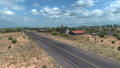
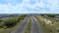
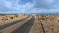
Gallery
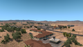
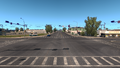
Valle
Flagstaff
Holbrook
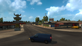
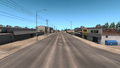
St. Johns
Springerville
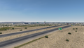
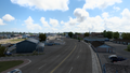
Deming
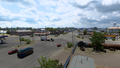
Las Cruces
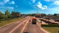
El Paso
Carlsbad
Hobbs
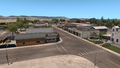
Seminole
Lamesa


Trivia
- Signage at SR 64 in Valle indicates that US 180 starts here, which is consistent with the AASHTO U.S. Highway logs in real life. Many maps also continue the highway's designation to Grand Canyon Village, which is also presented on the map in ATS. Signage at SR 64 in Valle as of 2021 indicated that US 180 continues north concurrent with the route. However, no signage along the route exists past Valle (and also heading southbound from the Grand Canyon) until SR 64 turns east towards Cameron.
- In real life, US 180 originally terminated at its "parent" route, US 80, until that route was bypassed by several Interstate Highways. Beginning in the 1950s, US 80 was replaced by Interstate 10 from New Mexico to Interstate 20, while the rest was replaced by I-20 and Interstate 30 from Pecos to Louisiana. Replacement by the Interstates made the parent highway obsolete in California, Arizona, New Mexico, and Texas west of Dallas, which was decommissioned between 1964 until 1991, leaving US 180 separate from its auxiliary route.
References
- ↑ End of US highway 180 - US Ends.com, accessed 2023-05-23
See also
| Cities | |
|---|---|
| Highways | Interstate 8 • Interstate 10 • Interstate 15 • Interstate 17 • Interstate 19 • Interstate 40 • US 60 • US 64 • US 70 • US 89 • US 89A • US 93 • US 95 • US 160 • US 163 • US 180 • US 191 • SR 51 • SR 61 • SR 64 • SR 66 • SR 77 • SR 85 • SR 89 • SR 90 • SR 92 • SR 98 • SR 260 • SR 303 • SR 389 |
| See also | |
| Cities | Alamogordo • Albuquerque • Artesia • Carlsbad • Clovis • Farmington • Gallup • Hobbs • Las Cruces • Raton • Roswell • Santa Fe • Socorro • Tucumcari |
|---|---|
| Highways | |
| See also | |