US 87
U.S. Route 87 (US 87) is a north–south United States Highway in Texas, northeastern New Mexico, Colorado, Wyoming, and Montana in American Truck Simulator. The route is separated into six sections: The first section runs from SH 35 in Port Lavaca to due north of US 59 in Victoria. The second section runs from US 77 in Victoria to Loop 13 in San Antonio. The third section runs from New Braunfels Avenue to Hildebrande Avenue within San Antonio, entirely concurrent with Interstate 10 and partially with Interstate 35. The fourth sections runs within Fredericksburg, concurrent with US 290. The fifth section runs from US 277 in San Angelo to WYO 258 in Casper, partially concurrent with Interstate 27 and mostly with Interstate 25. The sixth sections runs from Brookhurst to US 2 in West Havre, mostly concurrent with Interstate 25 and Interstate 90.
Most of the portion from Raton, New Mexico to Billings, Montana overlaps Interstates 25 and 90, and it also overlaps the entirety of Interstate 27 between Lubbock and Amarillo in northern Texas. The portion from Raton, New Mexico to the Colorado–Wyoming state line is unsigned.
In real life, US 87 spans a total length of 1,998 miles (3,215 km) from Port Lavaca, Texas to West Havre, Montana. Unlike the southern terminus in ATS, the road actually meets with SH 238, which is rendered as an inaccessible road. It is the longest US Highway to not have a "1" in its number and the third longest north–south road in the United States.
Course
US 87 begins at SH 35 in Port Lavaca at the coast of the Gulf of Mexico and runs a short distance northwest to US 59 at Victoria, where there's a small gap in the highway through the downtown district of the city. US 87 resumes at US 77, in the north of Victoria, and continues through the towns of Sutherland Springs and Lone Oak before the second section ends when meeting with Loop 13 in southeastern San Antonio. The highway resumes at exit 576 of Interstate 10, where it overlaps with the latter route and US 90 around downtown San Antonio to the south. The highway overlaps a small portion of Interstate 35 east of downtown; soon afterwards, another gap in the route begins at exit 566 of I-10 northeast of San Antonio. A short segment of the highway resumes and runs within Fredericksburg, where it also overlaps with US 290. The fifth section of US 87 begins at US 277 south of San Angelo, overlapping the latter route and Bryant Boulevard through the city and intersects US 67. The highway trends northwest and begins to cross the prairie-covered plateau of the Llano Estacado from the south. Along the way, it overlaps a small portion of Interstate 20 as it runs through and partially bypasses Big Spring; here, a business route of the highway runs through the busy downtown area. Along its way to the panhandle of northern Texas, it intersects US 180 in Lamesa, and afterwards, it begins to overlap with Interstate 27 from Lubbock, where it meets the overlapped highways of US 62 and 82, intersecting US 70 in Plainview, US 60 in Canyon (where the latter overlaps with the two highways), all the way to Amarillo. There, the concurrency of I-27 ends, and the highway intersects Interstate 40 and US 287 (which the latter overlaps until the left-driving configuration through downtown). US 60 ends in downtown Amarillo; soon afterwards, the 287 resumes its overlapping of US 87, crosses the Canadian River, until reaching Dumas, where the 287 continues into Oklahoma while the highway turns east and northeast into Dalhart; there, it intersects US 54 and US 385.
Soon after entering New Mexico, the highway enters Clayton, where it intersects US 56 and US 412 and begins running concurrent with US 64. The highways run across the shortgrass prairies of northeastern New Mexico and run through Des Moines. They enter Raton, where it intersects Interstate 25 while US 64 continues west into the city. The highway begins to overlap with I-25 to the north as it leaves Raton into Colorado.
US 87 remains concurrent with Interstate 25 throughout Colorado. It is a rare occurrence for a US Highway to have a concurrency with an Interstate in its entirety within state boundaries. Besides the concurrency, it runs through Colorado's major cities including Pueblo, Colorado Springs, Denver, and Fort Collins.
The highway continues to follow Interstate 25 as soon as it enters Wyoming. It runs through the city of Cheyenne, meeting the overlapped highways of Interstate 80 and US 30, and begins to cross the northwestern portion of the Great Plains. Approaching Casper, a small gap in the route is presented and begins at WYO 258. Just northeast of the interchange in Brookhurst, US 87 resumes and begins its fifth section. It runs parallel with I-25 through Brookhurst and Evansville until it re-enters Casper and rejoins the Interstate once again. Here, it also follows a concurrency with US 20 and 26 (which previously followed from Douglas to WYO 258). At I-25's northern terminus in Buffalo, the 87 then overlaps with Interstate 90 and passes Sheridan, where it begins a concurrency with US 14 until reaching exit 9.
The two highways enter Montana and the Crow Indian Reservation, the homeland of the Crow Tribe. They begin to overlap with US 212 in Crow Agency and turn to the east into Billings. It is here that US 87 finally ends its long journey of overlapping Interstates all the way back from Raton in New Mexico. The highway begins running northward as it climbs out of Billings and crosses the Bull Mountains, where it intersects with Old Divide Road, which provides access to the Signal Peak coal mine. Shortly after, the highway runs through Roundup, where it has a brief concurrency with US 12 and continues to the junction of Grass Range with MT 19 and MT 200. The highway turns westward, running concurrent with the 200 through Lewistown, where US 191 follows the highways briefly as far as Eddies Corner. Proceeding across the plains of Montana, the highways meet with US 89 at Armington Junction, where a rest stop and a weigh station is presented. The highways run together to Great Falls, where US 87 breaks away from the 89 and the 200 to run north through town. After crossing the Missouri River above Black Eagle Falls and passing through the town of Black Eagle, the highway runs northeast along the Missouri northeastward. After crossing the Marias River and passing through the town of Big Sandy, the highway terminates at US 2 in West Havre near the city of Havre.
Cities
Texas
Scenery Towns
New Mexico
Scenery Towns
Colorado
Scenery towns
Wyoming
Montana
- Billings
- Lewistown
- Great Falls
- Havre (via US 2)
Scenery towns
Junction list
Texas
| Location | mi | km | Destinations | Facilities | Notes |
|---|---|---|---|---|---|
| Port Lavaca | 0 | 0 | Southern terminus in-game; US 87 continues south inaccessibly | ||
| 3 | 4 | Vortex Truck Stop | |||
| Victoria | 10 | 16 | Victoria Steeler Warehouse | ||
| 11 | 19 | ||||
| 14 | 23 | Minor road | |||
| 14 | 23 | Vortex Truck Stop | US 87 continues north inaccessibly | ||
| End first section; start second section | |||||
| Victoria | 14 | 23 | US 87 continues south inaccessibly | ||
| 16 | 26 | Vortex Truck Stop | |||
| 31 | 50 | Victoria Petrolucent Oil Well | |||
| 34 | 55 | Victoria Nielsen Roads Roadworks | Dynamic prefab | ||
| Sutherland Springs | 53 | 86 | Access to San Antonio Grand Pastures farm; FM 539 northbound is inaccessible | ||
| Lone Oak | 63 | 102 | Inaccessible | ||
| San Antonio | 69 | 111 | Foster Road | Inaccessible | |
| 71 | 115 | US 87 continues west inaccessibly; Loop 13 southbound is inaccessible | |||
| End second section; start third section | |||||
| San Antonio | 71 | 115 | New Braunfels Avenue | Southbound exit and northbound entrance; southern terminus of I-10 and US 90 concurrencies; road continues as I-10 and US 90; I-10 exit 576; inaccessible | |
| 77 | 124 | I-10 exit 574; I-37 exit 139 | |||
| 91 | 146 | TOTSO; northern terminus of US 90 concurrency; southern terminus of I-35 concurrency; I-10 exit 572; I-35 exit 153 | |||
| 93 | 150 | ||||
| 102 | 165 | TOTSO; northern terminus of I-35 concurrency; I-10 exit 570; I-35 exit 156 | |||
| 113 | 182 | Hildebrande Avenue | Northern terminus of I-10 concurrency; road continues as I-10; I-10 exit 566 | ||
| End third section; start fourth section | |||||
| Fredericksburg | 113 | 182 | The city of Fredericksburg | Southern terminus of US 290 concurrency; road continues as US 290 | |
| 116 | 187 | Northern terminus of US 290 concurrency; road continues as US 290; US 87 northbound is inaccessible | |||
| End fourth section; start fifth section | |||||
| San Angelo | 116 | 187 | Southbound exit and northbound entrance; southern terminus of US 277 concurrency; US 87 continues south inaccessibly | ||
| 117 | 189 | Aron Truck Stop | |||
| 118 | 191 | Minor road | |||
| 119 | 192 | The city of San Angelo | |||
| 121 | 195 | Northern terminus of US 277 concurrency | |||
| 123 | 198 | Minor road | |||
| 123 | 198 | Minor road | |||
| 123 | 199 | Minor road | |||
| Big Spring | 193 | 311 | No southbound exit; southern terminus of US 87 Bus. | ||
| 213 | 342 | TOTSO; southern terminus of I-20 concurrency; I-20 exit 173 | |||
| 228 | 367 | TOTSO; northern terminus of US 87 Bus.; northern terminus of I-20 concurrency; I-20 exit 177 | |||
| 232 | 373 | WP Truck Stop | |||
| Lamesa | 269 | 434 | Aron Gas Station | ||
| 270 | 435 | Eastern terminus of US 180 | |||
| 293 | 472 | Picnic Area | Southbound only | ||
| Lubbock | 300 | 483 | Minor road | ||
| 304 | 489 | 114th Street | |||
| 314 | 506 | 50th Street | Southern terminus of I-27 concurrency; I-27 exit 1 | ||
| See | |||||
| Amarillo | 443 | 713 | Northern terminus of I-27 concurrency; southern terminus of US 287 concurrency; I-27 exit 123; I-40 exit 70 | ||
| 453 | 729 | Northbound exit and southbound entrance; northern terminus of US 287 concurrency; US 87 southbound follows US 60 westbound; US 60 eastbound is inaccessible | |||
| 453 | 730 | Southeast 11th Avenue | |||
| 453 | 730 | Southeast 6th Avenue | |||
| 454 | 730 | Southeast 5th Avenue | |||
| 454 | 731 | Southeast 2nd Avenue | |||
| 454 | 732 | Northeast 3rd Avenue | Northern terminus of US 60 concurrency | ||
| 455 | 732 | Minor road | |||
| 455 | 732 | Minor road | |||
| 456 | 735 | Southbound exit and northbound entrance; northern terminus of US 287 concurrency; inaccessible | |||
| 462 | 744 | North 15th Avenue | Southbound exit and northbound entrance; inaccessible | ||
| 474 | 763 | Amarillo Vortex Drilling Site and Oil Storage | |||
| Dumas | 486 | 783 | TOTSO; northern terminus of US 287 concurrency; US 287 northbound and SH 152 are inaccessible | ||
| 488 | 786 | Minor road | |||
| Dalhart | 521 | 838 | Aron Truck Stop | ||
| 521 | 839 | Northern terminus of US 87 Bus.; southern terminus of US 385 concurrency | |||
| 522 | 840 | Northern terminus of US 385 | |||
| 522 | 841 | Spur 17 is inaccessible | |||
| 531 | 854 | Minor road | |||
New Mexico
| Location | mi | km | Destinations | Facilities | Notes |
|---|---|---|---|---|---|
| Clayton | 558 | 898 | Northern terminus of US 64 concurrency; US 56, US 64 eastbound, and US 412 are inaccessible | ||
| 614 | 988 | Rest Stop | Northbound only | ||
| Raton | 639 | 1,029 | Gallon Oil Truck Stop, NAF Truck Stop | ||
| 641 | 1,033 | TOTSO; northern terminus of US 64 concurrency; southern terminus of I-25 concurrency; I-25 exit 451 | |||
| See | |||||
Colorado
| Location | mi | km | Destinations | Facilities | Notes | |
|---|---|---|---|---|---|---|
| See | ||||||
Wyoming
| Location | mi | km | Destinations | Facilities | Notes |
|---|---|---|---|---|---|
| See | |||||
| Casper | 1,136 | 1,829 | Wyoming Boulevard – Evansville | Northern terminus of I-25, US 20, and US 26 concurrencies; road continues as I-25; I-25 exit 185 | |
| End fifth section; start sixth section | |||||
| Brookhurst | 1,136 | 1,829 | Minor road | Access to Casper Gallon Oil refinery; southern terminus of US 20 and US 26 concurrencies; US 87 continues east inaccessibly | |
| Evansville | 1,136 | 1,829 | Eastern terminus of WYO 258 | ||
| Casper | 1,137 | 1,830 | Minor road | ||
| 1,138 | 1,831 | TOTSO; southern terminus of I-25 concurrency | |||
| See | |||||
| Buffalo | 1,232 | 1,984 | TOTSO; northern terminus of I-25 concurrency; southern terminus of I-90 concurrency; I-25 exit 300; I-90 exit 56 | ||
| See | |||||
Montana
| Location | mi | km | Destinations | Facilities | Notes |
|---|---|---|---|---|---|
| See | |||||
| Lockwood | 1,443 | 2,322 | TOTSO; northern terminus of I-90 and US 212 concurrencies; southern terminus of I-90 BL concurrency | ||
| 1,443 | 2,322 | North Frontage Road | |||
| Billings | 1,454 | 2,340 | TOTSO; northern terminus of I-90 BL concurrency | ||
| 1,456 | 2,343 | Fourth Avenue | Inaccessible | ||
| 1,458 | 2,347 | Billings Home Store Market | |||
| 1,459 | 2,348 | Old Highway 312 / Bench Boulevard – Huntley | TOTSO; inaccessible | ||
| 1,475 | 2,373 | Billings NAMIQ Quarry | |||
| Camp Three | 1,485 | 2,389 | Southern terminus of US 12 concurrency; US 12 westbound is inaccessible | ||
| Roundup | 1,491 | 2,399 | Gallon Oil Truck Stop | ||
| 1,494 | 2,404 | Minor road | TOTSO; northern terminus of US 12 concurrency; inaccessible | ||
| Grass Range | 1,538 | 2,476 | TOTSO; southern terminus of MT 19; southern terminus of MT 200 concurrency | ||
| Lewistown | 1,563 | 2,516 | Lewistown MWM Waste Transfer Station | ||
| 1,569 | 2,525 | Gallon Oil Truck Stop | |||
| 1,574 | 2,533 | Southern terminus of US 191 concurrency; S-238 is inaccessible | |||
| 1,574 | 2,534 | Third Avenue | Inaccessible | ||
| 1,575 | 2,536 | Lewistown Bitumen Depot | |||
| 1,576 | 2,536 | Lewistown Drake Car Dealer Dealership | |||
| 1,576 | 2,537 | Lewistown Plaster & Sons Warehouse | |||
| Eddies Corner | 1,587 | 2,555 | Gallon Oil Truck Stop | ||
| 1,590 | 2,559 | Northern terminus of US 191 concurrency; southern terminus of MT 3 concurrency | |||
| Armington Junction | 1,642 | 2,643 | Southern terminus of US 89 concurrency | ||
| 1,648 | 2,652 | Belt | Inaccessible | ||
| Great Falls | 1,667 | 2,683 | Southern terminus of US 87 Byp.; a secret road runs south to the Great Falls Wallbert market | ||
| 1,667 | 2,683 | Minor road | Access to Great Falls Wallbert market | ||
| 1,668 | 2,684 | Minor road | Access to Great Falls Wallbert market | ||
| 1,674 | 2,694 | TOTSO; northern terminus of I-15 BL; northern terminus of US 89, MT 3, and MT 200 concurrencies | |||
| 1,677 | 2,699 | Central Avenue | |||
| 1,681 | 2,705 | Northern terminus of US 87 Byp.; access to Great Falls 42 Print packaging plant | |||
| Black Eagle | 1,682 | 2,707 | River Road | Inaccessible | |
| 1,689 | 2,719 | Old Havre Highway | Inaccessible | ||
| 1,692 | 2,724 | Bootlegger Trail – Benton Lake Wildlife Refuge | |||
| 1,744 | 2,807 | Havre Faraday Electric Substation | |||
| West Havre | 1,767 | 2,843 | Weigh Station | ||
| 1,767 | 2,844 | Northern terminus | |||
Special routes
- Main article: Special routes of US 87
U.S. Route 87 has eight special routes in Texas, Wyoming, and Montana, respectively in the cities of Dalhart, Cheyenne, Casper, Sheridan, and Great Falls, as well as in the scenery towns of Big Spring, Wheatland, and Douglas.
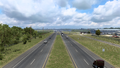
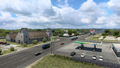
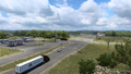
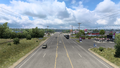
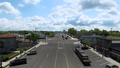
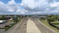
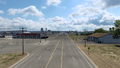
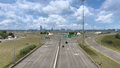
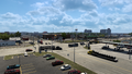
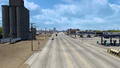
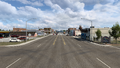
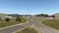
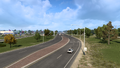
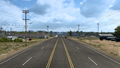
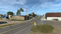
Gallery
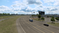
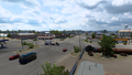
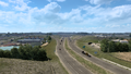
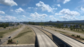
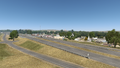
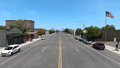
Port Lavaca
Victoria
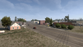
Sutherland Springs
Lone Oak
San Antonio
Fredericksburg
San Angelo
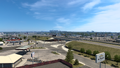
Big Spring
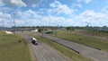
Lamesa
Lubbock
Plainview
Canyon
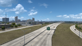
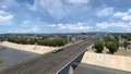
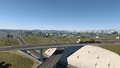
Amarillo
Dumas
Dalhart
Clayton
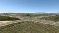
Des Moines
Raton
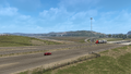
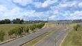
Starkville
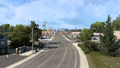
Walsenburg
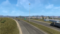
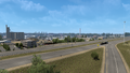
Pueblo
Colorado Springs
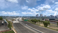
Denver
Cheyenne
Wheatland
Orin
Brookhurst
Evansville
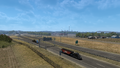
Casper
Kaycee
Buffalo
Sheridan
Crow Agency
Hardin
Lockwood
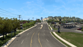
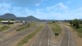
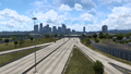
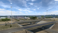
Billings
Roundup
Grass Range
Lewistown
Eddies Corner
Armington Junction
Great Falls
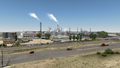
Black Eagle
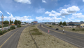
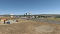
Big Sandy
West Havre


History
- In the initial version of the Colorado map expansion DLC, the section of US 87 from Raton to SH 14 in Fort Collins, concurrent with Interstate 25, was added.
- In the initial version of the Wyoming map expansion DLC, the sections of US 87 from SH 14 in Fort Collins to WYO 258 in Casper, concurrent with Interstate 25, and from Brookhurst, concurrent with Interstate 25, to US 14 northeast of Sheridan, concurrent with Interstate 90, were added.
- In update 1.44, the section of US 87 from east of Interstate 25 in Raton, concurrent with US 64, to the Colorado–New Mexico state line, concurrent with Interstate 25, was added.
- In the initial version of the Montana map expansion DLC, the section of US 87 from US 14 northwest of Sheridan, concurrent with Interstate 90, to US 2 in West Havre was added.
- In the initial version of the Texas map expansion DLC, the sections of US 87 from SH 35 in Port Lavaca to Victoria, from US 77 in Victoria to Loop 13 in San Antonio, around downtown San Antonio, concurrent with Interstate 10, in Fredericksburg, concurrent with US 290, and from US 277 south of San Angelo to Raton were added.
- In update 1.48, the section of US 87 from US 56 and US 412 in Clayton, concurrent with US 64, to east of Interstate 25 in Raton became part of the New Mexico map expansion DLC.
See also
| Cities | Alamogordo • Albuquerque • Artesia • Carlsbad • Clovis • Farmington • Gallup • Hobbs • Las Cruces • Raton • Roswell • Santa Fe • Socorro • Tucumcari |
|---|---|
| Highways | |
| See also | |
| Cities | Alamosa (Alamosa East, Monte Vista) • Burlington • Colorado Springs • Denver (Aurora) • Durango • Fort Collins (Loveland) • Grand Junction (Fruita) - Lamar • Montrose • Pueblo • Rangely • Steamboat Springs • Sterling |
|---|---|
| Highways | |
| See also | |
| Cities | Casper (Brookhurst, Mills) • Cheyenne (Fox Farm-College, South Greeley) • Cody • Evanston • Gillette • Jackson • Laramie • Rawlins (Sinclair) • Riverton • Rock Springs • Sheridan |
|---|---|
| Highways | Interstate 25 • Interstate 80 • Interstate 90 • Interstate 180 • US 14 • US 14 Alternate • US 16 • US 18 • US 20 • US 26 • US 30 • US 85 • US 87 • US 89 • US 189 • US 191 • US 287 • US 310 • WYO 22 • WYO 28 • WYO 50 • WYO 51 • WYO 59 • WYO 76 • WYO 89 • WYO 94 • WYO 110 • WYO 120 • WYO 135 • WYO 150 • WYO 210 • WYO 212 • WYO 220 • WYO 222 • WYO 258 • WYO 339 • WYO 351 • WYO 374 • WYO 450 • WYO 487 • WYO 789 |
| See also | |
| Cities | Billings (Lockwood) • Bozeman (Four Corners) • Butte (Rocker, Silver Bow) • Glasgow • Glendive • Great Falls • Havre (Havre North, West Havre) • Helena • Kalispell (Columbia Falls, Evergreen) • Laurel • Lewistown • Miles City • Missoula (Bonner-West Riverside, Wye) • Sidney • Thompson Falls |
|---|---|
| Highways | |
| See also | |