Interstate 10
Interstate 10 (I-10) is an east–west Interstate Highway in southern California, Arizona, New Mexico, and Texas in American Truck Simulator. It begins at Interstate 5 in Los Angeles and ends just east of Beaumont, a few miles away from the border with Louisiana.
In real life, Interstate 10 spans a total length of 2,460.34 miles (3,959.53 km) from Los Angeles, California to Jacksonville, Florida. It is the southernmost cross-country east–west Interstate Highway and the fourth-longest Interstate Highway in the United States, following Interstate 90, Interstate 80 and Interstate 40.
Course
Although I-10 in real life begins in Santa Monica, the freeway originating from this point in the game is not marked as such, and does not directly connect to I-10 proper. The highway in ATS begins in Los Angeles, at its junction with Interstate 5, and soon afterwards meets with Interstate 15 in the Inland Empire. The highway moves down the gentle San Gorgonio Pass, notable for the many wind turbines along the road, and passes to the north of the Imperial Valley, where CA 111 meets with the highway at Indio. The highway climbs into the Sonoran Desert via Chiriaco Summit, and proceeds through this sparse region past the towns of Desert Center and Blythe, the latter of which being the western end of a short concurrency with US 95.
After crossing the Colorado River, I-10 enters Arizona at the town of Ehrenberg, features an eastbound Weigh Station, and soon after passes through Quartzsite, where US 95 breaks off and heads south to Yuma. After continuing through the desert, the highway reaches Phoenix, where it intersects with Interstate 17 and US 60, and from there turns southeast to Tucson. Between the two cities, I-10 encounters the eastern terminus of Interstate 8, travel services at Sunland Gin Road, and Picacho Peak, a prominent landmark. Past Tucson the highway resumes its eastward trend through a region known as the Madrean Archipelago, where it meets with AZ 90 at Benson (Although it's not in the game, it is east of this point in real life where the highway reaches its highest point at Texas Summit). Apache Pass Road provides access to San Simon, and soon after passes through the town itself. After a westbound weigh station, the highway enters New Mexico.
Across the state line, I-10 passes Lordsburg, where US 70 joins the highway. From there it proceeds through the Chihuahuan Desert, where it crosses the Great Continental Divide. East of the divide, the highway meets Deming (which features services) and offers a westbound Rest Stop. In the western limits of Las Cruces, US 70 breaks from the highway, and soon after an eastbound rest area is provided. After crossing the Rio Grande, I-10 passes by Las Cruces proper, and meets with Interstate 25 at its southern terminus before turning southwards towards Texas.
I-10 enters Texas at the town of Anthony, soon after entering the city of El Paso, adjacent to the Mexican city of Ciudad Juárez, which is visible from the highway. Curving around the Franklin Mountains, the highway runs through downtown El Paso and intersects with US 54 and US 62/180. Leaving El Paso, I-10 passes through Socorro before running along the Rio Grande. Turning away from the valley of the river, the highway runs below the Sierra Blanca, where there are east and westbound rest areas and an eastbound border patrol inspection station. The highway then reaches Van Horn, where it intersects with US 90, and continues across the Chihuahuan Desert through Scroggins Draw (where the highway meets Interstate 20 at its western terminus) to Fort Stockton, where it intersects with US 285. East of Fort Stockton, the highway intersects with US 67/385 and enters greener, hillier country, where there are east and westbound rest areas. I-10 soon intersects with US 277 at Sonora, and shortly afterward features another pair of rest areas; these rest areas are located at the approximate midpoint of the entire highway, which is also very close to the 100th Meridian West, a traditional dividing line between the eastern and western US. The highway then intersects with US 83 at Junction, followed by US 290. Trending southeast, descending the Edwards Plateau, more rest areas are provided. The highway soon reaches San Antonio, where it intersects with Interstates 35 (with which the 10 runs concurrent briefly) and 37, and US 90. Just east of San Antonio, US 87 breaks away from I-10; in real life, the 87 runs concurrent with the 10 as far west as Comfort, south of Fredericksburg, however the western end of this concurrency isn't in the game. After another pair of rest areas, the highway intersects with US 77 at Schulenburg, and shortly after with TX 71. Running across fertile lowlands, west and eastbound weigh stations are passed before reaching Houston, Texas' largest city. I-10 passes through Houston along the north side of the city's downtown area, and intersects with Interstates 45 and 69. After passing through an industrial area, I-10 exits Houston after crossing the San Jacinto River, and soon afterwards intersects with TX 146 at Baytown and TX 73 at Winnie, which from there, provides a connection to TX 142. The highway then passes through Beaumont, where it intersects with US 96, and currently ends in the swamps in the east of the city, to eventually be continued into Louisiana. It's worth noting that I-10 in Texas is the longest stretch of Interstate Highway in a single state; over a third of the highway's length is in Texas, and the driving distance from Anthony to Beaumont is longer than that from Anthony to Los Angeles.
Cities
California
Scenery towns
Arizona
Scenery towns
New Mexico
Texas
Scenery towns
Exit list
California
| Location | mi | km | Exit | Destinations | Facilities | Notes |
|---|---|---|---|---|---|---|
| Los Angeles | 0 | 0 | Western terminus in game | |||
| 7 | 11 | 37 | Barranca Street | |||
| 29 | 46 | 58 A-B | I-15 exits 109 A–B | |||
| 43 | 69 | 93 | ||||
| 101 | 162 | ---- | Truck stop | Westbound only | ||
| Indio | 107 | 172 | ||||
| Cactus City | 129 | 207 | ---- | Cactus City Rest Area | ||
| Chiriaco Summit | 150 | 242 | Gas station | |||
| Desert Center | 179 | 288 | 192 | Rice Road – Desert Center | Inaccessible | |
| Blythe | 192 | 310 | 241 | Eastern terminus in base game; western terminus of US 95 concurrency |
Arizona
| Location | mi | km | Exit | Destinations | Facilities | Notes |
|---|---|---|---|---|---|---|
| Ehrenberg | 214 | 344 | 1 | Ehrenberg | ||
| 225 | 362 | ---- | Weigh station | Eastbound only | ||
| Quartzsite | 243 | 391 | 17 | Eastern terminus of US 95 concurrency | ||
| 270 | 436 | ---- | Bouse Wash Rest Stop | |||
| 283 | 455 | 94 | Tonopah | Inaccessible | ||
| 310 | 499 | 124 | ||||
| Phoenix | 335 | 539 | 141 | 35th Avenue | ||
| 336 | 542 | 143 A-B | I-17 exit 200 | |||
| 344 | 553 | 145 | 7th Avenue | Westbound exit and eastbound entrance; Inaccessible | ||
| 347 | 559 | 146 | 7th Street | Eastbound exit and westbound entrance; Inaccessible | ||
| 349 | 561 | 147 148 |
Eastbound exit 147; westbound exit 148 | |||
| 358 | 576 | 149 | Buckeye Road, Sky Harbor | |||
| 391 | 629 | 199 | I-8 exits 178 A–B | |||
| 396 | 638 | 200 | Sunland Gin Road, Arizona City | |||
| Tucson | 444 | 714 | 255 | |||
| 451 | 727 | 258 | Congress Street, Downtown | |||
| 460 | 740 | 260 | ||||
| 467 | 751 | 261 | 6th Avenue, Downtown | |||
| 477 | 768 | 267 | Valencia Road | |||
| 505 | 813 | 302 | ||||
| 536 | 863 | 337 | Apache Pass Road | |||
| San Simon | 575 | 926 | 378 | |||
| 585 | 941 | 382 | ||||
| 596 | 959 | ---- | Weigh station | Westbound only |
New Mexico
| Location | mi | km | Exit | Destinations | Facilities | Notes |
|---|---|---|---|---|---|---|
| Lordsburg | 613 | 986 | 22 | Eastern terminus in Arizona DLC; western terminus of US 70 concurrency | ||
| 622 | 1,002 | ---- | Weigh station | Eastbound only | ||
| Deming | 660 | 1,062 | 68 | West end of US 180 concurrency | ||
| Akela | 678 | 1,091 | 102 | Akela | Westbound only | |
| 694 | 1,117 | ---- | Inspection Station | Westbound only; closed | ||
| Las Cruces | 702 | 1,130 | 135 | Eastern terminus of US 70 concurrency; also serves Alamogordo and Truth or Consequences | ||
| 710 | 1,142 | ---- | Rest area | Eastbound only | ||
| 721 | 1,160 | 139 | ||||
| 724 | 1,165 | 143 | University Avenue | Eastbound exit only; no entry back to I-10 | ||
| 724 | 1,166 | 144 | Eastern terminus in New Mexico DLC |
Texas
| Location | mi | km | Exit | Destinations | Facilities | Notes |
|---|---|---|---|---|---|---|
| Anthony | 740 | 1,191 | 0 | Western terminus in Texas DLC | ||
| El Paso | 757 | 1,218 | 18 | Schuster Avenue – University of Texas at El Paso | Inaccessible | |
| 769 | 1,238 | 19 | Santa Fe Street – El Paso, Downtown | Inaccessible | ||
| 784 | 1,262 | 22 B | Eastern terminus of US 180 concurrency; US 54 westbound is inaccessible | |||
| 788 | 1,269 | 22 A | Stevens Street / Missouri Avenue | Westbound exit only; Inaccessible | ||
| 803 | 1,293 | 25 | Airway Boulevard – El Paso Airport | |||
| Socorro | 816 | 1,314 | 37 | |||
| El Paso | 817 | 1,315 | (no name) | Westbound exit only | ||
| 848 | 1,366 | ---- | Picnic area | Eastbound only | ||
| 855 | 1,377 | 99 | Lasca Road | Access to westbound picnic area | ||
| 873 | 1,405 | ---- | Inspection Station | Eastbound only; closed | ||
| Van Horn | 885 | 1,425 | 138 | Eastbound exit and westbound entrance | ||
| 895 | 1,440 | 140 A | Southern terminus of SH 54; also serves Marfa and Del Rio | |||
| 909 | 1,463 | 140 B | Westbound exit and eastbound entrance | |||
| Scroggins Draw | 947 | 1,524 | 186 | Westbound exit and eastbound entrance; access for I-20 westbound to I-10 eastbound | ||
| 951 | 1,531 | 187 | No eastbound entrance; western terminus of I-20 | |||
| Fort Stockton | 997 | 1,605 | 256 | No eastbound entrance; western terminus of US 67 | ||
| 1,005 | 1,617 | 257 | ||||
| 1,029 | 1,657 | 261 | Western terminus of US 385 concurrency | |||
| 1,042 | 1,677 | 273 | No eastbound entrance; westbound picnic area; eastbound terminus of US 67 concurrency; eastbound terminus of US 385 concurrency | |||
| 1,062 | 1,710 | 307 | Western terminus of US 190; southern terminus of FM 305 | |||
| 1,080 | 1,738 | ---- | Pecos Country Rest Area | |||
| Sonora | 1,164 | 1,873 | 400 | |||
| 1,184 | 1,906 | ---- | Parking area | |||
| Junction | 1,208 | 1,945 | 456 | Western terminus of US 83 concurrency; western terminus of Loop 481 | ||
| 1,223 | 1,969 | 457 | ||||
| 1,235 | 1,988 | 462 | Eastern terminus of US 83 concurrency | |||
| 1,253 | 2,016 | 477 | Also serves Austin; US 290's direction is mislabeled as North on eastbound signage | |||
| 1,282 | 2,064 | ---- | Kerr Safety Rest Area | |||
| San Antonio | 1,309 | 2,107 | 566 | Hildebrande Avenue | Western terminus of US 87 concurrency | |
| 1,317 | 2,120 | 156 570 |
TOTSO; western terminus of I-35 concurrency; exit 156 westbound; exit 570 eastbound | |||
| 1,330 | 2,140 | 153 572 |
TOTSO; eastern terminus of I-35 concurrency; western terminus of US 90 concurrency; exit 153 eastbound; exit 572 westbound | |||
| 1,331 | 2,143 | |||||
| 1,345 | 2,165 | 574 | I-37 exit 139 | |||
| 1,358 | 2,185 | 576 | New Braunfels Avenue | Eastbound exit and westbound entrance; Eastern terminus of US 87 concurrency; Inaccessible | ||
| 1,367 | 2,201 | 580 | ||||
| 1,381 | 2,223 | 581 | Ackerman Road | |||
| 1,410 | 2,269 | ---- | Guadalupe County Safety Rest Area | |||
| Schulenburg | 1,440 | 2,318 | 674 | |||
| 1,468 | 2,362 | 695 | No eastbound exit | |||
| 1,481 | 2,384 | ---- | Westbound CMV Inspection Station | Westbound only | ||
| 1,488 | 2,395 | ---- | Eastbound CMV Inspection Station | Eastbound only | ||
| Houston | 1,525 | 2,455 | 768 A-B | I-45 exits 48 A-B | ||
| 1,542 | 2,482 | 770 A-B | I-69 exit 132 | |||
| 1,556 | 2,505 | 773 | McCarty Drive | Eastern terminus of US 90 concurrency | ||
| Mont Belvieu | 1,579 | 2,542 | 797 | Route shield is mislabeled as SH 124 | ||
| Winnie | 1,595 | 2,568 | 828 | Eastbound exit and westbound entrance | ||
| 1,605 | 2,583 | 829 | ||||
| Beaumont | 1,615 | 2,600 | 851 | Southern terminus of US 69; southern terminus of US 96; southern terminus of US 287; Western terminus of US 90 concurrency | ||
| 1,627 | 2,619 | 853 | Eastern terminus of US 69 concurrency; eastern terminus of US 96 concurrency; eastern terminus of US 287 concurrency | |||
| 1,637 | 2,636 | 854 | ||||
| 1,648 | 2,652 | 855 | Willow Street, Downtown | Inaccessible | ||
| 1,658 | 2,668 | 856 | Rose City | Eastern terminus in-game |
Business Routes

- Main article: Business routes of Interstate 10
Interstate 10 has several business routes along its route in Arizona and Texas, respectively in the cities of San Simon, Van Horn, and Fort Stockton. There is also another business route in Las Cruces; however, that route is inaccessible to the player and has been defuncted in real-life (a highway shield of the route can also be found while heading east towards the intersection with Main and Picacho Streets on US 70).
History
- In the initial version of American Truck Simulator, Interstate 10 began at an at-grade four-way junction in eastern Los Angeles and ended at SR 111 in Indio.
- In the initial version of the Arizona map expansion DLC, the section of Interstate 10 from SR 111 in Indio to San Simon was added.
- In update 1.5, as part of the 1:35 to 1:20 map rescale, Interstate 10 was extended to a new trumpet interchange with Interstate 5, and the previous terminus was changed to a diamond interchange. On the rest of the route, new sections, including the rest areas and inaccessible exits between SR 111 and Phoenix, were added to the existing route to accommodate the new map scale. The trumpet interchange with Interstate 15 and the diamond interchange with US 95 in Blythe Ehrenberg were rebuilt. The at-grade three-way junction with SR 74 was changed to a diamond interchange, while the at-grade three-way junction with an unnamed road to Interstate 40 was removed. The junction with Interstate 17 was moved from a four-level stack interchange with US 60 in eastern Phoenix to a four-level stack interchange with SR 85 in central Phoenix.
- In update 1.29, the trumpet interchange with Interstate 15 was changed to a four-level stack interchange when the route was extended to Interstate 8, and a diamond interchange with Loop 303 was added.
- In the initial version of the New Mexico map expansion DLC, the section of Interstate 10 from San Simon to Interstate 25 and US 180 in Las Cruces was added.
- In update 1.31, the four-level stack interchange with Interstate 17 was partially rebuilt.
- In update 1.32, Quartzsite and a diamond interchange there with US 95 were added.
- In update 1.35, the semi-directional T interchange with Interstate 19 in Tucson was partially rebuilt.
- In the initial version of the Texas map expansion DLC, the section of Interstate 10 from Interstate 25 and US 180 in Las Cruces to Beaumont was added.
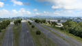
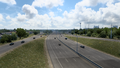
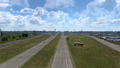
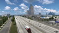
Gallery
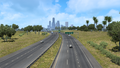
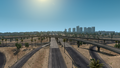
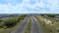
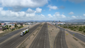
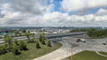
Los Angeles
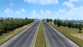
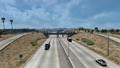
Ontario
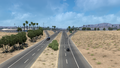
Indio
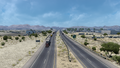
Quartzsite
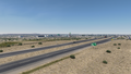
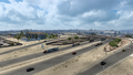
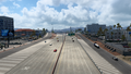
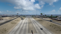
Phoenix
Tucson
San Simon
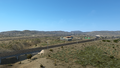
Deming
Las Cruces
Anthony
El Paso
Socorro
Van Horn
Scroggins Draw
Fort Stockton
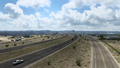
Sonora
Junction
San Antonio
Schulenburg
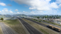
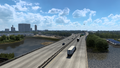
Houston
Mont Belvieu
Winnie
Beaumont


See also
| Cities |
| ||||||
|---|---|---|---|---|---|---|---|
| Highways |
| ||||||
| See also | |||||||
| Cities | |
|---|---|
| Highways | Interstate 8 • Interstate 10 • Interstate 15 • Interstate 17 • Interstate 19 • Interstate 40 • US 60 • US 64 • US 70 • US 89 • US 89A • US 93 • US 95 • US 160 • US 163 • US 180 • US 191 • SR 51 • SR 61 • SR 64 • SR 66 • SR 77 • SR 85 • SR 89 • SR 90 • SR 92 • SR 98 • SR 260 • SR 303 • SR 389 |
| See also | |
| Cities | Alamogordo • Albuquerque • Artesia • Carlsbad • Clovis • Farmington • Gallup • Hobbs • Las Cruces • Raton • Roswell • Santa Fe • Socorro • Tucumcari |
|---|---|
| Highways | |
| See also | |