US 70
U.S. Route 70 (US 70) is an east–west United States Highway in eastern Arizona, southern New Mexico, and northern Texas in American Truck Simulator. The route is separated into five sections: The first section runs from US 60 and SR 77 to SR 77, concurrent with the latter route within Globe. The second section runs from US 191 northeast of San Simon to US 54 in Tularosa. The third section runs from US 380 west of Roswell to US 84 at a Grand Pastures livestock auction between Clovis and Lubbock. The fourth section runs from a Mary's Cotton plant to due east of Interstate 27 and US 87 within Plainview. The fifth section runs from due west of US 81 in Waurika to US 259 and SH-3 in Broken Bow.
In real life, US 70 spans a total length of 2,381 miles (3,832 km) from Globe, Arizona to Atlantic, North Carolina.
Course
US 70 begins at US 60 in Globe and runs for a very short distance, concurrent with SR 77, where a gap in the highway begins and the latter route heading south to Tucson. The route resumes at its intersection with US 191 northeast of San Simon, where a weigh station is located.
Shortly after entering New Mexico, the highway runs a short distance to Lordsburg, where it begins a concurrency with Interstate 10. West of Las Cruces, the highway breaks off of I-10, and after crossing the Rio Grande passes through the city via Picacho Avenue and Main Street. The highway leaves Las Cruces after intersecting with Interstate 25, and immediately traverses San Augustin Pass, which divides the San Andres Mountains to the north and the Organ Mountains to the south. At the summit of the pass is an overlook with a rest stop and, to commemorate the White Sands Missile Range, is an Army missile on display. Descending the pass, the highway passes an eastbound Border Patrol checkpoint and White Sands National Park before entering Alamogordo, where it begins a concurrency with US 54 until it breaks off in Tularosa, where a second gap in the route begins. The highway resumes at its junction with US 380 at the Historic Monument of Lincoln and runs concurrent with it towards Roswell, where the highway splits in two sections with the main highway running through downtown and the bypass route, partially signed as US 70 proper, around the city to the northeast. The highway leaves Roswell at US 285 and trends northeast across the Llano Estacado, a large, prairie-covered plateau. Soon after passing through Elida, the highway reaches Clovis, where it meets back with US 60 and runs concurrent with it and US 84 into Texico.
Shortly after breaking off of US 60, the highway enters Farwell in Texas. The surrounding terrain of the route transfers as it enters the Great Plains. The route continues to run concurrent with the 84 and trends southwest through Lariat and Progress. At a Grand Pastures livestock auction, another gap of the route begins here, while US 84 continues southeast towards Lubbock. Another section of US 70, which stretches for 3 miles (5 km), runs within the town of Plainview, where it intersects Interstate 27 and US 87, as well as serving a truck stop here.
Further beyond the great plains and into the state of Oklahoma, US 70 resumes its course in Waurika at US 81, southeast of Lawton. The highway travels east as it parallels the Red River and the state line with Texas to the south upon entering the city of Ardmore. In Ardmore, the 70 runs concurrently with a small section of Interstate 35, heading south, and then turning east again. The highway runs through the town of Madill, crosses the northern part of Lake Texoma, and enters Durant, where it intersects US 69 and US 75; soon afterwards, the 70 runs through the small town of Blue and begins to trace across the Ouachita Uplift. The highway then follows a small section of US 271, as well as intersecting the Indian Nation Turnpike (SH-375), around the town of Hugo. US 70 crosses the Kiamichi River next to the Hugo Lake Spillway, featuring a viewpoint showcasing the landmark, and passes through Sawyer at the lake. Entering Idabel, US 70 bypasses the city to the north, while its special bypass route traces around the settlement to the south and east (the section west of Idabel is inaccessible). Northeast of Idabel, the highway begins to overlap US 259 and SH-3, crosses the Little River, and into Broken Bow, where its current eastern terminus is at the said routes (US 259 and SH-3) and will eventually continue into Arkansas.
Cities
Arizona
Scenery towns
New Mexico
Texas
Oklahoma
Junction list
Arizona
| Location | mi | km | Destinations | Facilities | Notes | |
|---|---|---|---|---|---|---|
| Globe | 0 | 0 | Western terminus; western terminus of SR 77 concurrency | |||
| 0 | 0 | Minor road | Access to Aron Gas Station | |||
| 3 | 5 | Eastern terminus of SR 77 concurrency; US 70 continues east inaccessibly | ||||
| End first section; start second section | ||||||
| 3 | 5 | Southern terminus of US 191; US 70 continues west inaccessibly | ||||
| 10 | 16 | Weigh Station | Westbound only | |||
New Mexico
| Location | mi | km | Destinations | Facilities | Notes | |
|---|---|---|---|---|---|---|
| Lordsburg | 24 | 40 | TOTSO; western terminus of I-10 concurrency; I-10 exit 22 | |||
| See | ||||||
| Las Cruces | 111 | 179 | TOTSO; eastern terminus of I-10 concurrency; I-10 exit 135 | |||
| 133 | 214 | |||||
| 133 | 214 | Las Cruces Garage | ||||
| 133 | 215 | TOTSO; I-10 BL has been defuncted in real-life; inaccessible | ||||
| 135 | 217 | Elks Drive, Aron Gas Station | ||||
| 135 | 218 | I-25 exit 6 | ||||
| 150 | 242 | Rest Stop | ||||
| 170 | 274 | Inspection Station | Eastbound only; closed | |||
| 179 | 288 | White Sands National Park | Inaccessible | |||
| Alamogordo | 182 | 294 | TOTSO; western terminus of US 54 concurrency | |||
| 202 | 325 | TOTSO; western terminus of US 82 | ||||
| Tularosa | 205 | 331 | Eastern terminus of US 54 concurrency; US 70 continues east inaccessibly | |||
| End second section; start third section | ||||||
| 205 | 331 | Western terminus of US 380 concurrency; US 70 continues west inaccessibly | ||||
| Roswell | 237 | 382 | Western terminus of US 70 Truck; southern terminus of US 285 Truck; access to Roswell Sunshine Crops farm | |||
| 246 | 396 | Service shop | ||||
| 246 | 396 | Roswell Bitumen Garage | ||||
| 246 | 397 | Minor road | ||||
| 247 | 397 | Minor road | ||||
| 247 | 398 | TOTSO; eastern terminus of US 380 concurrency; western terminus of US 285 concurrency; US 380 eastbound is inaccessible | ||||
| 247 | 398 | Minor road | ||||
| 247 | 398 | Minor road | ||||
| 248 | 399 | Minor road | ||||
| 248 | 399 | Aron Gas Station | ||||
| 252 | 406 | Roswell Wallbert Market | ||||
| 252 | 406 | Roswell Garage | ||||
| 257 | 414 | TOTSO; eastern terminus of US 70 Truck; northern terminus of US 285 Truck; access to Roswell Sunshine Crops farm; truck route shields are signed as US 70 and US 285 | ||||
| 293 | 472 | Rest Area | ||||
| Clovis | 355 | 572 | Minor road | |||
| 356 | 573 | Minor road | ||||
| 357 | 574 | TOTSO; western terminus of US 60 and US 84 concurrencies | ||||
| 357 | 576 | Gallon Oil Truck Stop | ||||
| 358 | 576 | Minor road | ||||
| Texico | 369 | 594 | Northern terminus of NM 348 | |||
| 370 | 595 | Gallon Oil Truck Stop | ||||
| 371 | 598 | Eastern terminus of US 60 concurrency | ||||
Texas
| Location | mi | km | Destinations | Facilities | Notes | |
|---|---|---|---|---|---|---|
| Farwell | 376 | 605 | Southern terminus of FM 292 | |||
| 390 | 628 | Lubbock Grand Pastures Farm | ||||
| Progress | 404 | 650 | Lubbock Grand Pastures Livestock Auction | Eastern terminus of US 84 concurrency; road continues as US 84 | ||
| End third section; start fourth section | ||||||
| Plainview | 404 | 650 | Amarillo Mary's Cotton Plant | A secret road slightly extends US 70 to the west and then continues inaccessibly | ||
| 405 | 652 | I-27 exit 49 | ||||
| 407 | 655 | Gallon Oil Truck Stop | US 70 continues east inaccessibly | |||
Oklahoma
| Location | mi | km | Destinations | Facilities | Notes |
|---|---|---|---|---|---|
| Waurika | 407 | 665 | Aron Truck Stop | US 70 continues west inaccessibly | |
| 408 | 668 | US 81 southbound is inaccessible | |||
| Ardmore | 448 | 731 | Dynamix Road / Plainview Road | Dynamix Road is Michelin Road in real life | |
| 449 | 732 | TOTSO; western terminus of I-35 concurrency; I-35 exits 31 A-B | |||
| 458 | 748 | TOTSO; eastern terminus of I-35 concurrency; I-35 exit 29; access to Ardmore NAMIQ quarry | |||
| Madill | 479 | 782 | TOTSO; US 177 and SH-199 are inaccessible | ||
| 503 | 819 | Johnson Creek, Willow Springs | Inaccessible | ||
| Durant | 507 | 826 | West Main Street / Phoenix Truck Stop – Durant | TOTSO | |
| 517 | 842 | US 69 and US 75 exits 12 A-B | |||
| Hugo | 564 | 900 | TOTSO; southern terminus of SH-375; western terminus of US 271 concurrency; SH-375 exit 1; US 70 Bus. and US 271 Bus. are inaccessible | ||
| 580 | 944 | Eastern terminus of US 271 concurrency; US 271 Bus. is inaccessible | |||
| 591 | 962 | Hugo Lake Spillway | |||
| 607 | 987 | Idabel Page & Price Paper Plant | |||
| Idabel | 617 | 1,004 | TOTSO; some route markers mislabel US 70 Bypass (US 70B) as SH-70B; US 70 Bypass and SH-37 are inaccessible | ||
| 635 | 1,033 | TOTSO; eastern terminus of US 70 Byp.; western terminus of US 259 and SH-3 concurrencies | |||
| 638 | 1,037 | Idabel NAMIQ Quarry / Aron Truck Stop | |||
| Broken Bow | 653 | 1,062 | Eastern terminus in-game; eastern terminus of US 259 and SH-3 concurrencies; US 70 continues east inaccessibly; SH-3 westbound is inaccessible |
Special routes
- Main article: Special routes of US 70
U.S. Route 70 has two special routes in New Mexico and Oklahoma, respectively in the cities of Roswell and Idabel.
History
- In the initial version of the New Mexico map expansion DLC, US 70 was separated into two sections. The first section began at Interstate 10 and US 180 in Las Cruces and ended at US 54 in Tularosa. The second section began at US 380 west of Roswell and ended at US 60 in Clovis.
- In update 1.32, the section of US 70 between US 191 and Interstate 10 in Lordsburg was added.
- In update 1.35, the section of US 70 concurrent with SR 77 in Globe was marked as US 70.
Trivia

- In the original plans for the Oklahoma DLC, a section of US 70 was going to be added from US 287 at Oklaunion in Texas, follow a concurrency with US 183, and continue east towards Waurika (where one of its rendered sections resume there) as marked in the usa.dds map starting in the update 1.48 Open Beta. Ultimately, that section was cut from the release of the expansion.
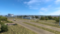
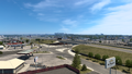
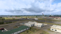
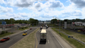
Gallery
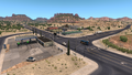
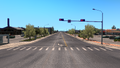
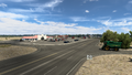
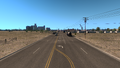
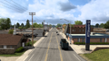
Globe
Lordsburg
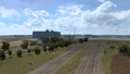
Deming
Akela
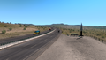
Las Cruces
Between Las Cruces and Alamogordo
White Sands National Monument
Alamogordo
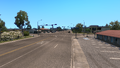
Tularosa
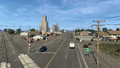
Roswell
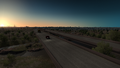
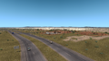
Between Roswell and Elida
Elida
Clovis
Texico
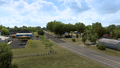
Farwell
Lariat
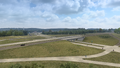
Progress
Plainview
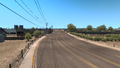
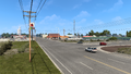
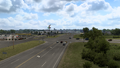
Waurika
Ardmore
Madill
Durant
Blue
Hugo
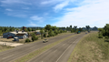
Sawyer
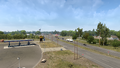
Idabel
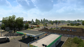
Broken Bow


See also
| Cities | |
|---|---|
| Highways | Interstate 8 • Interstate 10 • Interstate 15 • Interstate 17 • Interstate 19 • Interstate 40 • US 60 • US 64 • US 70 • US 89 • US 89A • US 93 • US 95 • US 160 • US 163 • US 180 • US 191 • SR 51 • SR 61 • SR 64 • SR 66 • SR 77 • SR 85 • SR 89 • SR 90 • SR 92 • SR 98 • SR 260 • SR 303 • SR 389 |
| See also | |
| Cities | Alamogordo • Albuquerque • Artesia • Carlsbad • Clovis • Farmington • Gallup • Hobbs • Las Cruces • Raton • Roswell • Santa Fe • Socorro • Tucumcari |
|---|---|
| Highways | |
| See also | |
| Cities | |
|---|---|
| Highways | Interstate 35 • Interstate 40 • Interstate 44 • Interstate 235 • Interstate 244 • US 54 • US 56 • US 59 • US 60 • US 62 • US 64 • US 69 • US 70 • US 75 • US 77 • US 81 • US 83 • US 183 • US 259 • US 270 • US 271 • US 277 • US 281 • US 287 • US 377 • US 385 • US 412 • SH-1 • SH-3 • SH-7 • SH-8 • SH-9 • SH-15 • SH-31 • SH-34 • SH-66 • SH-99 • SH-136 • SH-142 • SH-259A • SH-375 |
| See also | List of scenery towns in Oklahoma • List of landmarks in Oklahoma - List of Truck Stops in Oklahoma |