Interstate 44

|
This article needs a clean-up.
You can help Truck Simulator Wiki by re-organizing parts of the article, checking grammar / spelling, and doing other helpful things to correct the article.
|
Interstate 44 (I-44) is an east–west Interstate Highway in northern Texas and central Oklahoma in American Truck Simulator. The route is separated into two sections: The first section runs from US 277, US 281 and US 287 in Wichita Falls to Interstate 40 and US 270 in southwestern Oklahoma City. The second section runs from Interstate 35 in northeastern Oklahoma City to US 59, US 60, and US 69 in Miami.
In real life, Interstate 44 spans a total length of 633.79 miles (1,019.99 km) from Wichita Falls, Texas to Saint Louis, Missouri.
Course
Interstate 44 begins at the downtown area of Wichita Falls concurrent with US 277, US 281 and US 287. The three U.S. Highways continue to the south until US 277 and 287 split at an interchange; US 281 simply ends there. Heading north for 3 miles (4 km) the 287 leaves I-44 at exit 3.
Soon afterwards, I-44 continues to the north until it reaches the Red River, where it crosses into Oklahoma as the H. E. Bailey Turnpike, and then it encounters a toll gate underneath SH-5 and a Service Center shortly thereafter. The highway soon crosses the Wichita Uplift and passes through the city of Lawton to the east, where it intersects SH-7 and has a short concurrency with US 62. After leaving Lawton, I-44 crosses the easternmost portion of the Anadarko Basin and a second toll gate is reached as the highway approaches Oklahoma City, where I-44 intersects Interstate 40 and its western segment ends here. The highway resumes at Interstate 35 northeast of the city as the Turner Turnpike and is soon greeted by a toll gantry and another Service Center before reaching US 377 and SH-99 in Stroud. Continuing northeast across the Cherokee Platform, one last toll gate is encountered before I-44 loops to the southeast of Tulsa, where Interstate 244 (along with US 75) provides access into its downtown, as it joins with SH-66 for a concurrency. The highway then briefly joins US 412 for a concurrency as it heads east out of Tulsa before reaching its current eastern terminus as it splits off from the 412 at an interchange that also serves the Creek Turnpike (SH-364). Due to an interchange with US 69 discovered on I-44 past this split; the highway will eventually be extended to this interchange with the release of the Kansas DLC, and will eventually continue past the 69 into Missouri.
Cities
Exit List
Texas
| Location | mi | km | Exit | Destinations | Facilities | Notes |
|---|---|---|---|---|---|---|
| Wichita Falls | 0 | 0 | Western terminus; road continues as US 277, US 281 and US 287 | |||
| 3 | 4 | 3A | Eastern terminus of US 287 concurrency; exit 3 westbound | |||
| 6 | 9 | 3B | Spur 325 northbound is inaccessible; westbound turnaround only | |||
| 14 | 23 | 6 | Bacon Switch Road | Eastern terminus in Texas DLC; access to Wichita Falls Azure Glasswork plant |
Oklahoma
| Location | mi | km | Exit | Destinations | Facilities | Notes | |
|---|---|---|---|---|---|---|---|
| 35 | 57 | 20 | Toll Gate under overpass; eastern terminus of US 277 and US 281 concurrencies; inaccessible | ||||
| 39 | 63 | ---- | Elmer Graham Plaza | ||||
| Lawton | 56 | 90 | 36 A-B | Western terminus in Oklahoma DLC; western terminus of SH-7; western terminus of US 277 and US 281 concurrencies; signed as exit 36 eastbound | |||
| 74 | 119 | 40 A-B-C | Eastern terminus of US 277 and US 281 concurrencies | ||||
| 100 | 162 | ---- | Toll Gate | ||||
| Oklahoma City | 128 | 206 | 120 A-B | I-40 exits 147 A-B; I-44 continues north inaccessibly | |||
| End first section; start second section | |||||||
| Oklahoma City | 128 | 206 | ---- | Kilpatrick Turnpike | Signed as I-44 westbound on I-35; inaccessible | ||
| I-35 exits 138 A-B | |||||||
| 137 | 222 | ---- | Toll Gantry | ||||
| 141 | 227 | ---- | W.D. "Bill" Hoback Plaza | ||||
| Stroud | 151 | 243 | 179 | Toll Gate within ramp; access to Oklahoma City Vortex plant; US 377 and SH-99 southbound are inaccessible | |||
| 170 | 274 | ---- | Toll Gate | ||||
| Tulsa | 187 | 301 | 244 A-B | Western terminus of I-244; western terminus of SH-66 concurrency | |||
| 218 | 351 | 277 | Lewis Avenue | Access to Tulsa Pickit market | |||
| 232 | 373 | 236 | Westbound exit and eastbound entrance; eastern terminus of I-244; western terminus of US 412 concurrency | ||||
| 234 | 378 | ---- | Eastern terminus in-game; eastern terminus of US 412 concurrency; eastern terminus of SH-66 concurrency; SH-364 is inaccessible | ||||
History
- In the initial version of the Texas map expansion DLC, Interstate 44 was entirely within Wichita Falls and began at US 277, US 281 and US 287 and ended at the Wichita Falls Azure Glasswork plant, concurrent with US 277 and US 281 for its entire length.
- In the initial version of the Oklahoma map expansion DLC, the sections of Interstate 44 from the Wichita Falls Azure Glasswork plant to Interstate 40 in Oklahoma City and from Interstate 35 in Oklahoma City to US 412, SH-66, and SH-364 east of Tulsa were added.
Trivia

- In the original plans for the Oklahoma DLC, I-44 was going to be one continuous section as marked in the usa.dds map starting in the update 1.48 Open Beta; the section that was planned to be added is around the northwestern part of Oklahoma City. Ultimately, that section was cut from the release of the expansion, possibly due to the fact that another interchange between Interstate 40 and the Turner Turnpike would have taken up more space because of the 1:20 map scale (1:3 scale for cities) of ATS. This was in favor of the existing "truck route" of I-44, which follows portions of I-40 and Interstate 35 around the southeastern part of Oklahoma City. I-44 was also planned to continue northeast and end at US 69 in Big Cabin. Ultimately, this area was not added in the initial version of the DLC and will be added in update 1.49.
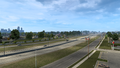
Gallery
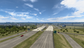
Wichita Falls
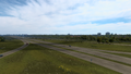
Lawton
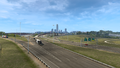
Oklahoma City
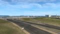
Stroud
Tulsa


See also
| Cities | |
|---|---|
| Highways | Interstate 35 • Interstate 40 • Interstate 44 • Interstate 235 • Interstate 244 • US 54 • US 56 • US 59 • US 60 • US 62 • US 64 • US 69 • US 70 • US 75 • US 77 • US 81 • US 83 • US 183 • US 259 • US 270 • US 271 • US 277 • US 281 • US 287 • US 377 • US 385 • US 412 • SH-1 • SH-3 • SH-7 • SH-8 • SH-9 • SH-15 • SH-31 • SH-34 • SH-66 • SH-99 • SH-136 • SH-142 • SH-259A • SH-375 |
| See also | |