US 59
U.S. Route 59 (US 59) is a north–south United States Highway in southern and eastern Texas in American Truck Simulator. The route is separated into two sections: The first section runs from FM 1472, Interstate 69W, and Loop 20 in Laredo to Interstate 30 and Interstate 369 in Texarkana. The second section runs from US 259 and US 271 south of Sunset Corner to due north of Interstate 40 in Sallisaw.
In real life, US 59 spans a total length of 1,911 miles (3,075 km) from the Mexican border in Laredo to the Canadian border north of Lancaster, Minnesota.
Course
US 59 begins at an interchange with FM 1472, following a concurrency with Interstate 69W and Loop 20 in northern Laredo towards the east. The route follows I-69W until it reaches Interstate 35, where I-69W simply ends there, while Loop 20 continues to run concurrently with US 59 throughout the northern city limits. As soon as the route traces to the south, the 59 branches off of Loop 20 northeast of Laredo, and then it starts running towards the northeast. The route passes by a Border Patrol Interior Checkpoint at a junction with FM 2050; soon afterwars, it traces through the oil fields of south Texas, where the oil producing company, Vortex, drills the ground to bring oil to the surface. The highway veers to the east and follows a short concurrency with SH 44 in Freer, and after leaving SH 44, the highway resumes its northeasterly run towards its junction with Interstate 37, where two truck stops are presented at this location. As it approaches Victoria, the 59 crosses Medio Creek, and north and southbound weigh stations are passed; soon afterwards, the highway enters Victoria, where it turns to the southeast as it begins to trace around the city, and then it turns to the northeast once again, intersecting US 87 south of the city, and then it intersects Loop 463 in the eastern limits. As the traces across the northern fringes of Texas' coastal plain, the highway runs through several farmlands, crosses the northern portion of Lake Texana, and enters El Campo, where it intersects a small section of SH 71. As it enters Greater Houston, the highway begins to follow Interstate 69 concurrently through Houston and Humble, intersecting several other numbered roads, mainly (from north to south) SH 288, Interstate 45, Interstate 10, and FM 1960. Leaving Greater Houston and Interstate 69, US 59 begins to enter the Piney Woods in eastern Texas as it traces to the north, intersecting US 190 in Livingston, passing by the Polk County Safety Rest Area, and enters Lufkin from the south. Here, it bypasses the city to the east, following Loop 287 and US 69 concurrently. A business route, US 59 Business, runs through the city; however, the route is inaccessible between the perimeter of Loop 287, separating it into two sections. As the 59 gradually continues northeast, the highway runs partially concurrent with US 84 and intersects US 96 in Tenaha altogether, and then it runs north as it continues to trace through the Piney Woods. As it continues north, the highway passes by a drilling site (operated by Vortex), a timber harvest site (operated by Chuck & Jack's), and approaches Interstate 20 in Marshall. US 59 continues north through the Piney Woods region, serving two rest areas in this area (the second one north of Marshall is southbound only), crosses the Big Cypress Bayou and the Sulphur River, where it passes the Wright Patman Spillway and the lake with the same name, and enters the city of Texarkana; here, it intersects SH 93, the frontage roads of Loop 151, and follows the entirety of Interstate 369 through the city before it reaches its junction with Interstate 30, where its first section ends here.
The gap between Texarkana, Texas and Oklahoma will eventually be filled in with the future release of the Arkansas map expansion. The highway through Arkansas will mostly follow a concurrency with US 71 across the eastern part of the state.
US 59 resumes at the northern terminus of US 259 without an intermediate interchange north of Ouachita Mountains; here, it also overlaps a section of US 271 and travels north across the Arkansas Valley into Sunset Corner, where the 271 branches off the highway towards Fort Smith, Arkansas inaccessibly, and follows a short section of SH-9. North of Sunset Corner, US 59 crosses the Arkansas River with the Robert S. Kerr Dam seen to the east of the river crossing; soon afterwards, the highway intersects Interstate 40 and follows a concurrency with Interstate 40 Business in Sallisaw until ending at its current northern terminus at a parking area due north of I-40.
Cities
Texas
Oklahoma
Scenery towns
Junction list
Texas
| Location | mi | km | Exit | Destinations | Facilities | Notes |
|---|---|---|---|---|---|---|
| Laredo | 0 | 0 | ---- | Southern terminus in-game; southern terminus of I-69W and Loop 20 concurrencies; FM 1472 southbound is inaccessible | ||
| 4 | 7 | 2 A-B | No exit number westbound; northern terminus of I-69W concurrency; facilities are served by exit 2B eastbound only; I-35 exits 8A-B | |||
| 27 | 44 | McPherson Road | Southbound exit and northbound entrance | |||
| 39 | 63 | ---- | TOTSO; northern terminus of Loop 20 concurrency; US 59 Bus. is inaccessible; Loop 20 southbound is inaccessible | |||
| 43 | 69 | Deep Wells Oil Well | ||||
| 55 | 88 | Picnic Area | ||||
| 59 | 95 | Laredo Nielsen Roads Roadworks | Dynamic prefab | |||
| 60 | 96 | Inaccessible | ||||
| 60 | 97 | Inspection Station | Northbound only; closed | |||
| 69 | 111 | Laredo Vortex Drilling Site | ||||
| Freer | 89 | 143 | Southern terminus of SH 44 concurrency; SH 16 is inaccessible | |||
| 94 | 151 | TOTSO; northern terminus of SH 44 concurrency; SH 44 eastbound is inaccessible | ||||
| 138 | 233 | Gallon Oil Truck Stop | ||||
| 140 | 225 | Southern terminus of US 281; facilities are served by I-37 Northbound Frontage Road; I-37 exit 56 | ||||
| 145 | 234 | Haulett Truck Stop | ||||
| 174 | 281 | Rest Stop | ||||
| 181 | 292 | Check Station | ||||
| Victoria | 201 | 323 | TOTSO; US 59 Bus. is inaccessible; US 59 Bus. is mislabeled as "US 59 North" without the "Business" plate | |||
| 228 | 367 | ---- | ||||
| 236 | 380 | US 59 Frontage Road North | Northbound exit and southbound entrance; exit has no number nor control signs | |||
| 243 | 392 | ---- | Eastern terminus of Loop 463 | |||
| El Campo | 299 | 481 | ---- | Access to Victoria Grand Pastures livestock auction | ||
| 312 | 502 | Check Station | Northbound only | |||
| 319 | 513 | Frontage Road | Southbound exit only; exit has no number nor control signs; inaccessible | |||
| Houston | 323 | 520 | Southern terminus of I-69 concurrency | |||
| See | ||||||
| 410 | 660 | Northern terminus of I-69 concurrency | ||||
| 421 | 678 | Aron Truck Stop | ||||
| Livingston | 431 | 694 | ---- | |||
| 450 | 725 | ---- | Polk County Safety Rest Area | |||
| Lufkin | 461 | 743 | Minor road | Access to Lufkin Taylor construction site | ||
| 465 | 748 | TOTSO; southern terminus of US 54 Bus. and Loop 287 concurrencies; US 59 northbound follows exit 390; US 59 southbound has no access to US 59 Bus. | ||||
| 477 | 768 | ---- | Southern terminus of US 69 concurrency; US 69 Bus. is inaccessible | |||
| 487 | 784 | Minor road | ||||
| 498 | 802 | 386 | TOTSO; northern terminus of US 69 and Loop 287 concurrencies; northern terminus of US 59 Bus.; US 59 northbound follows exit 386; US 59 northbound has no access to US 59 Bus. | |||
| Tenaha | 546 | 878 | Southern terminus of US 84 and FM 947 concurrencies; FM 947 eastbound is inaccessible | |||
| 547 | 881 | Northern terminus of FM 947 concurrency; FM 947 westbound is inaccessible | ||||
| 548 | 882 | Inaccessible | ||||
| 553 | 890 | TOTSO; northern terminus of US 84 concurrency; northern terminus of US 96 | ||||
| 573 | 923 | Minor road | Access to Longview Vortex Drilling Site | |||
| 588 | 946 | Minor road | Access to Longview Chuck & Jack's Timber Harvest Site | |||
| Marshall | 597 | 961 | Frontage Road | |||
| 601 | 967 | I-20 exit 617 | ||||
| 602 | 968 | Frontage Road | Inaccessible | |||
| 632 | 1,017 | Rest Area | ||||
| 647 | 1,041 | Rest Area | Southbound only | |||
| Texarkana | 661 | 1,064 | 111 | TOTSO; southern terminus of SH 93; southern terminus of I-369 concurrency; Loop 151 is inaccessible; I-369 exit 111 | ||
| 673 | 1,083 | ---- | Northern terminus in Texas DLC; northern terminus of I-369 concurrency; US 59 continues east inaccessibly; I-30 eastbound is inaccessible; I-30 exit 220 | |||
| End first section | ||||||
Oklahoma
| Location | mi | km | Destinations | Facilities | Notes | |
|---|---|---|---|---|---|---|
| Start second section | ||||||
| 673 | 1,083 | Southern terminus in Oklahoma DLC; northern terminus of US 259; southern terminus of US 271 concurrency; road continues as US 259 | ||||
| Sunset Corner | 685 | 1,102 | TOTSO; northern terminus of US 271 concurrency; southern terminus of SH-9 concurrency; US 271 northbound and SH-9 eastbound are inaccessible | |||
| 687 | 1,106 | Gallon Oil Truck Stop | Northern terminus of SH-9 concurrency | |||
| Sallisaw | 707 | 1,138 | Aron Truck Stop | |||
| 709 | 1,140 | Eastern terminus of I-40; southern terminus of I-40 BL concurrency; I-40 eastbound is inaccessible; I-40 exit 308 | ||||
| 712 | 1,145 | Ruth Street | Inaccessible | |||
| 713 | 1,148 | Rest Stop | Northern terminus of US 59 in-game; northern terminus of I-40 BL concurrency; US 59 continues north inaccessibly | |||
Special Route

- Main article: US 59 Business
U.S. Route 59 has one business route in Texas, respectively in Lufkin. There is also a second business route in Livingston, on US 190; however, that route is inaccessible to the player.
History
- In the initial version of the Texas map expansion DLC, US 59 began at FM 1472 in Laredo and ended at Interstate 20 in Marshall.
- In update 1.48, the section of US 59 from Interstate 20 in Marshall to Interstate 30 and Interstate 369 in Texarkana was added.
- In the initial version of the Oklahoma map expansion DLC, the section of US 59 from US 259 and US 271 south of Sunset Corner to due north of Interstate 40 in Sallisaw was added.
Trivia
- In the initial release of the Texas map expansion DLC, a small network of roads was discovered in the northeastern portion of the state beyond Dallas, Tyler and Longview, including an unfinished section of US 59 between Interstate 20 in Marshall and the northern limits of Texarkana in Arkansas. This indicated that a future update (mainly update 1.48) would extend US 59 from its northern terminus into Arkansas, ending at the northernmost portions of the Texarkana Loop.[1] The system of roads was later removed in update 1.47. With the release of update 1.48, the section north of its current northern terminus at Interstate 30 into Arkansas, was cut from the release of the update.
Gallery
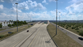
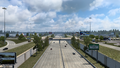
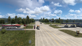
Laredo
Freer

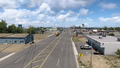
Victoria
El Campo
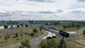
Houston
Humble
Livingston
Lufkin
Tenaha
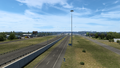
Marshall
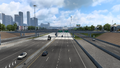
Texarkana
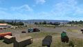
Sunset Corner
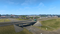
Sallisaw


References
- ↑ Texas Discussion Thread, Page 790, Message #7896 in SCS Forums, 2022-11-15 (accessed 2022-11-16)
See also
| Cities | |
|---|---|
| Highways | Interstate 35 • Interstate 40 • Interstate 44 • Interstate 235 • Interstate 244 • US 54 • US 56 • US 59 • US 60 • US 62 • US 64 • US 69 • US 70 • US 75 • US 77 • US 81 • US 83 • US 183 • US 259 • US 270 • US 271 • US 277 • US 281 • US 287 • US 377 • US 385 • US 412 • SH-1 • SH-3 • SH-7 • SH-8 • SH-9 • SH-15 • SH-31 • SH-34 • SH-66 • SH-99 • SH-136 • SH-142 • SH-259A • SH-375 |
| See also | List of scenery towns in Oklahoma • List of landmarks in Oklahoma - List of Truck Stops in Oklahoma |