Interstate 35

|
This article needs a clean-up.
You can help Truck Simulator Wiki by re-organizing parts of the article, checking grammar / spelling, and doing other helpful things to correct the article.
|
Interstate 35 (I-35) is a north–south Interstate Highway in Texas, central Oklahoma, eastern Kansas, and western Missouri in American Truck Simulator. It runs from US 83 in Laredo near the Mexican border to I-70, US 24, and US 40 in Kansas City.
Between Waco and Oklahoma, I-35 is split into two different auxiliary routes from Hillsboro to Denton. Interstate 35E heads northeast through Dallas and Interstate 35W heads northwest through Fort Worth. I-35E maintains the continuation of I-35's exit numbers, while I-35W maintains its own.
In real life, Interstate 35 spans a total length of 1,569 miles (2,525 km) from Laredo, Texas to Duluth, Minnesota. It is the ninth-longest Interstate Highway following Interstate 94 and the third-longest north–south Interstate Highway.
Course
Interstate 35 beings at an intersection of US 83 in Laredo and runs a north-south direction through the city limits. It intersects Interstate 69W, US 59 and Loop 20 altogether at a partially completed stack interchange before leaving Laredo. After running concurrently with US 83 in Botines, I-35 continues to trace to the north through the South Texas Plains. The highway passes a rest area in La Salle County and soon afterwards, intersect US 57 before reaching San Antonio. In San Antonio, I-35 intersects Interstate 10, US 87 and US 90 southwest of downtown. I-35 runs a concurrency with I-10 and US 87 for several miles until branching off the highway afterwards; soon, it intersects Interstate 37 and US 281 northeast of downtown. I-35 runs a northeast-southwest direction, running through the city of New Braunfels and enters Texas' state capital, Austin. There, it intersects US 290 and SH 71 and runs east of downtown. Shortly after passing by downtown, I-35 is split into two decks while it still runs through the Austin city limits and intersects FM 734 before leaving the city. Continuing to trace a northerly direction, I-35 passes by a second rest area between Austin and Belton. In Belton, the highway intersects Interstate 14 and US 190 before reaching Waco in the Central Texas region, where it begins its concurrency with US 77 after intersecting Loop 396. I-35 reaches Bellmead and intersects Loop 340 and FM 3051 east of the Lacy Lakeview city limits. Continuing up across Central Texas, I-35 runs through West and soon afterwards, reaches Hillsboro, where US 77 branches off of the highway and splits into two auxiliary routes before reaching Fort Worth and Dallas. For further information about the course of I-35 through the Dallas–Fort Worth metroplex, see Interstate 35E and Interstate 35W. The two auxiliary routes join to reform I-35 in Denton, and once again cosigns US 77.
After intersecting with US 82 at Gainesville, I-35 crosses the Red River into Oklahoma and the Chickasaw Nation, where it is greeted with a northbound weigh station with a rest area. I-35 soon after reaches Ardmore and US 70. North of Ardmore, the 35 continues north through the Arbuckle Mountains and crosses the Washita River upon entering Oklahoma City, the capital of Oklahoma. Inside Oklahoma City, the highway intersects Interstate 235, Interstate 40 (as a concurrency for a short stretch) and Interstate 44. North of Oklahoma City, I-35 continues across the Great Plains to its junction with US 64 and US 412 east of Enid, and on through Tonkawa, where there are services, past north and southbound weigh stations (each with a rest area) to the Kansas border.
Upon entering Kansas, I-35 begins following the Kansas Turnpike, a toll route that follows multiple Interstates across eastern Kansas. I-35 soon runs through Wichita, the state's largest city, where it intersects with Interstate 135 and US 400. North of Wichita, I-35 passes El Dorado, where access to US 54 is provided, and afterwards enters the Flint Hills. It is in the Flint Hills where I-35 reaches its highest point in real life, which is represented in the game by a summit at the Bazaar Cattle Pens, where there is a viewpoint, as well as two parking areas. Out of the Flint Hills, I-35 reaches Emporia, where it intersects with Interstate 335, breaks from the Kansas Turnpike, and begins running concurrent with US 50. I-35 then intersects with US 75, where services are offered, and after north and southbound rest areas reaches the Kansas City Metro Area at Edgerton. After north and southbound weigh stations, I-35 intersects with Interstate 635 and US 69; it is in this area that US 50 breaks its concurrency, however this isn't represented in the game. I-35 soon after enters Missouri and Kansas City, and currently ends at its junction with Interstate 70.
Cities
Texas
- Laredo
- San Antonio
- Austin
- Waco
- Dallas (via I-35E)
- Fort Worth (via I-35W)
Scenery towns
Oklahoma
Scenery towns
Kansas
Scenery towns
Kansas/Missouri
Exit List
Texas
| Location | mi | km | Exit | Destinations | Facilities | Notes |
|---|---|---|---|---|---|---|
| Laredo | 0 | 0 | Southern terminus; southern terminus of US 83 concurrency | |||
| 3 | 6 | 8 A-B | Exit 8A northbound; exit 8B southbound; I-69W exits 2 A-B | |||
| 6 | 9 | Exit 8B northbound; exit 8A southbound | ||||
| Botines | 21 | 34 | 18 | Northern terminus of US 83 concurrency | ||
| 41 | 67 | ---- | Inspection Station | Northbound only; closed | ||
| 63 | 102 | ---- | La Salle County Rest Area | |||
| 101 | 163 | 111 | Access to San Antonio Mary's Cotton plant | |||
| 113 | 182 | ---- | CMV Station | |||
| San Antonio | 134 | 215 | 150 | Zaramora Street, Military Drive | ||
| 155 | 249 | 153 | Eastern terminus of I-10 concurrency; southern terminus of US 87 concurrency; I-10 exit 572 | |||
| 168 | 270 | 156 | Western terminus of I-10 concurrency; northern terminus of US 87 concurrency; I-10 exit 570 | |||
| 183 | 295 | 158 | Northern terminus of I-37; exits 158 A-B southbound; I-37 exits 142 A-B; US 281 northbound is inaccessible; northbound exit is mislabeled as exit 139 | |||
| 197 | 318 | 164 | Rittiman Road | |||
| New Braunfels | 212 | 342 | 191 | |||
| Austin | 241 | 388 | 230 231 |
Ben White Boulevard, Woodward Street | Exit 230 northbound; exit 231 southbound | |
| 242 | 390 | Southern terminus of US 290 concurrency; exit 231 northbound; exit 230 southbound | ||||
| 259 | 418 | 234 | Cesar Chavez Street, 2nd Street, 4th Street | |||
| 274 | 441 | |||||
| 282 | 455 | 237 A | Airport Boulevard | Upper deck only; northbound exit and southbound entrance; some control signs label the exit without the suffixed letter as Exit 237; Inaccessible | ||
| 284 | 458 | |||||
| 289 | 465 | 245 | Northern terminus of US 290 concurrency; FM 734 northbound is inaccessible | |||
| 296 | 476 | ---- | Bell County Safety Rest Area | |||
| Belton | 311 | 501 | 293 | Eastern terminus of I-14; I-14 exit 300 | ||
| Waco | 331 | 534 | 331 | New Road | Also serves Cameron | |
| 349 | 561 | 333 | Southbound exit and northbound entrance; southern terminus of US 77 concurrency | |||
| Bellmead | 357 | 575 | 339 | Eastern terminus of FM 3051 | ||
| West | 377 | 606 | 353 | |||
| Hillsboro | 392 | 632 | 370 | Northern terminus of US 77 concurrency; Spur 579 is inaccessible | ||
| 402 | 647 | 370 B | I-35 northbound splits into I-35E and I-35W | |||
| See | ||||||
| Denton | 499 | 804 | 467 | I-35 southbound splits into I-35E and I-35W | ||
| 503 | 809 | 471 | Southern terminus of US 77 concurrency | |||
| Gainesville | 517 | 832 | 498 | Northern terminus in Texas DLC; northern terminus of US 77 concurrency | ||
Oklahoma
| Location | mi | km | Exit | Destinations | Facilities | Notes |
|---|---|---|---|---|---|---|
| 540 | 869 | ---- | Weigh Station | Northbound only | ||
| Ardmore | 562 | 904 | 29 | Southern terminus in Oklahoma DLC; southern terminus of US 70 concurrency | ||
| 573 | 922 | 31 A-B | Northern terminus of US 70 concurrency | |||
| 575 | 925 | 33 | ||||
| Oklahoma City | 622 | 1,001 | 125 | Southeast 15th Street | Southern terminus of US 62 and US 77 concurrencies | |
| 631 | 1,015 | 126 | Northern terminus of US 77 concurrency; northbound access to I-40 west via I-235 exit 1B; I-235 exit 1B | |||
| ---- | Southern terminus of I-40 and US 270 concurrencies; I-40 exits 151 A-B | |||||
| 638 | 1,027 | 127 | Reno Avenue / Eastern Avenue / Martin Luther King Avenue | |||
| 647 | 1,041 | ---- | Northern terminus of I-40 and US 270 concurrencies; I-40 exit 153 | |||
| 662 | 1,065 | 138 A-B | I-44 westbound is inaccessible | |||
| 710 | 1,142 | 194 A-B | Northern terminus in-game |
History
- In the initial version of the Texas map expansion DLC, Interstate 35 began at US 83 in Laredo and ended at US 82 in Gainesville.
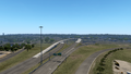
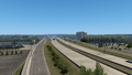
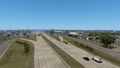
Gallery
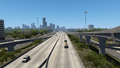
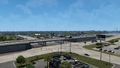
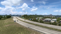
Laredo
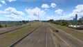
Botines
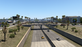
San Antonio
New Braunfels
Austin
Belton
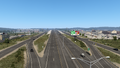
Waco
Bellmead
West
Hillsboro
Denton
Gainesville
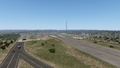
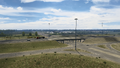
Ardmore
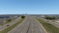
Oklahoma City


See also
| Cities | |
|---|---|
| Highways | Interstate 35 • Interstate 40 • Interstate 44 • Interstate 235 • Interstate 244 • US 54 • US 56 • US 59 • US 60 • US 62 • US 64 • US 69 • US 70 • US 75 • US 77 • US 81 • US 83 • US 183 • US 259 • US 270 • US 271 • US 277 • US 281 • US 287 • US 377 • US 385 • US 412 • SH-1 • SH-3 • SH-7 • SH-8 • SH-9 • SH-15 • SH-31 • SH-34 • SH-66 • SH-99 • SH-136 • SH-142 • SH-259A • SH-375 |
| See also | List of scenery towns in Oklahoma • List of landmarks in Oklahoma - List of Truck Stops in Oklahoma |
| Cities | Colby • Dodge City • Emporia • Garden City • Hays • Hutchinson • Junction City • Kansas City • Marysville • Phillipsburg • Pittsburg • Salina • Topeka • Wichita |
|---|---|
| Highways | Interstate 35 • Interstate 70 • Interstate 135 • Interstate 335 • Interstate 470 • Interstate 635 • TBA |
| See also | List of scenery towns in Kansas • List of landmarks in Kansas - List of Truck Stops in Kansas |
| Cities | |
|---|---|
| Highways | Interstate 29 • Interstate 35 • Interstate 44 • Interstate 55 • Interstate 70 • Interstate 670 • TBA |
| See also | List of scenery towns in Missouri • List of landmarks in Missouri - List of Truck Stops in Missouri |