US 90
U.S. Route 90 (US 90) is an east–west United States Highway in Texas in American Truck Simulator. The route is separated into two sections: The first section runs from Interstate 10 Business and SH 54 in Van Horn to Houston. The second section runs from Beaumont to east of the latter city, near the border with Louisiana, mostly concurrent with Interstate 10.
In real life, US 90 spans a total length of 1,633 miles (2,628 km) from Van Horn, Texas to Jacksonville Beach, Florida.
Course
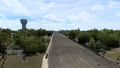
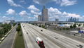
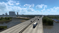
US 90 begins at an intersection with Interstate 10 Business and SH 54 in Van Horn and travels southward, overlapping SH 54 to Interstate 10. The highway travels in a southeastern direction across the Chihuahuan Desert and runs parallel with a Union Pacific railroad as it heads through the town of Valentine. In Marfa, it begins its concurrency with US 67. As the highways head east, they pass by a rest area, where it is also the "official" viewing area of the Marfa Lights observed near the highway at Mitchell Flats between Marfa and Mexico, which has gained some fame to onlookers attributing the paranormal phenomenon of ghosts, UFOs, or will-o'-the-wisp. Winding around Paisano Pass, the highway traces through the Trans-Pecos Volcanic Field, passing by Paisano Peak to the south, which formally functioned as a volcano until around 17 million years ago. Entering Alpine, US 90 ends its concurrency with the 67 and continues east to serve Marathon; soon afterwards, the highway meets the southern terminus of US 285 in Sanderson. A long time after passing through Dryden, the highway begins to run closely parallel with the Mexican border. It crosses the Pecos River via the Pecos River Bridge, which carries the highway across the canyon, and a viewpoint is also presented there. Approaching Del Rio, the highway crosses Amistad Reservoir, where another viewpoint is presented, and overlaps US 277 as it runs through Del Rio. At the eastern skirts of the city limits, a third viewpoint is presented. Across Texas' southern Hill Country, US 90 encounters two level crossings in Cline, passes by a Border Patrol Interior Checkpoint, and crosses the Neuces River via a separated double bridge, featuring an eastbound through truss bridge and a westbound beam bridge; soon afterwards, the highway intersects US 83 in Uvalde as it continues to cross the southern Hill Country. It crosses the Dry Frio River, and for some miles later, a rest area is presented. US 90 then arrives in San Antonio where it serves as a freeway and intersects Interstate 10, Interstate 35, and US 87 through the city. The highway multiplexes with I-10 as it crosses the southern Prairies and Lakes region to Houston, where a section of US 90 ends there, just east of the interchange with Interstate 69 and US 59. The highway resumes west of Beaumont, following College Street and overlaps with I-10 again afterwards; here, it also multiplexes with US 69, 96, and 287 as it runs a north–south orientation until turning east again as it continues to follow I-10 around downtown Beaumont. The highways cross the Neches River before reaching its current eastern terminus at I-10's exit 856, where it will eventually continue into Louisiana.
Cities
Junction list
| Location | mi | km | Destinations | Facilities | Notes |
|---|---|---|---|---|---|
| Van Horn | 0 | 0 | Western terminus; western terminus of SH 54 concurrency; road continues as SH 54 inaccessibly | ||
| 0 | 0 | Van Horn Pickit Market | |||
| 0 | 0 | Eastern terminus of SH 54 concurrency; I-10 exit 140 A | |||
| 3 | 5 | Driverse Truck Stop | |||
| 5 | 8 | Rest Stop | |||
| 6 | 10 | Van Horn Faraday Electric Substation | |||
| 25 | 40 | Rest Stop | |||
| 50 | 81 | Labeled as "RM 505" in real-life; inaccessible | |||
| Marfa | 78 | 126 | Western terminus of US 67 concurrency; SH 17 is inaccessible | ||
| 85 | 137 | Rest Stop | |||
| 89 | 144 | Picnic Area, Marfa Lights | |||
| 118 | 190 | Parking Area | |||
| Alpine | 129 | 208 | Mosley Lane | Eastern terminus of US 67 concurrency; inaccessible | |
| Marathon | 152 | 245 | Cemetery, County Park, Health Clinic | Inaccessible | |
| 157 | 254 | Inaccessible | |||
| Sanderson | 198 | 319 | Southern terminus of US 285 | ||
| 199 | 321 | Aron Truck Stop | |||
| 221 | 356 | Rest Stop | |||
| Dryden | 225 | 363 | Inaccessible | ||
| 237 | 382 | Rest Stop | |||
| 268 | 423 | The Pecos river | |||
| 285 | 459 | Inspection Station | Westbound only; closed | ||
| Del Rio | 319 | 514 | Western terminus of US 277 concurrency; minor road serves the Del Rio Nielsen Roads roadworks (dynamic prefab) and Governor's Landing Bridge | ||
| 326 | 525 | Del Rio Home Store Market, Del Rio Wallbert Market | |||
| 326 | 526 | Del Rio Home Store Market | Eastbound only | ||
| 327 | 527 | TOTSO; northern terminus of Spur 239; the direction of Spur 239 and 297 are misdirected on westbound signage; Spur 297 is inaccessible | |||
| 328 | 528 | Eastern terminus of US 277 concurrency | |||
| 328 | 529 | The city of Del Rio | |||
| 357 | 575 | Inspection Station | Eastbound only; closed | ||
| Uvalde | 383 | 617 | The city of Uvalde | ||
| 385 | 620 | ||||
| 417 | 672 | Medina County Safety Rest Area | |||
| San Antonio | 442 | 711 | |||
| 450 | 724 | Western terminus of I-10 and US 87 concurrencies; road continues as I-10 and US 87; I-10 and US 90 exit 572; I-35 exit 153 | |||
| See | |||||
| Houston | 676 | 1,089 | McCarty Drive | Eastern terminus of I-10 concurrency; I-10 exit 773 | |
| End first section; start second section | |||||
| Beaumont | 676 | 1,089 | Beaumont Garage, Beaumont Avalanche Steel Scrapyard | ||
| 677 | 1,089 | Beaumont Asuma Warehouse | |||
| 677 | 1,090 | 23rd Street | Access to Beaumont Equos Power warehouse | ||
| 678 | 1,092 | TOTSO; western terminus of I-10, US 69, US 96, and US 287 concurrencies; I-10 exit 851 | |||
| See | |||||
| 718 | 1,156 | Rose City | Eastern terminus in-game; eastern terminus of I-10 concurrency; access to Beaumont Avalanche Steel mill; I-10 exit 856 | ||
Galley
Van Horn
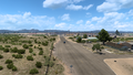
Valentine
Marfa
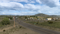
Alpine
Marathon
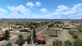
Sanderson
Dryden
Del Rio
Cline
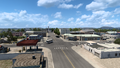
Uvalde
San Antonio
Schulenburg
Houston
Beaumont


