Interstate 5

|
This article needs a clean-up.
You can help Truck Simulator Wiki by re-organizing parts of the article, checking grammar / spelling, and doing other helpful things to correct the article.
|
- "I-5" redirects here. For other roads numbered I-5, see I-5 (disambiguation).
Interstate 5 (I-5) is a north–south interstate highway in California, Oregon, and Washington in American Truck Simulator. It runs from San Diego to Bellingham.
Course
| This page uses Creative Commons Licensed content from Wikipedia (view authors). |
Interstate 5 starts at the Mexican border and soonafter intersects with Interstate 8 in San Diego, California. After passing through the city, it runs parallel to the Pacific coast up to Carlsbad. Past Carlsbad, I-5 enters the Los Angeles region. Between Interstate 10 and SR 126, the freeway ranges between two and four lanes in each direction. North of Los Angeles, I-5 passes through the Grapevine. Climbing the pass, the right lane is used for slow vehicles only, as there are steep grades. A runaway ramp is even provided during the descent of the high altitudes. South of Bakersfield, the freeway splits with SR 99.
After the split, Interstate 5 passes through the San Joaquin Valley for about 200 miles until reaching the San Francisco–Sacramento metropolitan area. Before Oakland, the freeway splits with Interstate 580, which takes traffic toward Oakland and San Francisco. I-5 continues north through Stockton before reaching Sacramento. The freeway intersects with US 50, twists through the center of the California capital, and then intersects with Interstate 80, taking truckers towards San Francisco to the southwest or Truckee to the northeast. Interstate 5 continues north through the Sacramento Valley toward Redding, with services offered at Dunnigan and Corning. North of Redding, after intersecting with CA 44 and CA 299, the freeway crosses Shasta Lake, a reservoir on the Sacremento River hemmed in by craggy mountains. After climbing a winding grade, the highway passes by the town of Weed and then continues north toward Hilt and the Oregon border. Southbound traffic is required to stop at an agricultural inspection station south of Hilt.
Upon entering Oregon's Rogue Valley, it continues through the Siskiyou Mountains and into the city of Medford. It turns west and intersects with US 199 in the town of Grants Pass before turning north again. Gradually, the mountains turn into hills as the freeway snakes its way into the Willamette Valley. In Eugene, the highway intersects with Interstate 105, a short spur route providing access to downtown Eugene, OR 126, and OR 569. The Interstate then heads almost due north, skirting Albany and passing through Salem. After first tracking a little to the northeast, the highway hits the southern terminus of Interstate 405 and the Marquam Bridge, where it crosses the Willamette River. North of the river, I-5 has junctions at the western end of I-84 and the northern end of Interstate 405. It then continues through the northern parts of the city of Portland, and crosses the Columbia River into Washington via the Interstate Bridge.
After crossing into Washington, Interstate 5 passes under the railroad tracks and intersects WA 14 which goes to Vancouver. A few miles down the road the highway enters Longview, where it intersects WA 432 before it crosses the Newaukum River on two truss bridges. It intersects US 12 just outside of town. After passing between the Cascades and the Willapa Hills, I-5 enters Olympia, where it intersects US 101 and WA 510. The highway than snakes northwest passing just below the capital dome.
Upon entering Tacoma, Puget Sound comes into view on the left as the highway turns north. Leaving Tacoma, Interstate 5 makes an interchange with Spokane Street (to the Port of Seattle), after passing the Port of Seattle, Interstate 5 enters the Emerald City itself, Seattle, where it intersects Interstate 405 and Interstate 90 before entering the Melrose Ave Tunnel under the city. Upon exiting the tunnel, I-5 passes the Space Needle and the Ship Canal Bridge, and enters Everett.
In Everett, Interstate 5 intersects with WA 526, which goes to the Darwing (Boeing in real-life) in Everett Plant. A few miles down the road the highway enters downtown and intersects US 2. I-5 continues north before intersecting WA 529 and leaves Everett. After leaving Everett, I-5 enters Burlington, where it intersects with WA 20. The highway curves around the city before it turns north, where it then enters Bellingham and passes through the city before it reaches the northern boundary and crosses the 49th Parallel, where it terminates at the Peace Arch Port of Entry in Blaine, where it becomes BC Highway 99 in Canada.
Cities
California
Oregon
Scenery towns
Washington
Scenery towns
Exit list
California
| Location | mi | km | Exit | Destinations | Facilities | Notes |
|---|---|---|---|---|---|---|
| San Diego | 0 | 0 | Downtown San Diego, near the Wallbert and a minor road to central San Diego | South terminus in game | ||
| 4 | 6 | 20 | ||||
| 18 | 28 | 23 | Southern Drive | |||
| Carlsbad | 47 | 75 | Carlsbad | |||
| 59 | 94 | Carlsbad | ||||
| 64 | 102 | Carlsbad | ||||
| 79 | 127 | |||||
| Los Angeles | 103 | 165 | 130 | Southern Boulevard – Los Angeles Downtown | ||
| 116 | 186 | 135 | ||||
| 122 | 196 | 136 | Northern Boulevard – Plaster & Sons depots | |||
| 134 | 215 | 137 | ||||
| 144 | 231 | |||||
| Santa Clarita | 153 | 246 | ||||
| 165 | 265 | |||||
| 213 | 342 | 221 | Northbound left exit and southbound left entrance | |||
| 252 | 405 | 257 | ||||
| 288 | 463 | ---- | Weigh station | |||
| 296 | 476 | ---- | Truck stop | |||
| Huron | 311 | 500 | Minor road towards Huron and Fresno | |||
| 335 | 539 | |||||
| 346 | 556 | Minor road towards Huron and Fresno | ||||
| 390 | 627 | 403 | ||||
| Patterson | 411 | 661 | 434 | Diablo Grande Parkway, SR 130 | ||
| 425 | 683 | 446 | Northbound left exit and southbound left entrance | |||
| 442 | 711 | Minor road to Oakland |
||||
| Stockton | 471 | 758 | ||||
| 477 | 767 | Stockton, |
||||
| Sacramento | 518 | US 50 exit 4 | ||||
| 522 | I-80 exit 86 | |||||
| Dunnigan | 541 | 871 | 554 | Road 8 | ||
| 608 | 979 | ---- | Rest area | |||
| Corning | 634 | 1,020 | 630 | South Avenue | ||
| 649 | 1,045 | ---- | Weigh station | Northbound only | ||
| 660 | 1,063 | ---- | Weigh station | Southbound only | ||
| Redding | 673 | Knighton Road | ||||
| 677 | Cypress Avenue | |||||
| 678 A-B | Northbound exit 678; SR 44 exits 2 A–B | |||||
| 680 | ||||||
| 743 | 1,195 | ---- | Rest area | Northbound only | ||
| Weed | 750 | 1,207 | 747 | |||
| 787 | 1,267 | ---- | Border Protection Station | Southbound only | ||
| Hilt | 798 | 1,284 | 796 | Hilt | North terminus in base game |
Oregon
| Location | mi | km | Exit | Destinations | Facilities | Notes |
|---|---|---|---|---|---|---|
| 808 | 1,301 | ---- | Port of Entry, weigh station | Northbound only | ||
| 816 | 1,313 | ---- | Weigh station | Southbound only | ||
| Medford | 832 | 1,339 | 27 | |||
| 842 | 1,356 | 30 | ||||
| Grants Pass | 875 | 1,409 | 55 | |||
| Canyonville | 904 | 1,455 | 99 | Canyonville | ||
| 949 | 1,528 | ---- | Weigh station | |||
| 980 | 1,578 | ---- | Rest area | |||
| 995 | 1,602 | 188 | ||||
| Eugene | 1,013 | 1,631 | 194 A-B | First photo of Oregon | ||
| 1,028 | 1,655 | 195 A-B | Southbound exit 195 | |||
| Albany | 1,056 | 1,700 | 233 | |||
| Salem | 1,074 | 1,729 | 253 | |||
| 1,079 | 1,737 | 256 | ||||
| Portland | 1,098 | 1,768 | 299 B | Left exits No exit number southbound | ||
| 1,114 | 1,793 | 300/ 301 |
Northbound exit 300; southbound exit 301 South end of US 30 concurrency | |||
| 1,121 | 1,805 | 302 B | North end of US 30 concurrency | |||
| 1,145 | 1,843 | 307 | OR 99E South (Vancouver Way in game) / OR 99W (Shipyard Rd) | North terminus in Oregon DLC
| ||
| 1,154 | 1,858 | 308 | Hayden Island, ODOT Permits | Inaccessible
One of the road signs is labeled incorrectly as exit 380 |
Washington
| Location | mi | km | Exit | Destinations | Facilities | Notes |
|---|---|---|---|---|---|---|
| Vancouver | 1,163 | 1,873 | 1 | South terminus in Washington DLC | ||
| Longview | 1,174 | 1,890 | 36 | |||
| 1,192 | 1,919 | 68 | ||||
| 1,203 | 1,937 | 72 | Rush Road | |||
| Olympia | 1,217 | 1,960 | 104 | |||
| 1,230 | 1,980 | 105 | State Capitol, City Center, Port of Olympia | |||
| 1,237 | 1,991 | 111 | ||||
| Tacoma | 1,254 | 2,019 | 136 A-B | 20th Street East – Port of Tacoma | Southbound exit 136 | |
| 1,265 | 2,037 | ---- | Rest area, weigh station | Northbound only | ||
| 1,269 | 2,044 | ---- | Weigh station | Southbound only | ||
| Seattle | 1,273 | 2,050 | 154 A-B | Nortbound exit 154 | ||
| 1,281 | 2,062 | 163 | West Seattle Bridge / Spokane Street – Port of Seattle | |||
| 1,290–1,301 | 2,076–2,096 | 164 A | Southbound exit 164; I-90 exits 2 B–C | |||
| 1,290 | 2,076 | 164 A | Dearborn Street / Edgar Martinez Drive | Inaccessible Northbound only | ||
| 1,292 | 2,080 | 164 B | James Street / Medison Street | Inaccessible Northbound only Labeled incorrectly, Medison Street does not exist, the correct name is Madison Street | ||
| Everett | 1,318 | 2,123 | 189 | |||
| 1,325 | 2,133 | 193 | Everett City Center | Northbound exit and southbound entrance | ||
| 1,326–1,333 | 2,135–2,146 | 194 | ||||
| 1,333 | 2,146 | 194 | Everett Avenue | Southbound exit and northbound entrance | ||
| 1,345 | 2,166 | 198 | Southbound exit and northbound entrance | |||
| 1,350 | 2,174 | ---- | Rest area, weigh station | Northbound only | ||
| Burlington | 1,362 | 2,192 | 230 | |||
| 1,370 | 2,205 | 232 | Cook Road – Sedro–Woolley | |||
| 1,382 | 2,227 | ---- | Rest area, weigh station | Southbound only | ||
| Bellingham | 1,389 | 2,237 | 254 | State Street / Iowa Street | ||
| 1,404 | 2,261 | 258 | Bakerview Road – Bellingham International Airport | North terminus in game |
History
- In the initial version of American Truck Simulator, Interstate 5 began in San Diego and ended in Hornbrook.
- In update 1.5, as part of the 1:35 to 1:20 map rescale, new sections, including the Grapevine, were added to accommodate the new map scale. The hybrid interchange with Interstate 8 and the trumpet interchanges with Interstate 10 and US 101 were added as the routes were extended to Interstate 5. In San Diego, Carlsbad, and Los Angeles, all junctions were rebuilt and additional lanes were added. The diamond interchange with SR 14 and SR 126 was separated into two separate diamond interchanges for each route, while the cloverleaf interchange with SR 99 and SR 110 was changed to a trumpet interchange with SR 110 as the junction with SR 99 was moved to a new half-trumpet interchange south of Bakersfield. The diamond interchange with SR 58 was changed to a folded diamond interchange and the truck stop there was added. The trumpet interchange with Interstate 580 was changed to a half-trumpet interchange. In Redding the TOTSO at the cloverleaf interchange was removed as the route through the town was changed.
- In update 1.31, the cloverleaf interchange with SR 299 was rebuilt, and Weed and the diamond interchange there with US 97 were added.
- In update 1.32, the cloverleaf interchange with Interstate 80 was changed to a cloverstack interchange.
- In the initial version of the Oregon map expansion DLC, the section of Interstate 5 from Hornbrook to Portland was added.
- In update 1.35, a diamond interchange with a new section of SR 299 was added north of Redding, while the previous section was redesignated as SR 44, and the previous section of SR 44 became undesignated.
- In the initial version of the Washington map expansion DLC, the section of Interstate 5 from Portland to Bellingham was added.
- In update 1.41, as part of the first phase of the California rework, the sections of Interstate 5 from Interstate 80 in Sacramento to just south of Redding and from SR 299 in Redding to the California–Oregon state line were completely reworked. Hornbrook was reworked and replaced by Hilt, and a Border Protection Station south of it was added. The scenery towns of Corning and Dunnigan were added, and truck stops there and a rest area south of Corning and a weigh station between Corning and Redding replaced the previous truck stops and weigh station between Sacramento and Redding. Sacramento River just north of Sacramento, Shasta Lake, and a rest area north of the latter were added. The minor road running parallel to Interstate 5 between Sacramento and Redding was also completely reworked. The diamond interchange with it in Dunnigan was rebuilt, a Sunshine Crops farm was added north of Sacramento, and the rest area south of Redding was removed.
- In update 1.44, as part of the second phase of the California rework, from Stockton to just north of Dunnigan and from just south of Redding to SR 299 in Redding were completely reworked, including a complete rework of Redding and Sacramento. All junctions except in Dunnigan were rebuilt, the diamond interchange in Sacramento was replaced by a four-level stack interchange with US 50, and a diamond interchange with Knighton Road in Redding was added. An inaccessible northern section of Stockton was added, and Sacramento River just north of Sacramento was removed. The minor road running parallel to Interstate 5 between Sacramento and Redding was also completely reworked around Dunnnigan.
Gallery
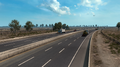
Sacramento Valley (before update 1.41)
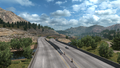
Mountains (before update 1.41)


See also
| Cities |
| ||||||
|---|---|---|---|---|---|---|---|
| Highways |
| ||||||
| See also | |||||||
| Cities | Astoria (Warrenton) • Bend (Terrebonne) • Burns • Coos Bay (North Bend) • Eugene (Springfield) • Klamath Falls • Lakeview • Medford • Newport (Toledo) • Ontario • Pendleton (Rieth) • Portland (Troutdale) • Salem • The Dalles |
|---|---|
| Highways | Interstate 5 • Interstate 82 • Interstate 84 • Interstate 105 • Interstate 205 • Interstate 405 • US 20 • US 26 • US 30 • US 95 • US 97 • US 101 • US 197 • US 199 • US 395 • OR 7 • OR 22 • OR 39 • OR 58 • OR 62 • OR 78 • OR 99 • OR 126 • OR 140 • OR 201 • OR 213 • OR 569 |
| See also | |
| Cities | |
|---|---|
| Highways | Interstate 5 • Interstate 82 • Interstate 90 • Interstate 182 • Interstate 205 • Interstate 405 • US 2 • US 12 - US 97 • US 101 • US 395 • US 730 • SR 8 • SR 14 • SR 20 • SR 155 • SR 261 • SR 285 • SR 397 • SR 432 • SR 433 • SR 526 • SR 529 • SR 900 |
| See also | List of scenery towns in Washington • List of landmarks in Washington • List of Truck Stops in Washington |