US 287
U.S. Route 287 (US 287) is a north–south United States Highway in eastern and northern Texas, eastern Colorado, central Wyoming, and southwestern Montana in American Truck Simulator. The route is separated into nine sections: The first section runs from Interstate 10, US 69, and US 96 in Beaumont to US 190 in Woodville, concurrent with US 69. The second section runs from Interstate 30 and Interstate 35W in Fort Worth to US 60 and US 87 in Amarillo. The third section runs from US 87 in Amarillo to US 87 in Dumas, concurrent with the latter route. The fourth section runs from US 50 and US 385 in Lamar to Interstate 70 and US 40 in Aurora. The fifth section runs from US 34 in Loveland to SH 14 north of Fort Collins. The sixth section runs from Interstate 80 Business and US 30 in Laramie to WYO 487 in Medicine Bow, concurrent with US 30. The seventh section runs from Interstate 80 and WYO 76 in Sinclair to US 89 and US 191 at the South Entrance of Yellowstone National Park north of Jackson. The eight section runs from US 20 at the West Entrance of Yellowstone National Park east of West Yellowstone to Ennis. The ninth section runs entirely within Helena, concurrent with US 12.
In Grand Teton and Yellowstone National Parks, commercial trucking is prohibited beyond entry of the toll gates from US 89 and US 191 at Moran Junction, Wyoming to US 20 and US 191 at West Yellowstone, Montana. When one tries to drive through the gate with a trailer, they will get a message saying: Commercial trucking is prohibited here. You have to turn around and go back! If the player ignores that, they will receive a fine. A Special Transport route from Riverton to Jackson runs through the parks, however, the driver and the escort team are permitted to drive through these areas to reach their destionation at the Government Area in Yellowstone. If the player wants to leave the park with no Illegal Trailer ticket, it is required to deliver the cargo by using the freight market and not the cargo market.
In real life, US 287 is separated into two sections by Yellowstone National Park, where unnumbered park roads serve as a connector, which is also similar to the highway's rendering in ATS. The highway spans a total length of 1,791 miles (2,882 km) from Port Arthur, Texas to Choteau, Montana. It is the second-longest three-digit US Route in the United States, behind US 281.
Course
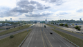
US 287 begins at its southern terminus (as well as those of US 69 and US 96) with Interstate 10 and US 90 in Beaumont. The highway overlaps the latter routes until I-10 and the 90 turn towards the west, while staying on the 69 and 96. Shortly afterwards, the 96 branches off of the highway in Lumberton. The highway continues to overlap with the 69 through Kountze until reaching a gap in the route at US 190 in Woodville, where the road continues as US 69 towards the north into Lufkin. Resuming in Fort Worth, at the stack interchange with Interstates 30 and 35W, the highway follows a short concurrency with I-35W until branching off at exit 59 and heads northwest, passing by the city's neighborhood of Avondale before leaving the Fort Worth city limits. After passing by a rest area, the 287 overlaps with US 82 and begins to run parallel with Oklahoma and the Red River to the north as it traces into Wichita Falls, where the 82 branches off and the highway then overlaps with US 277 and 281; soon afterwards, it overlaps with Interstate 44 before branching off of the highways at exit 3A. A second rest area is passed as the highway enters Childress, ending its parallel course with Texas' neighboring state to the north, where it intersects US 62 and 83. East of Childress, a weigh station is passed, and the 287 crosses the Prairie Dog Town Fork Red River; soon afterwards, a third rest area is passed. Entering Amarillo, the highway begins to run concurrent with Interstate 40, intersecting the in-game clockwise end of Loop 335 and Interstate 27, US 60 and 87; I-27 also ends here. There, the 287 turns to the north, overlapping the 60 and 87 until it reaches its second gap through downtown. US 287 resumes at the northern end of the one-way street pairs through downtown and once again, overlaps with the 87 across the panhandle of northern Texas, crossing the Canadian River, and into Dumas, where another gap in the route begins here, while the 87 leaves its concurrency with the highway towards Dalhart and New Mexico.
The gap between Texas and Colorado will eventually be filled in with the future release of the Oklahoma map expansion. The highway through Oklahoma's panhandle will serve Boise City and intersect the highways of US 56, 64, 385, 412, and SH-3.
The highway resumes at US 50 in Lamar, Colorado, where the 287 had come north from Oklahoma. The 287 runs concurrent with the 50 for a short distance and breaks away at the Bushnell feed lot west of Lamar. The 287 continues north across the vast Great Plains, through the towns of Eads and Kit Carson. At Kit Carson, the highway meets US 40, and the two highways run together past Wild Horse to Limon and Interstate 70, along which the highways run concurrent to Denver. US 287 resumes at its intersection with US 34 in Loveland, and continues north through Fort Collins, ending at a Bushnell ranch at the northern end of the SH 14 concurrency north of the city.
US 287 resumes in Laramie, Wyoming, where it runs through downtown, concurrent with US 30. Out of Laramie, the highways run together through Rock River to Medicine Bow and WYO 487, where a gap in their courses begin. The 287 continues at Interstate 80 at Sinclair and run parallel with WYO 76 into Rawlins. Passing through downtown, it sets off along the edge of the arid Great Divide Basin to Muddy Gap Junction, concurrent with WYO 789. At Muddy Gap the highways meet WYO 220, and trend northwest along the course of the Oregon Trail, which features a rest area and intersects WYO 135 at Sweetwater Station. After slipping through the brilliantly red rocks of the Derby Dome, the highway intersects with WYO 28, and shortly after reaches Lander, where the 789 breaks away to Riverton. The 287 continues along the feet of the Wind River Range to US 26, along which the highway runs concurrent to Moran Junction. There, the 287 breaks from the 26 and follows US 89 and US 191 north through Grand Teton and Yellowstone National Parks, the latter also introducing US 20 to this concurrency. These highways gradually go their own ways through Yellowstone by unnumbered park roads through Wyoming until shortly after entering Montana.
Tracing through West Yellowstone, US 20 branches off of the 287 towards Idaho to the southwest. Being the last to separate from the 191 north of West Yellowstone, the 287 follows the Madison River between the Henrys Lake Mountains to the south and the Madison Range to the north, running along the north shore of Earthquake Lake, where there is an overlook with a viewpoint. Past Earthquake Lake, the highway enters the Madison Valley, bound to the west by the Centennial Mountains and the Gravelly Range; here there are two NAMIQ facilities belonging to Bozeman. US 287 ends across the Madison from the town of Ennis, and resumes in Helena, where it runs concurrent with US 12 along Prospect Avenue and intersects Interstate 15 at its northern terminus.
Cities
Texas
Colorado
- Lamar
- Denver (via I-70)
- Fort Collins
Scenery Towns
Wyoming
Montana
Scenery Towns
Junction list
Texas
| Location | mi | km | Destinations | Facilities | Notes |
|---|---|---|---|---|---|
| Beaumont | 0 | 0 | Southern terminus of I-10, US 69, and US 96 concurrencies; road continues as I-10 | ||
| Southern terminus of US 90 concurrency; I-10 exit 851 | |||||
| 11 | 18 | TOTSO; northern terminus of I-10 and US 90 concurrencies; I-10 exit 853 | |||
| Lumberton | 21 | 34 | Northern terminus of US 96 concurrency | ||
| Kountze | 51 | 83 | Aron Truck Stop | ||
| Woodville | 65 | 104 | Northern terminus of US 69 concurrency; road continues as US 69 | ||
| End first section; start second section | |||||
| Fort Worth | 65 | 104 | Southern terminus of I-35W concurrency; road continues as I-35W; I-30 exits 15 A-B; I-35W exits 51 A-B | ||
| 70 | 113 | Access for US 287 southbound to I-35W northbound; I-35W exit 59 | |||
| 75 | 121 | TOTSO; northern terminus of I-35W concurrency; no southbound exit; I-35W exit 60 | |||
| 95 | 153 | (no name) | Southbound exit only; inaccessible | ||
| 96 | 154 | Northbound exit and southbound entrance; inaccessible | |||
| 108 | 173 | Picnic Area | |||
| 126 | 203 | Access Road | Southbound exit and northbound entrance; inaccessible | ||
| 134 | 216 | Southern terminus of US 82 concurrency | |||
| Wichita Falls | 147 | 236 | Windthorst Road | ||
| 158 | 255 | Northern terminus of US 82 concurrency; southern terminus of I-44, US 277, and US 281 concurrencies | |||
| 173 | 279 | TOTSO; northern terminus of I-44, US 277, and US 281 concurrencies; I-44 exits 3 A-B | |||
| 188 | 302 | Frontage Road | Southbound exit and northbound entrance; inaccessible | ||
| 194 | 312 | Wichita Falls Petrolucent Oil Well | |||
| 233 | 375 | Hardeman County Safety Rest Area | |||
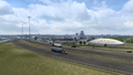
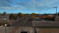
| Childress | 271 | 437 | |||
| 273 | 439 | Gallon Oil Truck Stop | |||
| 284 | 457 | CMV Station | |||
| 316 | 509 | Donley County Safety Rest Area | |||
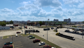
| Amarillo | 369 | 594 | I-40 Frontage Road | Outbound access only | |
| 373 | 601 | TOTSO; southern terminus of I-40 concurrency; I-40 exit 78; I-40 eastbound is inaccessible | |||
| 379 | 610 | Loop 335 northbound is inaccessible; I-40 exit 75 | |||
| 391 | 629 | TOTSO; northern terminus of I-27; northern terminus of I-40 concurrency; southern terminus of US 60 and US 87 concurrencies; I-27 exit 123; I-40 exit 70 | |||
| 394 | 634 | ||||
| 399 | 642 | Northern terminus of US 60 and US 87 concurrencies; US 287 northbound follows US 60 (Buchanan Street) inaccessibly | |||
| End second section; start third section | |||||
| Amarillo | 399 | 642 | Southern terminus of US 87 concurrency; US 287 southbound follows Taylor Street inaccessibly | ||
| 403 | 649 | North 15th Avenue | Southbound exit and northbound entrance; inaccessible | ||
| 415 | 668 | Amarillo Vortex Drilling Site and Oil Storage | |||
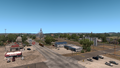
| Dumas | 428 | 689 | Northern terminus of US 87 concurrency; US 287 continues north inaccessibly; SH 152 is inaccessible | ||
| End third section | |||||
Colorado
| Location | mi | km | Destinations | Facilities | Notes |
|---|---|---|---|---|---|
| Start fourth section | |||||
| Lamar | 428 | 689 | Southern terminus of US 50 concurrency; US 287 continues south inaccessibly; US 385 southbound is inaccessible | ||
| 428 | 689 | Maple Street | |||
| 428 | 690 | Phoenix Truck Stop | |||
| 428 | 690 | Avenue Colonia | Access to Driverse truck stop | ||
| 429 | 691 | Minor road | No southbound entrance | ||
| 430 | 692 | Minor road | |||
| 430 | 692 | Weigh Station | |||
| 436 | 701 | Frontage Road | Access to Lamar Bushnell Farms farm | ||
| 442 | 711 | TOTSO; northern terminus of US 50 concurrency | |||
| Eads | 481 | 775 | Phoenix Truck Stop | ||
| Kit Carson | 506 | 814 | Museum | Southern terminus of US 40 concurrency; inaccessible | |
| 507 | 816 | Seibert | Inaccessible | ||
| Limon | 541 | 871 | Southern terminus of I-70 BL and US 24 concurrencies | ||
| 558 | 898 | Southern terminus of SH 71 concurrency; access to Denver Vitas Power construction site | |||
| 564 | 907 | E Avenue | Northern terminus of SH 71 concurrency; inaccessible | ||
| 570 | 918 | TOTSO; northern terminus of US 24 concurrency; US 24 westbound is inaccessible | |||
| 574 | 925 | TOTSO; northern terminus of I-70 BL concurrency; southern terminus of I-70 concurrency; I-70 exit 359 | |||
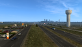
| Denver | 629 | 1,013 | Airport Boulevard – Denver International Airport | Northern terminus of I-70 and US 40 concurrencies; road continues as I-70: I-70 exit 285 | |
| End fourth section; start fifth section | |||||
| Loveland | 629 | 1,013 | US 287 continues south inaccessibly | ||
| 631 | 1,016 | Fort Collins Bitumen Depot | Northbound only | ||
| Fort Collins | 632 | 1,018 | Fort Collins Recruitment Agency | ||
| 632 | 1,018 | Fort Collins Sell Goods Warehouse | |||
| 633 | 1,018 | Lake Street | Access to Fort Collins Freightliner Truck Dealer | ||
| 633 | 1,019 | Laurel Street | Inaccessible | ||
| 634 | 1,020 | ||||
| 634 | 1,020 | Southern terminus of SH 14 concurrency; Maple Street is inaccessible | |||
| 634 | 1,021 | Aron Gas Station | |||
| 634 | 1,021 | Vine Drive | |||
| 638 | 1,027 | Fort Collins Avalanche Steel Scrapyard | |||
| 639 | 1,028 | Southern terminus of SH 1; access to Fort Collins Sunshine Crops farm | |||
| 639 | 1,028 | Fort Collins Bushnell Farms Auction | |||
| 640 | 1,030 | Northern terminus of SH 14 concurrency; access to Fort Collins farm; US 287 continues north inaccessibly | |||
| End fifth section | |||||
Wyoming
| Location | mi | km | Destinations | Facilities | Notes |
|---|---|---|---|---|---|
| Start sixth section | |||||
| Laramie | 640 | 1,030 | Southern terminus of I-80 BL and US 30 concurrencies; US 287 continues south inaccessibly | ||
| 640 | 1,031 | Ivinson Avenue | Inaccessible | ||
| 641 | 1,031 | Minor road | Access to Laramie Voltison Motors warehouse | ||
| 641 | 1,032 | Northern terminus of I-80 BL | |||
| 642 | 1,033 | Laramie NAMIQ Storage | |||
| Medicine Bow | 678 | 1,092 | Southern terminus of WYO 487; northern terminus of US 30 concurrency; US 30 and US 287 continues west inaccessibly | ||
| End sixth section; start seventh section | |||||
| Sinclair | 678 | 1,092 | Sinclair | Eastern terminus of WYO 76; southern terminus of I-80 and US 30 concurrencies; I-80 exit 221 | |
| Rawlins | 707 | 1,138 | TOTSO; western terminus of WYO 76; northern terminus of I-80 and US 30 concurrencies; southern terminus of I-80 BL and US 30 Bus. concurrecnies; I-80 exit 215 | ||
| 717 | 1,154 | Airport Road | |||
| 717 | 1,155 | Southern terminus of US 287 Byp. | |||
| 718 | 1,155 | Colorado Street | Inaccessible | ||
| 718 | 1,156 | 3rd Street / Cedar Street – Business District | TOTSO; inaccessible | ||
| 718 | 1,156 | Northern terminus of I-80 BL and US 30 Bus. concurrecnies; southern terminus of WYO 789 concurrency | |||
| 720 | 1,159 | Northern terminus of US 287 Byp. | |||
| Muddy Gap Junction | 741 | 1,193 | TOTSO; western terminus of WYO 220 | ||
| Sweetwater Station | 776 | 1,249 | Sweetwater Station Rest Area | ||
| 778 | 1,252 | Southern terminus of WYO 135 | |||
| 814 | 1,311 | TOTSO; eastern terminus of WYO 28 | |||
| Lander | 826 | 1,330 | Northern terminus of WYO 789 concurrency | ||
| 859 | 1,383 | TOTSO; southern terminus of US 26 concurrency | |||
| 867 | 1,396 | Diversion Dam Rest Area | |||
| 879 | 1,415 | Bull Lake Road | Inaccessible | ||
| 881 | 1,418 | Rest Stop | |||
| 950 | 1,530 | Rest Stop | |||
| 977 | 1,573 | Rest Stop | |||
| Moran Junction | 983 | 1,582 | TOTSO; northern terminus of US 26 concurrency; southern terminus of US 89 and US 191 concurrencies | ||
| Grand Teton National Park | 986 | 1,587 | Moran Entrance Station | ||
| Yellowstone National Park | 1,020 | 1,642 | Yellowstone National Park South Entrance | US 89, US 191, and US 287 unofficially continues north through Yellowstone National Park; US 287 resumes at West Entrance in Montana | |
| End seventh section | |||||
Montana
| Location | mi | km | Destinations | Facilities | Notes |
|---|---|---|---|---|---|
| Start eighth section | |||||
| Yellowstone National Park | 1,020 | 1,642 | Yellowstone National Park West Entrance | US 20, US 191, and US 287 unofficially continues east through Yellowstone National Park; US 287 resumes at South Entrance in Wyoming | |
| West Yellowstone | 1,025 | 1,650 | Canyon Street / Yellowstone Avenue | TOTSO; inaccessible | |
| 1,028 | 1,654 | Northern terminus of US 20 concurrency | |||
| 1,044 | 1,681 | TOTSO; northern terminus of US 191 concurrency | |||
| 1,060 | 1,707 | Earthquake lake | |||
| 1,074 | 1,729 | Bozeman NAMIQ Quarry | |||
| Ennis | 1,081 | 1,739 | Bozeman NAMIQ Talc Plant | US 287 continues north inaccessibly | |
| End eighth section; start ninth section | |||||
| Helena | 1,081 | 1,739 | Minor road | Southern terminus of US 12 concurrency; US 12 and US 287 continues east inaccessibly | |
| 1,081 | 1,740 | Minor road | |||
| 1,081 | 1,741 | Gallon Oil Truck Stop | |||
| 1,082 | 1,741 | Carter Street | |||
| 1,082 | 1,742 | 18th Street | |||
| 1,083 | 1,743 | Northern terminus in-game; northern terminus of US 12 concurrency; road continues as US 12; I-15 exit 192 | |||
Special Route

- Main article: US 287 Bypass
U.S. Route 287 has one bypass route in Wyoming, respectively in Rawlins.
History
- In the initial version of the Colorado map expansion DLC, US 287 was separated into two sections. The first section began at US 50 and US 385 in Lamar and ended at Interstate 70 and US 40 in Aurora. The second section began at US 34 in Loveland and ended at SH 14 north of Fort Collins.
- In the initial version of the Wyoming map expansion DLC, the sections of US 287 from Interstate 80 Business and US 30 in Laramie to WYO 487 in Medicine Bow and from Interstate 80 and WYO 76 at Sinclair to Yellowstone National Park were added.
- In the initial version of the Montana map expansion DLC, the sections of US 287 from Yellowstone National Park to Ennis and in Helena, concurrent with US 12, were added.
- In the initial version of the Texas map expansion DLC, the sections of US 287 from Interstate 10, US 69, and US 96 in Beaumont to US 190 in Woodville, concurrent with US 69, from Interstate 30 and Interstate 35W in Fort Worth to US 60 and US 87 in Amarillo, and from US 87 in Amarillo to US 87 in Dumas, concurrent with US 87, were added.
- In update 1.47, a short section of US 287 in Lamar, concurrent with US 385, was added, slightly extending the route south of US 50.
Gallery
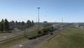
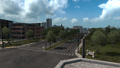
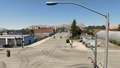
Beaumont
Lumberton
Kountze
Woodville
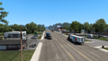
Fort Worth
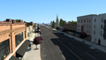
Wichita Falls
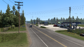
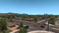
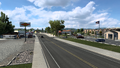
Childress
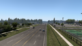
Amarillo
Dumas
Lamar
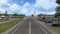
Eads
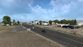
Kit Carson
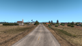
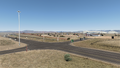
Wild Horse
Limon
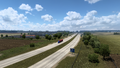
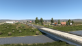
Aurora
Loveland
Fort Collins
Laramie
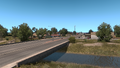
Rock River
Medicine Bow
Rawlins
Muddy Gap Junction
Sweetwater Station
Lander
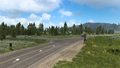
Moran Junction
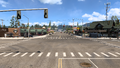
West Yellowstone
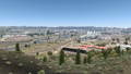
Ennis
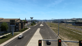
Helena


Trivia

- A route marker of State Highway 287 (SH-287) was added to the game files in the update 1.47 open beta. In real life, the designation of SH-287 does not exists anywhere in the state of Oklahoma as a state highway, however it is actually a route marker of US 287, which is mislabeling the highway as an Oklahoma State Highway even though US 287 is still part of the United States Numbered Highway System.
- These mislabeling route markers, however, are not so common across the United States and globally. Some particular examples of route marker mislabeling in the US is this guide sign in western Kentucky on I-24—The Western Kentucky Parkway was mislabeled as Interstate 100 (this sign was taken down possibly by weather afterwards). Another example is these groups of route markers in northwestern Vermont—VT 207 and VT 235 are mislabeled as US 207 and US 235 respectively.
See also
| Cities | Alamosa (Alamosa East, Monte Vista) • Burlington • Colorado Springs • Denver (Aurora) • Durango • Fort Collins (Loveland) • Grand Junction (Fruita) - Lamar • Montrose • Pueblo • Rangely • Steamboat Springs • Sterling |
|---|---|
| Highways | |
| See also | |
| Cities | Casper (Brookhurst, Mills) • Cheyenne (Fox Farm-College, South Greeley) • Cody • Evanston • Gillette • Jackson • Laramie • Rawlins (Sinclair) • Riverton • Rock Springs • Sheridan |
|---|---|
| Highways | Interstate 25 • Interstate 80 • Interstate 90 • Interstate 180 • US 14 • US 14 Alternate • US 16 • US 18 • US 20 • US 26 • US 30 • US 85 • US 87 • US 89 • US 189 • US 191 • US 287 • US 310 • WYO 22 • WYO 28 • WYO 50 • WYO 51 • WYO 59 • WYO 76 • WYO 89 • WYO 94 • WYO 110 • WYO 120 • WYO 135 • WYO 150 • WYO 210 • WYO 212 • WYO 220 • WYO 222 • WYO 258 • WYO 339 • WYO 351 • WYO 374 • WYO 450 • WYO 487 • WYO 789 |
| See also | |
| Cities | Billings (Lockwood) • Bozeman (Four Corners) • Butte (Rocker, Silver Bow) • Glasgow • Glendive • Great Falls • Havre (Havre North, West Havre) • Helena • Kalispell (Columbia Falls, Evergreen) • Laurel • Lewistown • Miles City • Missoula (Bonner-West Riverside, Wye) • Sidney • Thompson Falls |
|---|---|
| Highways | |
| See also | |