US 395
U.S. Route 395 (US 395) is a north–south US Highway in northern and southern California, western Nevada, and eastern Oregon and Washington in American Truck Simulator. It runs from SR 14 and SR 58 between Bakersfield and Barstow to SR 20 in Barney's Junction. In real life, US 395 runs 1305 miles (2100 km) from Interstate 15 near Hesperia, CA, to the Canadian border at Laurier, WA.
Course
US 395 in ATS begins at its intersection with CA 58 in Antelope Valley, a region in the western Mojave Desert of southern California. The 395's junction with the 58 is further west in the game than in real life, and serves as a continuation from CA 14. After leaving Antelope Valley, the highway enters the Owens Valley, a long desert corridor that runs along the edge of the Sierra Nevada, the summit of which being Mt. Whitney, the highest point of the Contiguous US. This passage along the edge of the Great Basin features a few towns, each with a road meeting with the highway: at Olancha is CA 190, which heads to Death Valley; at Independence is a fictional road that crosses downscaled mountains to Fresno; and at Bishop is US 6, which begins its run to the Atlantic Ocean. At Mono Lake, CA 120 heads to Oakdale via Tioga Pass through Yosemite National Park, and at Topaz Lake the 395 enters Nevada.
Soon after crossing the state line the highway meets US 50, and shortly afterwards runs through Carson City, the state capital. Out of Carson City, the 395 begins a concurrency with Interstate 580 that ends at Reno, where it intersects with Interstate 80. North of I-80 the 395 continues as a freeway for a short distance before it narrows back down, soon re-entering California. At CA 44 the 395 heads north at a TOTSO to Alturas, where it meets CA 299. After crossing the North Fork Pit and running along Goose Lake, the highway enters Oregon.
At the feet of the Eagle Mountains the highway runs through Lakeview, where it intersects with OR 140 and shortly afterwards passes below high bluffs along Lake Albert. After running through the Harney Basin it begins running concurrent with US 20 at Riley, this concurrency ending north of Burns. From there the highway heads across the Blue Mountains, a scenic route with many grades and switchbacks. The highway crosses the Strawberry Range (a subrange of the Blues) via Starr Ridge, and descends to John Day, where it runs concurrent with US 26 to Mount Vernon. From there the 395 continues north to Ritter Butte Summit (3993 ft), where there is a viewpoint, and drops down to Pendleton via the North Fork John Day River. The highway then runs concurrent with Interstate 84, until, as the 395 runs in the game, Interstate 82. The 395 follows I-82 over the Columbia River into Washington.
The 395 breaks from I-82 at Kennewick, which it runs through to the Pioneer Memorial Bridge, where it crosses the Columbia for a second time. At Pasco, the highway runs concurrent with US 12 for a short stretch, afterwards setting off across the Columbia Plateau. At Ritzville the highway begins a concurrency with Interstate 90, which ends in Spokane, where the 395 continues concurrent with US 2 for a ways. The 395 then continues through the Selkirk Mountains to Colville, after which it soon crosses the Columbia for a third time and terminates at its intersection with WA 20 at Barney's Junction.
Cities
California
- Los Angeles (via SR 14)
- Bakersfield (via SR 58)
- Barstow (via SR 58)
Scenery towns
Nevada
Oregon
Scenery towns
Washington
Scenery towns
Junction list
Southern California
| Location | mi | km | Destinations | Facilities | Notes |
|---|---|---|---|---|---|
| 0 | South terminus in game; road continues as SR 14 | ||||
| 52 | Gas station, rest area | ||||
| Olancha | 102 | ||||
| 136 | Rest area | ||||
| 138 | Minor road to Fresno | ||||
| Bishop | 232 | ||||
| 274 |
Nevada
| Location | mi | km | Exit | Destinations | Facilities | Notes |
|---|---|---|---|---|---|---|
| 289 | ---- | Walker Lake | ||||
| 304 | ---- | Road to Coastline Mining depot | ||||
| 325 | ---- | West end of US 50 concurrency | ||||
| Carson City | 331 | ---- | South end of I-580 concurrency | |||
| South end of freeway | ||||||
| 351 | 43 | Southbound exit and northbound entrance | ||||
| 365 | 44 | North end of US 50 concurrency | ||||
| 373 | Lake Washoe Resort | Northbound exit and southbound entrance Turnaround only | ||||
| Reno | 405 | 67 | East Second Street / Glendale Avenue | |||
| 408 | 68 A–B | Southbound exit 68; north end of I-580 concurrency; I-80 exit 15 | ||||
Northern California
| Location | mi | km | Destinations | Facilities | Notes | |
|---|---|---|---|---|---|---|
| 431 | Border Protection Station | Northbound only | ||||
| 437 | North end of freeway | |||||
| 449 | Rest area | |||||
| Johnstonville | 471 | North terminus in base game TOTSO | ||||
| Alturas | 560 | TOTSO | ||||
| 580 | Border Protection Station | Southbound only | ||||
Oregon
| Location | mi | km | Destinations | Facilities | Notes |
|---|---|---|---|---|---|
| Lakeview | 603 | TOTSO: south end of OR 140 concurrency | |||
| 604 | Truck stop | ||||
| 609 | North end of OR 140 concurrency | ||||
| Riley | 705 | TOTSO: south end of US 20 concurrency | |||
| 706 | Rest area | ||||
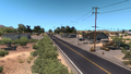
| Burns | 728 | Truck stop | |||
| 736 | TOTSO | ||||
| 743 | TOTSO: north end of US 20 concurrency | ||||
| John Day | 818 | Inaccessible TOTSO: south end of US 26 concurrency | |||
| 818 | Rest area | ||||
| Mount Vernon | 820 | Inaccessible TOTSO: north end of US 26 concurrency | |||
| Pendleton | 929 | Gas station | |||
| 929 | TOTSO: south end of I-84 concurrency; I-84 exit 209 | ||||
| South end of freeway | |||||
| 931 | Exit 207 South end of US 30 concurrency | ||||
| 936 | North terminus in Oregon DLC Northbound TOTSO: south end of I-82 concurrency; north end of I-84 and US 30 concurrency; I-84 and US 30 exit 179 | ||||
Washington
| Location | mi | km | Destinations | Facilities | Notes |
|---|---|---|---|---|---|
| 958 | 1,542 | Weigh station | Northbound only | ||
| Kennewick | 965 -7 | 1,553 -11 | North end of freeway | ||
| South terminus in Washington DLC TOTSO: north end of I-82 concurrency; I-82 exit 113 | |||||
| 969 | 1,559 | TOTSO | |||
| Pasco | 970 | 1,562 | TOTSO: south end of I-182 and US 12 concurrency; I-182 and US 12 exit 12 | ||
| South end of freeway | |||||
| 976 | 1,572 | Northbound only Exit 14 A | |||
| 980 | 1,578 | Northbound only TOTSO: north end of I-182 and US 12 concurrency; I-182 and US 12 exit 14 B | |||
| 987 | 1,589 | Southbound only TOTSO: north end of I-182 and US 12 concurrency | |||
| 991 | 1,596 | Kartchner Street | |||
| 998 | 1,607 | Weigh station | |||
| Ritzville | 1,033 | 1,663 | Northbound only South end of I-90 concurrency | ||
| 1,046 | 1,684 | Ritzville | Southbound only | ||
| 1,048 | 1,687 | Southbound only TOTSO: south end of I-90 concurrency; I-90 exit 220 | |||
| 1,051 | 1,691 | Exit 221 | |||
| Spokane | 1,088 | 1,751 | Exit 277 South end of US 2 concurrency | ||
| 1,096 | 1,764 | Inaccessible Exit 279 | |||
| 1,107 | 1,781 | North end of freeway | |||
| TOTSO: north end of I-90 concurrency; Interstate 90 exit 281 | |||||
| 1,108 | 1,783 | Trent Avenue | Southbound TOTSO | ||
| 1,109 | 1,784 | Volvo dealer | |||
| 1,110 | 1,787 | Inaccessible North end of US 2 concurrency | |||
| 1,117 | 1,798 | Inaccessible Southbound only TOTSO | |||
| 1,123 | 1,807 | Weigh station | Southbound only | ||
| 1,126 | 1,812 | Road to Bushnell Farms depot | |||
| 1,129 | 1,817 | Sea Horizon marina | |||
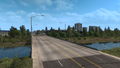
| Colville | 1,158 | 1,864 | South end of SR 20 concurrency | ||
| 1,158 | 1,865 | Gas station, rest area | |||
| Barney's Junction | 1,172 | 1,886 | North terminus in game North end of SR 20 concurrency | ||
History
- In the initial version of American Truck Simulator, US 395 was separated into two sections: The first section began at an at-grade three-way junction with SR 58 by the gas station east of Bakersfield and ended at an at-grade three-way junction with US 95 south of Tonopah. North of the unnamed road to Fresno, US 395 turned to the east and followed a route similar to current CA 190 and NV 374, meaning that the north terminus was equivalent to Beatty. The second section began at an at-grade three-way junction with US 6 and US 95 in Tonopah and ended at an at-grade three-way junction in Redding.
- In update 1.5, as part of the 1:35 to 1:20 map rescale, new sections were added to the existing route to accommodate the new map scale, including the two four-lane sections and the intermediate two-lane section north of the south terminus. The south terminus was changed to a five-ramp partial cloverleaf interchange that connected with SR 14 and was moved to the east. The at-grade three-way junction with a road to a Chemso depot was moved to the south to SR 14. The section north of the unnamed road to Fresno was straightened and the two sections of US 395 were connected at the former north terminus of the first section, which was moved to the west terminus of US 6 west of Tonopah and became Bishop. The at-grade four-way junction in Carson City that marked the south end of the Interstate 580 concurrency was changed to a half-trumpet interchange, and the diamond interchange with Interstate 80 in Reno that marked the north end of the Interstate 580 concurrency was changed to a "Spaghetti Bowl" junction. The north terminus in California was truncated as SR 299 was extended east.
- In update 1.29, Olancha and the at-grade three-way junction there with SR 190 were added.
- In version 1.31, the at-grade four-way junction with SR 120 was added. In northern California, an at-grade three-way junction was added that marked the junction with and the east terminus of SR 299 and from which US 395 was extended north to Oregon.
- In update 1.32, the section of Interstate 580, US 50, and US 395 bypassing Carson City was added. The previous section through Carson City was redesignated as US 395 Business.
- In the initial version of the Oregon map expansion DLC, the section of US 395 from SR 299 to Interstate 84 in Pendleton was added.
- In update 1.33, the concurrency with OR 140 and an inaccessible at-grade three-way junction at the north end of the concurrency were added.
- In update 1.34, the at-grade three-way junction at the north end of the OR 140 concurrency was made accessible.
- In update 1.35, the north terminus of US 395 was moved to a junction with Interstate 82, Interstate 84, and US 30 west of Pendleton. The section of SR 299 intersecting US 395 was redesignated as SR 44.
- In the initial version of the Washington map expansion DLC, the section of US 395 from Interstate 82, Interstate 84, and US 30 west of Pendleton to SR 20 in Barney's Junction was added.
- In update 1.41, as part of the first phase of the California rework, the section of US 395 from Interstate 80 and Interstate 580 in Reno to SR 44 was completely reworked. The scenery town of Johnstonville, a Border Protection Station west of the California–Nevada state line, and a rest area by Honey Lake were added. A Border Protection Station between Alturas and the California–Oregon state line was also added. The at-grade three-way junction with SR 44 was changed to an at-grade four-way junction with SR 36 in Johnstonville.
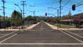
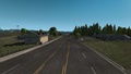
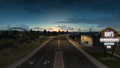
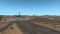
Gallery
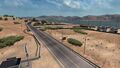
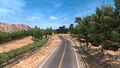
Near Olancha
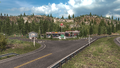
Olancha
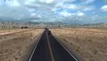
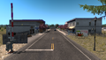
Near Bishop
Bishop
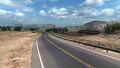
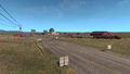
Nevada State Line
Farms
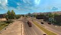
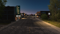
Carson City
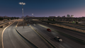
Reno
Small Forest (before update 1.41)
Northern California (before update 1.41)
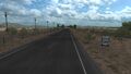
Johnstonville
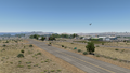
Plains
Alturas
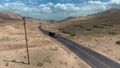
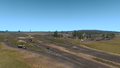
Lakeview
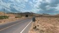
Riley
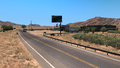
Burns
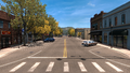
John Day

Mount Vernon
Pendleton
Kennewick
Pasco
Ritzville
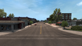
Spokane
Colville
Barney's Junction


See also
| Cities |
| ||||||
|---|---|---|---|---|---|---|---|
| Highways |
| ||||||
| See also | |||||||
| Cities | |
|---|---|
| Highways | Interstate 11 • Interstate 15 • Interstate 80 • Interstate 515 • Interstate 580 • US 6 • US 50 • US 93 • US 93 Alternate • US 95 • US 395 • SR 140 • SR 208 • SR 225 • SR 292 • SR 305 • SR 319 • SR 374 • SR 375 • SR 376 |
| See also | |
| Cities | Astoria (Warrenton) • Bend (Terrebonne) • Burns • Coos Bay (North Bend) • Eugene (Springfield) • Klamath Falls • Lakeview • Medford • Newport (Toledo) • Ontario • Pendleton (Rieth) • Portland (Troutdale) • Salem • The Dalles |
|---|---|
| Highways | Interstate 5 • Interstate 82 • Interstate 84 • Interstate 105 • Interstate 205 • Interstate 405 • US 20 • US 26 • US 30 • US 95 • US 97 • US 101 • US 197 • US 199 • US 395 • OR 7 • OR 22 • OR 39 • OR 58 • OR 62 • OR 78 • OR 99 • OR 126 • OR 140 • OR 201 • OR 213 • OR 569 |
| See also | |
| Cities | |
|---|---|
| Highways | Interstate 5 • Interstate 82 • Interstate 90 • Interstate 182 • Interstate 205 • Interstate 405 • US 2 • US 12 - US 97 • US 101 • US 395 • US 730 • SR 8 • SR 14 • SR 20 • SR 155 • SR 261 • SR 285 • SR 397 • SR 432 • SR 433 • SR 526 • SR 529 • SR 900 |
| See also | List of scenery towns in Washington • List of landmarks in Washington • List of Truck Stops in Washington |