Interstate 30
Interstate 30 (I-30) is an east–west Interstate Highway in northeastern Texas in American Truck Simulator. It runs from Interstate 20 west of Fort Worth to Interstate 369 and US 59 in Texarkana.
In real-life, Interstate 30 spans a total length of 366.76 miles (590.24 km) from I-20 west of Fort Worth, Texas to North Little Rock, Arkansas. It is the shortest two-digit Interstate Highway with a number ending in zero.
Course
Interstate 30 begins at Interstate 20 west of Fort Worth and traces eastward into the city limits. It then travels south of downtown and intersects Interstate 35W at the southeastern portions of the district. I-30 leaves Fort Worth and runs through Arlington; soon afterwards, it enters the western limits of Dallas in the city's western commercial districts. Just east of that, I-30 enters downtown Dallas after crossing the Trinity River via the Margaret McDermott Bridge and intersects Interstate 35E at what is known as the "Horseshoe", an interchange serving both I-30 and I-35E. After passing through the Horseshoe interchange, I-30 intersects the northern terminus of Interstate 45 and the southern terminus of US 75 at a four-way stacked interchange southeast of downtown. The highway travels through Garland before crossing Lake Ray Hubbard via the Eastern Dallas Causeway into the towns of Rockwall and Greenville, where it intersects US 69. I-30 intersects a short section of FM 275 in Cumby, as well as rest area at the town, before entering the Piney Woods region in northeastern Texas, which is then greeted with a weigh station in both directions. I-30 intersects US 259 before it crosses the Sulphur River towards New Boston, where it intersects US 82; soon afterwards, the highway approaches its current eastern terminus at Interstate 369 and US 59 in Texarkana, where it will eventually continue into Arkansas.
Cities
Scenery towns
Exit List
| Location | mi | km | Exit | Destinations | Facilities | Notes |
|---|---|---|---|---|---|---|
| 0 | 0 | Western terminus; westbound exit and eastbound entrance; I-20 exit 421 | ||||
| Fort Worth | 20 | 32 | 15 | I-35W exits 51 A-B | ||
| Dallas | 40 | 65 | 39 | Cockrell Hill Road | ||
| 54 | 87 | 45 46 |
Western terminus of US 67 concurrency; exit 45 eastbound; exit 46 westbound; I-35E exits 427 A-B and 428 A-B; also serves Reunion Boulevard and Commerce Street via exit 46 eastbound | |||
| 72 | 117 | 46 47 |
Northern terminus of I-45; southern terminus of US 75; exit 46 eastbound; exit 47 westbound | |||
| Garland | 83 | 142 | 64 | Dalrock Road | Eastbound exit and westbound entrance; also serves Sapphire Bay Marina; inaccessible | |
| 94 | 152 | 65 | Service Road | Eastbound exit and westbound entrance; inaccessible | ||
| Greenville | 108 | 174 | 94 | Also serves Denison and Mineola | ||
| 126 | 202 | 99 | County Line Road | Eastbound exit and westbound entrance; interchange and exit number does not exist in real life | ||
| Cumby | 140 | 226 | 110 | Eastern terminus of US 67 concurrency | ||
| 156 | 252 | ---- | CMV Inspection Station | |||
| 182 | 293 | 178 | ||||
| New Boston | 211 | 339 | 199 | Access to Texarkana Chuck & Jack's sawmill | ||
| Texarkana | 231 | 372 | 220 | Eastern terminus in-game; northern terminus of I-369 and US 59; I-30 and US 59 continues east inaccessibly |
History
- In the initial version of the Texas map expansion DLC, Interstate 30 began at Interstate 20 west of Fort Worth and ended at Interstate 45, US 67, and US 75 in Dallas.
- In update 1.48, the section of Interstate 30 from Interstate 45, US 67, and US 75 in Dallas to Interstate 369 and US 59 in Texarkana was added.
Trivia
- In the initial release of the Texas map expansion DLC, a small network of roads was discovered in the northeastern portion of the state beyond Dallas, Tyler and Longview, including an unfinished section of I-30 between US 69 in Greenville and the eastern limits of Texarkana in Arkansas; at this time, there was no section between Dallas and US 69. This indicated that a future update (mainly update 1.48) would extend I-30 from its current eastern terminus into Arkansas, ending at the easternmost portions of Texarkana's Beltway.[1] The system of roads was later removed in update 1.47. With the release of update 1.48, the section west of its current eastern terminus at Interstate 369 into Arkansas, was cut from the release of the update.
Gallery
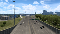
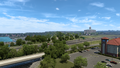
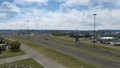
Fort Worth
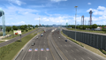
Arlington
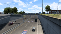
Dallas
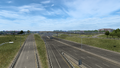
Garland
Rockwall
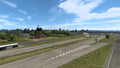
Greenville
Cumby
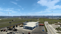
New Boston
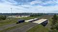
Texarkana


References
- ↑ Texas Discussion Thread, Page 790, Message #7896 in SCS Forums, 2022-11-15 (accessed 2022-11-16)