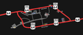
US 64
U.S. Route 64 (US 64) is an east–west United States Highway in northeastern Arizona, northern New Mexico and Oklahoma in American Truck Simulator. The route is separated into three sections: The first section runs from US 160 in Teec Nos Pos to northeastern Guymon. The second section runs from northern Enid to Interstate 35 and US 412 east of the latter city, mostly concurrent with US 412. The third section runs from a toll gate at US 412 and SH-99 between Enid and Tulsa to Interstate 244 and US 75 in Tulsa, mostly concurrent with US 412 and partially with Interstate 244 and US 75.
In real life, US 64 spans a total length of 2,326 miles (3,743 km) from Teec Nos Pos, Arizona to Nags Head, North Carolina.
Course
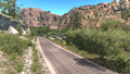
US 64 begins at its intersection with US 160 in Teec Nos Pos, AZ, and shortly after its beginning enters New Mexico. The highway here descends into Red Wash, where the massive volcanic neck named Ship Rock can first be seen, and rises to the town of Shiprock, where it intersects with US 491 and crosses the San Juan River. After running along the San Juan for a ways, the highway reaches Farmington, where it splits in two: US 64 Business runs through the town's central business district on Broadway and Main Street, while US 64 Bypass (officially the mainline routing of US 64), intended for through traffic, runs along the southern edge of the town on Murray Drive. Between Farmington and Interstate 25, this section is considered among the most scenic routes in New Mexico, as well as in the game. Leaving Farmington and Bloomfield, where it intersects with US 550, the highway crosses the colorful tablelands of the Colorado Plateau, which transitions to forest; somewhere in this forest the highway crosses the Great Continental Divide. The highway soon meets with US 84, with which it runs concurrent for a stretch before splitting off just south of Tierra Amarilla. The highway then crosses the Tusas Mountains through Carson National Forest, afterwards entering the Rio Grande Rift at the southern end of the San Luis Valley, where it crosses the Rio Grande Gorge via a bridge simply named after the gorge; this bridge, standing 600 ft. over the river, is the 10th-highest bridge in the United States. Out of the valley the highway reaches the Sangre de Cristo Mountains, a large range of the Southern Rocky Mountains. The highway first crosses the Taos Mountains, a subrange of the Sangre de Cristos, via Palo Flechado Pass, a tricky route with several switchbacks; the largest of these switchbacks can be bypassed with an secret dirt shortcut, which, after driving it for the first time, gives the Forest Shortcut achievement. The highway then enters the valley of Cieneguilla Creek, where it passes through the town of Eagle Nest below many snow-capped peaks, a mountain to the west being Wheeler Peak, the highest point of New Mexico. The highway then traverses the Cimarron Range, another daunting, yet scenic, route. After running through Cimarron Canyon the highway exits the mountains and meets Interstate 25, which then follows concurrent into Raton. US 64 branches off I-25 at exit 450 and follows 2nd Street (Interstate 25 Business) to the north, and then it turns east, following Clayton Road to cross I-25 once again; here, the 64 begins to follow US 87 and the Ports to Plains Corridor across the northeastern part of New Mexico and onto the Great Plains, passing through the town of Des Moines. Continuing east, US 64 approaches Clayton, where it ends its concurrency with the 87 and follows US 56 and US 412 to the northeast.
After passing by a rest area at the northwestern corner of Texas, US 64 enters the Oklahoma Panhandle and the Rita Blanca National Grasslands, while it still follows concurrently with US 56 and US 412. US 385 soon joins the concurrency across the panhandle into Boise City, where the latter route branches off the 64 at a roundabout encircling the Cimarron County Courthouse (which also features a viewpoint). The highway heads east, with SH-3 joining the concurrency, as it leaves Boise City and intersects US 287, which bypasses the said city to the northeast. Continuing across the panhandle, US 56 simply ends further east of Boise City, while US 64 continues into the city of Guymon, where it then follows a fifth highway with the multi-concurrent routes, SH-136. In Guymon, US 412, SH-3, and SH-136 ends the 64's multi-concurreny across the western part of the Oklahoma Panhandle and continues south as a secret road, while US 64 then overlaps the latter highways' truck route, bypassing the business district of the city to the east. The highway then leaves the truck routes and is then overlapped by US 54 to the northeast towards Kansas; here, the gap in the route begins northeast of Guymon, while the highway resumes in northern Enid. In Enid, US 64 gradually bypasses the city center to the north and east upon intersecting its second business route and following US 412 for the second time, heading east towards its junction with Interstate 35, where a second gap in the route is presented. The third second of US 64 is completely unsigned, but this section is still rendered in the game: The highway resumes at an inacessible interchange serving SH-99, with a toll booth underneath, at US 412. The 64 follows the latter route into the city of Tulsa, where it turns south, following a short section of Interstate 244 and US 75 until ending at exit 4 of I-244, at the downtown district of Tulsa.
Cities
Arizona
Scenery towns
New Mexico
Scenery towns
Oklahoma
Scenery towns
Junction list
Arizona
| Location | mi | km | Destinations | Facilities | Notes |
|---|---|---|---|---|---|
| Teec Nos Pos | 0 | 0 | Western terminus |
New Mexico
| Location | mi | km | Destinations | Facilities | Notes |
|---|---|---|---|---|---|
| Shiprock | 38 | 61 | TOTSO; western terminus in New Mexico DLC; western terminus of US 491 concurrency | ||
| 44 | 71 | Eastern terminus of US 491 concurrency | |||
| Farmington | 61 | 98 | TOTSO; western terminus of US 64 Bus. | ||
| 61 | 99 | Minor road | |||
| 61 | 99 | Gallon Oil Gas Station | |||
| 61 | 99 | Pinon Street / Bisti Highway – Hospital, Crownpoint | |||
| 63 | 101 | Miller Avenue | |||
| 63 | 101 | Farmington HMS Machinery Depot | |||
| 64 | 103 | Farmington Garage | |||
| 64 | 103 | Farmington Volvo Truck Dealer | |||
| 64 | 104 | Eastern terminus of US 64 Bus. | |||
| Bloomfield | 69 | 111 | Western terminus of US 550 concurrency | ||
| 72 | 116 | Eastern terminus of US 550 concurrency | |||
| 149 | 241 | TOTSO; western terminus of US 84 concurrency | |||
| Tierra Amarilla | 157 | 252 | Gallon Oil Gas Station / Rest Area | ||
| 166 | 268 | TOTSO; eastern terminus of US 84 concurrency | |||
| Eagle Nest | 284 | 457 | Minor road | ||
| 284 | 457 | Gallon Oil Gas Station | |||
| 284 | 457 | Minor road | |||
| 284 | 457 | Rest Area | |||
| 327 | 527 | US-64 rest area | |||
| 356 | 574 | TOTSO; western terminus of I-25 concurrency; I-25 exit 419 | |||
| Raton | 372 | 600 | Eastern terminus of I-25 concurrency; western terminus of I-25 BL concurrency; I-25 exit 450 | ||
| 382 | 617 | Minor road | Access to Raton NAMIQ cement plant, quarry and warehouse, and Plaster & Sons warehouse | ||
| 383 | 617 | Eastern terminus of I-25 BL concurrency | |||
| 383 | 618 | Raton Wallbert Market | |||
| 383 | 618 | Western terminus of US 87 concurrency; I-25 exit 451 | |||
| 388 | 626 | Gallon Oil Truck Stop / NAF Truck Stop | |||
| 413 | 667 | Rest Stop | Westbound only | ||
| Clayton | 470 | 757 | Eastern terminus of US 87 concurrency; western terminus of US 56 and US 412 concurrencies; US 56 and US 412 westbound are inaccessible | ||
| 477 | 769 | Rest Area | Eastern terminus in New Mexico DLC |
Oklahoma
| Location | mi | km | Destinations | Facilities | Notes | |
|---|---|---|---|---|---|---|
| 507 | 817 | Western terminus in Oklahoma DLC; western terminus of US 385 concurrency | ||||
| Boise City | 519 | 837 | TOTSO; Viewpoint within roundabout; eastern terminus of US 385 concurrency; western terminus of SH-3 concurrency; SH-325 is inaccessible; one route marker mislabel SH-325 as US 325 | |||
| 525 | 846 | Phoenix Truck Stop | ||||
| 527 | 849 | Weigh Station | ||||
| 534 | 860 | US 287 southbound is inaccessible | ||||
| 558 | 899 | Eastern terminus of US 56 concurrency; US 56 eastbound is inaccessible | ||||
| 570 | 919 | Western terminus of SH-136 concurrency; SH-136 northbound is inaccessible | ||||
| Guymon | 573 | 923 | Guymon Wallbert Market | |||
| 573 | 924 | Tiger Boulevard | Secret road; access to Guymon Wallbert market | |||
| 573 | 924 | TOTSO; eastern terminus of US 412, SH-3, and SH-136 concurrencies; western terminus of US 412 Truck, SH-3 Truck, and SH-136 Truck concurrencies; US 412 and SH-3 westbound and SH-136 southbound is a secret road | ||||
| 574 | 925 | Guymon Taylor Warehouse | ||||
| 575 | 926 | TOTSO; eastern terminus of US 412 Truck, SH-3 Truck, and SH-136 Truck concurrencies; western terminus of US 54 concurrency | ||||
| 576 | 928 | Hurliman Road | Access to Guymon Equos Power depot and Farmer's Barn feed mill | |||
| 576 | 929 | Minor road / Gas Station | Access to Guymon Global Mills food plant; gas station is hidden | |||
| 577 | 930 | Minor road | Access to Guymon Grand Pastures farm | |||
| 577 | 930 | Service Shop | Eastern terminus of US 54 concurrency | |||
| End first section; start second section | ||||||
| Enid | 577 | 930 | Enid Steeler Warehouse / Minor road | Access to Enid Recruitment Agency | ||
| 577 | 931 | Willow Road | TOTSO | |||
| 578 | 932 | Enid EPRO Chemical Factory | ||||
| 578 | 932 | Minor roads | TOTSO; partially accessible | |||
| 578 | 933 | Enid Global Mills Grain Elevator | ||||
| 579 | 933 | Enid Deep Wells Oil Well | ||||
| 580 | 935 | Enid Equos Power Warehouse | ||||
| 580 | 935 | TOTSO; eastern terminus of US 64 Bus.; western terminus of US 412 concurrency | ||||
| 589 | 949 | North 42nd Street | ||||
| 601 | 968 | Northern terminus of I-35; eastern terminus of US 412 concurrency; road continues as US 412; I-35 northbound is inaccessible; I-35 exits 194 A-B | ||||
| End second section; start third section | ||||||
| 601 | 968 | Toll Gate under overpass; western terminus of US 412 concurrency; road continues as US 412; inaccessible | ||||
| Tulsa | 624 | 1,006 | TOTSO; eastern terminus of US 412 concurrency; western terminus of I-244 concurrency; L.L. Tisdale Parkway is inaccessible; I-244 exits 5 B-C | |||
| 631 | 1,017 | 7th Street | Westbound exit and eastbound entrance; eastern terminus in-game; eastern terminus of I-244 concurrency; road continues as I-244 and US 75; I-244 exit 4; inaccessible | |||
Special routes
- Main article: Special routes of US 64
U.S. Route 64 has two special routes in New Mexico and Oklahoma, respectively in the cities of Farmington and Enid.
History
- In the initial version of the New Mexico map expansion DLC, the section of US 64 from US 160 and US 191 in Mexican Water to Interstate 25 south of Raton was added.
- In update 1.32, the concurrency with US 550 in Bloomfield was added and a previously inaccessible at-grade three-way junction at the west end of the concurrency made accessible.
- In update 1.35, the junction with US 160 and US 191 in Mexican Water was rebuilt and changed from one to two at-grade three-way junctions, with US 191 extending north to Utah from the second junction.
- In update 1.36, the concurrency with US 84 and an at-grade three-way junction at the west end of the concurrency were added.
- In update 1.39, the west terminus was truncated to a new at-grade three-way junction with US 160 in Teec Nos Pos as US 160 was extended east.
- In update 1.44, the section of US 64 from Interstate 25 south of Raton to US 87 in Raton was added.
- In the initial version of the Texas map expansion DLC, the section of US 64 from US 87 in Raton to US 56, US 87, and US 412 in Clayton was added.
- In update 1.48, the section of US 64 from US 87 in Raton to US 56, US 87, and US 412 in Clayton became part of the New Mexico map expansion DLC and was extended to a rest area northeast of Clayton.
- In the initial version of the Oklahoma map expansion DLC, the sections of US 64 from the rest area northeast of Clayton to northeastern Guymon, from northern Enid to Interstate 35 and US 412 east of Enid, and from US 412 and SH-99 between Enid and Tulsa to Interstate 244 and US 75 in Tulsa were added.
Gallery
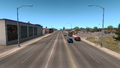
The US 64 split through Farmington
Teec Nos Pos
Shiprock
Farmington
Bloomfield
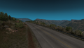
Between Farmington and Tierra Amarilla
Northwest of Tierra Amarilla before update 1.36 (This area now features an at-grade junction with US 84)
Tierra Amarilla
South of Tierra Amarilla
Rio Grande Gorge
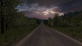
Eagle Nest
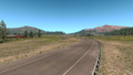
Between Eagle Nest and Raton
Raton
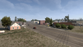
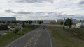
Des Moines
Clayton
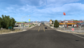
Boise City
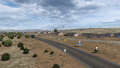
Four Corners
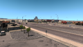
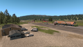
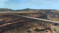
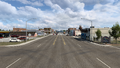
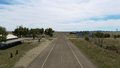
Guymon
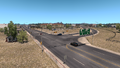
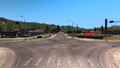
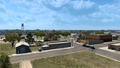
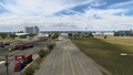
Enid
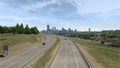
Tulsa


Trivia
- The Steam achievement "Forest Shortcut" can be unlocked by driving on a dirt road forming a shortcut between two segments of US 64.
See also
| Cities | |
|---|---|
| Highways | Interstate 8 • Interstate 10 • Interstate 15 • Interstate 17 • Interstate 19 • Interstate 40 • US 60 • US 64 • US 70 • US 89 • US 89A • US 93 • US 95 • US 160 • US 163 • US 180 • US 191 • SR 51 • SR 61 • SR 64 • SR 66 • SR 77 • SR 85 • SR 89 • SR 90 • SR 92 • SR 98 • SR 260 • SR 303 • SR 389 |
| See also | |
| Cities | Alamogordo • Albuquerque • Artesia • Carlsbad • Clovis • Farmington • Gallup • Hobbs • Las Cruces • Raton • Roswell • Santa Fe • Socorro • Tucumcari |
|---|---|
| Highways | |
| See also | |
| Cities | |
|---|---|
| Highways | Interstate 35 • Interstate 40 • Interstate 44 • Interstate 235 • Interstate 244 • US 54 • US 56 • US 59 • US 60 • US 62 • US 64 • US 69 • US 70 • US 75 • US 77 • US 81 • US 83 • US 183 • US 259 • US 270 • US 271 • US 277 • US 281 • US 287 • US 377 • US 385 • US 412 • SH-1 • SH-3 • SH-7 • SH-8 • SH-9 • SH-15 • SH-31 • SH-34 • SH-66 • SH-99 • SH-136 • SH-142 • SH-259A • SH-375 |
| See also | List of scenery towns in Oklahoma • List of landmarks in Oklahoma - List of Truck Stops in Oklahoma |