US 96
U.S. Route 96 (US 96) is a north–south intrastate United States Highway in eastern Texas in American Truck Simulator. It runs from Interstate 10, US 69, and US 287 in Beaumont to US 59 and US 84 in Tenaha.
US 96 is one of several rendered US Highways to run within a state in real life, along with US 57, US 181, US 290 and US 350, which excludes such other highways that are considered to run "within" a state in ATS, but the rest of these routes has yet to introduce its other section(s) along its course through several other states that run within in real life.
Also, in real life, the southern terminus of US 96 is in Port Arthur and ends in Tenaha, spanning a total length of 133.746 mi (215.243 km). The featured section of the road is roughly 25 miles (39 km) longer than in real life.
Course
US 96 begins at its southern terminus (as well as those of US 69 and US 287) with Interstate 10 and US 90 in western Beaumont. The highways follow the latter as a concurrency, along with US 96 and 287, until I-10 and US 90 turns to the east towards Louisiana. There, the highway continues to follow concurrently with US 96 and 287 towards Lumberton to the north, where US 69 and US 287 branches off of US 96 to Woodville and Lufkin to the northwest. Turning east, the highway crosses the Neches River, and then it turns back north as it enters Buna, where it passes by a viewpoint nearby a Chuck & Jack's timber harvest site (shown as part of Beaumont) and intersects its only accessible special route in-game, US 96 Business, and SH 62. As it continues to trace through the Piney Woods, the highway intersects US 190 and SH 63 in Jasper. It passes by a rest stop and nearby Sam Rayburn Reservoir before arriving in Bronson; soon afterwards, the highway intersects FM 3230 and FM 3451, which both roads serve a Chuck & Jack's sawmill, shown as part of Lufkin. US 96 arrives at Tenaha, where it meets its northern terminus at US 59 and US 84.
Cities
Junction list
| Location | mi | km | Destinations | Facilities | Notes |
|---|---|---|---|---|---|
| Beaumont | 0 | 0 | Southern terminus of I-10, US 69, and US 287 concurrencies; road continues as I-10 | ||
| Southern terminus of US 90 concurrency; I-10 exit 851 | |||||
| 11 | 18 | TOTSO; northern terminus of I-10 and US 90 concurrencies; I-10 exit 853 | |||
| Lumberton | 21 | 34 | Northern terminus of US 69 and US 287 concurrencies | ||
| 30 | 48 | Northbound exit and southbound entrance; inaccessible | |||
| Buna | 51 | 82 | Rest Stop, Buna county | Southbound only | |
| 52 | 84 | Beaumont Chuck & Jack's Timber Harvest Site | |||
| 57 | 92 | Northern terminus of US 96 Bus. and SH 62; FM 1004 is inaccessible | |||
| 58 | 94 | Aron Truck Stop | |||
| Jasper | 83 | 134 | |||
| 104 | 168 | Rest Stop | |||
| 109 | 176 | Inaccessible; the direction of the real-life Spur 414 heads south from US 96, ending at Sam Rayburn Reservoir | |||
| Bronson | 113 | 182 | Inaccessible | ||
| 121 | 195 | Western terminus of FM 3230; access to Lufkin Chuck & Jack's sawmill from the south via FM 3451 | |||
| 129 | 208 | Western terminus of FM 3451; access to Lufkin Chuck & Jack's sawmill from the north | |||
| Tenaha | 158 | 254 | Northern terminus; US 84 eastbound is inaccessible |
Special routes

- Main article: US 96 Business and TX 62
U.S. Route 96 has one business route in Texas, respectively in Buna. There is also a second business route north of Lumberton; however, that route is inaccessible to the player.
Gallery
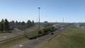
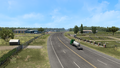
Beaumont
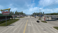
Buna
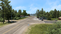
Jasper
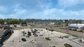
Bronson
Tenaha


Trivia
- Unlike most east–west U.S. Routes by rule, its number is a violation of the standard numbering convention of the United States Numbered Highway System. In 1927, prior to its realignment to the current routing of the highway, it began in Rosenberg and ended in Brownsville, and it was realigned to end in Laredo in 1935 (The route between Laredo and Rosenberg is currently US 59, while the route between Victoria and Brownsville is currently US 77), which was aligned east–west and also ran south of US 90. Minute Order 016701, dated September 26, 1939, realigned the highway to begin in Tenaha and end in Port Arthur, which also realigned US 59 to its current alignment today.[1]
References
- ↑ Texas Department of Transportation Highway Designation File - U. S. HIGHWAY NO. 96, accessed 2023-05-16