US 95

|
This article needs a clean-up.
You can help Truck Simulator Wiki by re-organizing parts of the article, checking grammar / spelling, and doing other helpful things to correct the article.
|
U.S. Route 95 (US 95) is a north–south US Highway in southwestern Arizona, southeastern California, central Nevada, southeastern Oregon, and western Idaho in American Truck Simulator. In real life, US 95 runs 1574 miles (2533 km) from the Mexican border at San Luis, AZ, to the Canadian border at Eastport, ID.
Course
US 95 is separated into three sections: The first section runs from Yuma to Interstate 40 in Needles. The second section runs from Interstate 11, Interstate 515, and US 93 in Las Vegas to US 6 in Coaldale. The third section runs from Interstate 80 in Winnemucca to US 2 in Ponderay.
The first section begins at the highway's current southern terminus in Yuma, AZ, where it intersects with Interstate 8. After passing through farmlands in the valley of the Colorado River, the 95 crosses the Sonoran Desert via Yuma Proving Ground, a US Army training facility and weapon/vehicle test site that is one of the largest military installations in the world. At Quartzsite the highway meets Interstate 10, which it follows to Blythe, CA. From there the 95 continues through the Sonoran Desert, through Vidal Junction, to Needles, where the southern section ends.
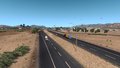
In Las Vegas the middle section begins where US 95 intersects with Interstate 15. Out of Nevada's largest city the highway sets off into the Great Basin, passing the towns of Indian Springs, Beatty (where it intersects with NV 374), and Goldfield. At Tonopah the highway begins running concurrent with US 6, an overlap that terminates at the northern end of the middle section in Coaldale. In real life the 95 runs concurrent with Interstate 80 from the Humboldt Sink to Winnemucca, however this concurrency is not featured in the game, and instead the 95 continues at Winnemucca. Out of the valley of the Humboldt, US 95 intersects with NV 140 and crosses into Oregon at McDermitt. After crossing Blue Mountain Pass (5285 ft) the highway leaves the Great Basin, and soon passes Basque. At Burns Junction, where it intersects with OR 78, the 95 trends east to Rome, where it crosses the Owyhee River and climbs up to Jordan Valley. From there it continues north past Succor Creek to the Idaho border.
Across the state line the highway crosses the Owyhee Mountains into the fertile Treasure Valley, where it intersects with Interstate 84. After passing through Fruitland and Payette, the 95 reaches the Northern Rocky Mountains, where it traverses Midvale Hill and passes through Cambridge. The highway then runs through the forest to New Meadows, where it intersects with ID-55. After crossing the 45th parallel north (the midway line between the equator and the North Pole), the 95 follows the Salmon River through its gorge to White Bird Hill, where it climbs up to the Palouse, a region of green, rolling hills on the Columbia Plateau. The highway soon reaches Grangeville and ID-13, and after passing the canyon of Lawyer Creek (where there is an overlook with historical markers) it descends to the Clearwater River, where it runs concurrent with US 12 to Lewiston. The 95 leaves the valley of the Clearwater via Lewiston Hill, a steep, switchbacking grade that brings the road back up to the Palouse. At the edge of the Northern Rockies, the highway passes a Deepgrove logging site, which features a viewpoint, and soon reaches Coeur d'Alene, where it intersects with Interstate 90. North of I-90 the highway runs through the forests of the Selkirk Mountains to Lake Pend Orielle and Sandpoint, where it meets US 2 and currently terminates.
Cities
Arizona
Scenery towns
Nevada
Scenery towns
Oregon
- Ontario (via Interstate 84 or US 30)
Scenery towns
Idaho
Scenery towns
Junction list
Arizona
| Location | mi | Destinations | Facilities | Notes | |
|---|---|---|---|---|---|
| Yuma | 0 | Downtown | South terminus in game | ||
| < 1 | I-8 exit 2 | ||||
| 5 | Unnamed road – Gila | Inaccessible TOTSO | |||
| 56 | Yuma Proving Ground, Imperial Dam Recreation Area | Inaccessible | |||
| Quartzsite | 94 | Inaccessible TOTSO | |||
| 103 | Inaccessible TOTSO | ||||
| 105 | TOTSO: south end of I-10 concurrency; I-10 exit 17 | ||||
| See Interstate 10 | |||||
California
| Location | mi | Destinations | Facilities | Notes | ||
|---|---|---|---|---|---|---|
| See Interstate 10 | ||||||
| Blythe | 150 | TOTSO: north end of I-10 concurrency; I-10 exit 241 | ||||
| Vidal Junction | 196 | SR 62 – 29 Palms, Parker | Inaccessible | |||
| 197 | Rest area | |||||
| Needles | 243 | I-40 exit 144 | ||||
| End first section | ||||||
Nevada
| Location | mi | Destinations | Facilities | Notes | ||
|---|---|---|---|---|---|---|
| Start second section | ||||||
| Las Vegas | 245 | South end of I-515 and US 93 concurrency; road continues as I-11 and US 93 | ||||
| Tropicana Avenue – McCarran Airport | Exit 68 | |||||
| 246 | Exits 76 A–B North end of I-515 and US 93 concurrency; I-15 exits 42 A–B | |||||
| 252 | Exit 77 | |||||
| North end of freeway | ||||||
| Indian Springs | 274 | Indian Springs | ||||
| 276 | Truck stop | |||||
| Beatty | 345 | TOTSO | ||||
| 348 | Truck parking | |||||
| Goldfield | 396 | Goldfield | ||||
| Tonopah | 447 | South end of US 6 concurrency | ||||
| 448 | Service shop | |||||
| 450 | Truck stop | |||||
| Coaldale | 465 | North end of US 6 concurrency | ||||
| End second section; start third section | ||||||
| Winnemucca | 465–470 | Two TOTSOs | ||||
| 502 | ||||||
| McDermitt | 555 | Gas station, rest area | North terminus in base game Mountain Standard Time begins at the border | |||
Oregon
| Location | mi | Destinations | Facilities | Notes |
|---|---|---|---|---|
| Basque | 608 | Basque | ||
| Burns Junction | 620–626 | |||
| Rome | 644 | Gas station | ||
| Jordan Valley | 667 | Gas station, hotel | ||
| 669 | Yturri Boulevard – Three Forks | Inaccessible TOTSO | ||
| 704 | Rest area |
Idaho
| Location | mi | Destinations | Facilities | Notes |
|---|---|---|---|---|
| 746 | North terminus in Oregon DLC I-84 exit 3 | |||
| 748 | Inaccessible South end of US 30 concurrency | |||
| Fruitland | 755 | North end of US 30 concurrency | ||
| Payette | 764 | Payette city center | Inaccessible TOTSO | |
| 798 | Rest area | South terminus in Idaho DLC | ||
| Cambridge | 808 | Inaccessible | ||
| 810 | TOTSO | |||
| New Meadows | 852 | TOTSO | ||
| 856 | 45th Parallel | |||
| 864 | Salmon River Arch Bridge | Pacific/Mountain Time Zone Boundary | ||
| 900 | White Bird Hill Summit | Scenic Overlook and Idaho History Sign on the Battle of White Bird Pass | ||
| Grangeville | 930 | |||
| 942 | Scenic Overlook | Idaho History about Lawyers Canyon, The Railroad Trestles, and Lewis and Clark | ||
| 980 | TOTSO: south end of US 12 concurrency | |||
| 986 | Weigh station | |||
| Lewiston | 990 | Service shop, truck stop | ||
| 1000 | TOTSO: north end of US 12 concurrency | |||
| 1028 | Weigh station | Southbound only | ||
| 1033 | Spiral Highway | Southbound only | ||
| 1072 | Road to Deepgrove harvest site | |||
| Coeur d'Alene | 1112 | Marina Drive Sea Horizon Shipyard | ||
| 1114 | Northwest Boulevard – Downtown Coeur d'Alene, Spokane | |||
| 1114 | Lincoln Way | Inaccessible TOTSO | ||
| 1118 | ||||
| Sandpoint | 1160 | Sandpoint | ||
| Ponderay | 1164 | South end of US 2 concurrency | ||
| 1166 | Schweitzer Cutoff Road / Kootenai Cutoff Road | North terminus in game |
History
- In initial version of American Truck Simulator, US 95 was separated into two sections. The first section began at Interstate 15 in Las Vegas and ended at US 50 east of Austin. The second section began at Interstate 80 in Winnemucca and ended at the Nevada–Oregon state line in McDermitt.
- In update 1.3, which added the Arizona map expansion DLC, the section of US 95 from Interstate 10 in Blythe to Interstate 40 in Needles was added.
- In update 1.5, as part of the 1:35 to 1:20 map rescale, several new sections were added to the existing route to accommodate the new map scale, including the scenery towns of Goldfield and Vidal Junction, while Beatty was completely reworked. The north terminus of the second section was changed to a new at-grade three-way junction with US 6 in Coaldale. The previous section between Tonopah and US 50 became SR 376.
- In update 1.32, the section of US 95 from Interstate 8 in Yuma to Interstate 10 in Quartzsite was added.
- In the initial version of the Oregon map expansion DLC, the section of US 95 from McDermitt to Interstate 84 east of Ontario was added.
- In update 1.34, Tonopah was completely reworked. The gas station and the service shop were changed, the motel was removed, and the truck stop was added. The at-grade three-way junction with US 6 was reworked and moved the TOTSO from US 95 to US 6. The at-grade three-way junction with SR 376 was moved to US 6 east of Tonopah. The at-grade three-way junction with SR 140 north of Winnemucca was added.
- In update 1.35, the section of US 95 from 16th Avenue to Interstate 8 within Yuma was added.
- In update 1.38, the section of US 95 concurrent with US 93 south of Interstate 15 in Las Vegas was added, including the diamond interchange with Tropicana Avenue. The trumpet interchange with Interstate 15 was changed to a "Spaghetti Bowl" interchange with Interstate 15 and US 93, and the diamond interchange with US 95 Business on Rancho Drive was changed to a single-point diamond interchange.
- In the initial version of the Idaho map expansion DLC, the section of US 95 from Interstate 84 east of Ontario to Schweitzer/Kootenai Cutoff Road in Sandpoint was added.
- In update 1.40, the section of Interstate 515 concurrent with US 95 in Las Vegas was marked as Interstate 515.
Gallery
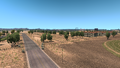
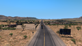
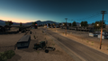
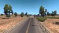
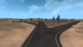
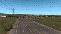
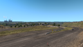
Yuma
Quartzsite
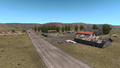
Ehrenberg
Blythe
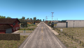
Vidal Junction
California
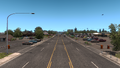
Needles
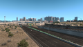
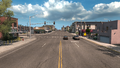
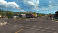
Las Vegas (after update 1.38)
Las Vegas (before update 1.38)
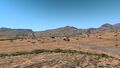
Indian Springs
North of Las Vegas
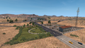
Beatty
Goldfield
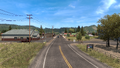
Tonopah (after update 1.34)
Tonopah (before update 1.34)
Coaldale Junction
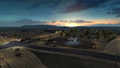
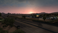
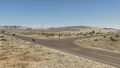
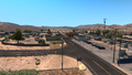
Winnemucca
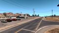
McDermitt
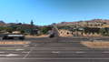
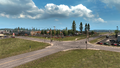
Oregon State Line
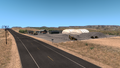
Basque
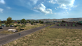
Burns Junction
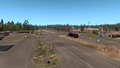
Rome
Jordan Valley
Fruitland
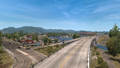
Payette
Cambridge
New Meadows
Grangeville
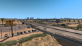
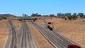
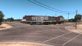
Lewiston
Coeur d'Alene
Sandpoint
Ponderay


See also
| Cities | |
|---|---|
| Highways | Interstate 8 • Interstate 10 • Interstate 15 • Interstate 17 • Interstate 19 • Interstate 40 • US 60 • US 64 • US 70 • US 89 • US 89A • US 93 • US 95 • US 160 • US 163 • US 180 • US 191 • SR 51 • SR 61 • SR 64 • SR 66 • SR 77 • SR 85 • SR 89 • SR 90 • SR 92 • SR 98 • SR 260 • SR 303 • SR 389 |
| See also | |
| Cities |
| ||||||
|---|---|---|---|---|---|---|---|
| Highways |
| ||||||
| See also | |||||||
| Cities | |
|---|---|
| Highways | Interstate 11 • Interstate 15 • Interstate 80 • Interstate 515 • Interstate 580 • US 6 • US 50 • US 93 • US 93 Alternate • US 95 • US 395 • SR 140 • SR 208 • SR 225 • SR 292 • SR 305 • SR 319 • SR 374 • SR 375 • SR 376 |
| See also | |
| Cities | Astoria (Warrenton) • Bend (Terrebonne) • Burns • Coos Bay (North Bend) • Eugene (Springfield) • Klamath Falls • Lakeview • Medford • Newport (Toledo) • Ontario • Pendleton (Rieth) • Portland (Troutdale) • Salem • The Dalles |
|---|---|
| Highways | Interstate 5 • Interstate 82 • Interstate 84 • Interstate 105 • Interstate 205 • Interstate 405 • US 20 • US 26 • US 30 • US 95 • US 97 • US 101 • US 197 • US 199 • US 395 • OR 7 • OR 22 • OR 39 • OR 58 • OR 62 • OR 78 • OR 99 • OR 126 • OR 140 • OR 201 • OR 213 • OR 569 |
| See also | |
| Cities | Boise (Eagle, Meridian) • Coeur d'Alene (Fernan Lake Village) • Grangeville • Idaho Falls • Ketchum (Sun Valley) • Lewiston • Nampa • Pocatello (Inkom) • Salmon • Sandpoint (Ponderay) • Twin Falls |
|---|---|
| Highways | |
| See also | |