US 160

|
This article needs a clean-up.
You can help Truck Simulator Wiki by re-organizing parts of the article, checking grammar / spelling, and doing other helpful things to correct the article.
|
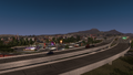
U.S. Route 160 (US 160) is an east–west US Highway in northeastern Arizona, northwestern New Mexico, and southern Colorado in American Truck Simulator. It runs from US 89 between Cameron and Page to US 350 east of Trinidad. In real life, US 160 runs 1465 miles (2358 km) from west of Tuba City, AZ, to southwest of Poplar Bluff, MO.
Course
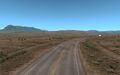
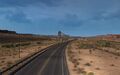
US 160 begins at its intersection with US 89, north of Cameron, AZ, and trends northeast through the colorful Colorado Plateau, where it is known as the Navajo Trail. After intersecting with AZ 98, which provides access to Page, the highway crosses under the conveyor of the Peabody Kayenta Mine, a coal mine on Black Mesa, a highland region to the south of the highway. The highway soon passes through Kayenta, where US 163 provides access to US 191 via Monument Valley, and not long afterward intersects with the 191 directly. After east and westbound weigh stations, at Teec Nos Pos, US 160 makes a TOTSO northward, with US 64 continuing straight on. The 160 soon enters New Mexico, which it runs through for just under a mile past the Four Corners, where New Mexico, Arizona, Utah, and Colorado meet; the monument here offers a rest stop and a viewpoint.
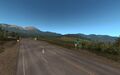
After entering Colorado, the highway crosses the San Juan River, and climbs up to US 491, meeting with the highway below the cliffs of Mesa Verde and the prominent butte Chimney Rock. The 160 runs concurrent with the 491 past the Ute Mountain Casino Hotel (which features travel services) and the Ute Mountains to the west to Cortez, which features a weigh station and rest stop. The 160 continues eastward, north of Mesa Verde and south of the San Juans, to Durango, where it intersects with US 550. In the forests south of the San Juans the highway passes below another landmark called Chimney Rock, this one being a mountaintop pillar of rock; this feature is a national monument, and was the site of an Ancestral Puebloan dwelling that housed around 2000 Pueblo Indians between the years 925 and 1125. The highway soon reaches Pagosa Springs, where it intersects with US 84 and once again crosses the San Juan. Passing Treasure Falls, the highway takes on Wolf Creek Pass, a high pass in the Southern San Juans that features two large switchbacks, the upper one featuring an overlook. After crossing the summit of the pass (which, at 10,857 feet, is the highest point on the highway, and a crossing of the Great Continental Divide), the 160 descends into the San Luis Valley, where, at Monte Vista, it intersects with US 285, and soon after runs through Alamosa. After crossing the Rio Grande and Alamosa East, the highway runs below the Blanca Peak Massif and crosses the Culebra Range (a subrange of the Sangre de Cristo Mountains) via North La Veta Pass (9413 ft), crossing the summit below Rough Mountain and Mt. Mestas, two prominent peaks that stand to the east. Leaving the mountains, the highway reaches Walsenburg, where it begins a concurrency with Interstate 25 that ends at Trinidad. East of Trinidad the highway currently ends at a TOTSO, where it continues east towards Kansas; continuing straight on from this point is US 350.
Cities
Arizona
Scenery towns
Colorado
Scenery towns
Junction list
Arizona
| Location | mi | km | Destinations | Facilities | Notes |
|---|---|---|---|---|---|
| 0 | 0 | Western terminus | |||
| 52 | 84 | ||||
| Kayenta | 81 | 130 | |||
| Mexican Water | 124 | 200 | West end of US 191 Concurrency | ||
| 129 | 208 | East end of US 191 Concurrency | |||
| Teec Nos Pos | 131 | 211 | Weigh station | ||
| 137 | 220 | TOTSO |
New Mexico
| Location | mi | km | Destinations | Facilities | Notes |
|---|---|---|---|---|---|
| 152 | 245 | East terminus in Arizona DLC |
Colorado
| Location | mi | km | Destinations | Facilities | Notes |
|---|---|---|---|---|---|
| 184 | 296 | TOTSO South end of US 491 Concurrency | |||
| Cortez | 192 | 309 | Mike Wash Road Truck Stop |
||
| 201 | 323 | Weigh station | |||
| 206 | 332 | North end of US 491 Concurrency | |||
| Durango | 247 | 398 | TOTSO North end of US 550 Concurrency | ||
| 248 | 399 | Dominguez Drive | |||
| 251 | 404 | South end of US 550 Concurrency | |||
| Pagosa Springs | 296 | 476 | |||
| Wolf Creek Pass | 351 | 565 | Scenic Overlook | ||
| 408 | 657 | Shaw Creek Rest Area | |||
| Monte Vista | 422 | 679 | West end of US 285 Concurrency SH 15 South is inaccessible | ||
| 424 | 682 | Truck Stop | |||
| Alamosa | 439 | 707 | Craft Drive | ||
| 440 | 708 | East end of US 285 Concurrency US 285 South is inaccessible | |||
| 442 | 711 | Minor road | TOTSO | ||
| Alamosa East | 443 | 713 | Minor road | ||
| La Veta Pass | 469 | 755 | Scenic Overlook | ||
| Walsenburg | 508 | 818 | TOTSO West end of I-25 Concurrency SH 10 is inaccessible | ||
| Trinidad | 534 | 859 | TOTSO East end of I-25 Concurrency | ||
| 536 | 863 | SH 12 is inaccessible | |||
| 549 | 884 | East terminus in game Road signs say US 160 continues to Springfield |
History
- In the initial version of the Arizona map expansion DLC, US 160 began at an at-grade three-way junction with US 89 between Flagstaff and Page and ended at an at-grade four-way junction with US 191 in Kayenta.
- In update 1.5, as part of the 1:35 to 1:20 map rescale, new sections were added to the existing route to accommodate the new map scale. The junction with US 191 was moved to a new at-grade three-way junction with US 64 in Mexican Water.
- In update 1.35, the at-grade three-way junction with US 89 was rebuilt. The junction with US 64 and US 191 in Mexican Water was rebuilt and changed from one to two at-grade three-way junctions, with US 191 extending north to Utah from the second junction.
- In update 1.39, the eastern terminus was changed to a new at-grade three-way junction with US 64 in Teec Nos Pos as US 160 was extended east over the section of US 64 intersecting US 160 and US 191 in Mexican Water.
- In the initial version of the Colorado map expansion DLC, the section of US 160 from US 64 in Teec Nos Pos to US 350 east of Trinidad was added.
- In update 1.47, the section of US 160 from US 191 in Mexican Water to NM 597 at the Four Corners Monument became part of the Arizona map expansion DLC.
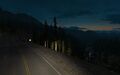
Gallery
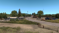
Alamosa East
Pagosa Springs
Monte Vista
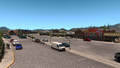
Cortez
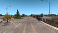
Trinidad
East of Alamosa
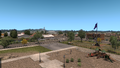
Kayenta
La Veta Pass
Wolf Creek Pass


See also
| Cities | |
|---|---|
| Highways | Interstate 8 • Interstate 10 • Interstate 15 • Interstate 17 • Interstate 19 • Interstate 40 • US 60 • US 64 • US 70 • US 89 • US 89A • US 93 • US 95 • US 160 • US 163 • US 180 • US 191 • SR 51 • SR 61 • SR 64 • SR 66 • SR 77 • SR 85 • SR 89 • SR 90 • SR 92 • SR 98 • SR 260 • SR 303 • SR 389 |
| See also | |
| Cities | Alamogordo • Albuquerque • Artesia • Carlsbad • Clovis • Farmington • Gallup • Hobbs • Las Cruces • Raton • Roswell • Santa Fe • Socorro • Tucumcari |
|---|---|
| Highways | |
| See also | |
| Cities | Alamosa (Alamosa East, Monte Vista) • Burlington • Colorado Springs • Denver (Aurora) • Durango • Fort Collins (Loveland) • Grand Junction (Fruita) - Lamar • Montrose • Pueblo • Rangely • Steamboat Springs • Sterling |
|---|---|
| Highways | |
| See also | List of scenery towns in Colorado • List of landmarks in Colorado • List of Truck Stops in Colorado |