US 385
U.S. Route 385 (US 385) is a north–south United States Highway in western and northern Texas and eastern Colorado in American Truck Simulator. The route is separated into four sections: The first section runs from Interstate 10 Business and US 285 in Fort Stockton to Interstate 20 in Odessa. The second section runs from Loop 338 north of Odessa to US 62 and US 180 in Seminole. The third section runs entirely within Dalhart from US 87 to Spur 24, partially concurrent with the latter route. The fourth section runs from US 50 and US 287 in Lamar to Interstate 76 in Julesburg.
In real life, US 385 spans a total length of 1,206 miles (1,941 km) from Big Bend National Park, Texas to Deadwood, South Dakota.
Course
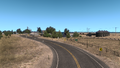
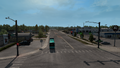
At the town of Marathon, US 385 is rendered at an intersection on US 90; however, that section of highway is inaccessible (even though signage indicates that the highway overlaps with the 90, there is no intermediate intersection east of this point, ending the concurrency towards Sanderson). The highway in-game actually begins at the intersection of Main Street on Interstate 10 Business and US 285 nearby the "Paisano Pete" roadrunner statue, a roadside attraction that welcomes visitors to Fort Stockton, which is also the city's mascot after all, and a viewpoint is also presented nearby. The highway follows East Dickinson Boulevard (I-10 BL and US 285) across eastern Fort Stockton and branches off the 285 towards Interstate 10 and US 67, which follows a brief concurrency of the latter routes as it leaves the city; soon afterwards, the highway branches off of I-10 at exit 273 and heads northeast across the Chihuahuan Desert into McCamey, where it then branches off of the 67 and also intersects the (inaccessible) northern terminus of FM 305. Leaving the town from the north, the 385 enters Odessa at the southern intersection with Loop 338, a state highway loop that encircles the city, and intersects Interstate 20 soon afterwards, which is where a gap in the route begins, obsoleting the highway through downtown Odessa. The 385 resumes at the northern intersection of Loop 338 and continues to head north until reaching its second gap at US 62 and US 180 in Seminole; here, the road simply continues towards Lubbock as "US 62". US 385 once again resumes in Dalhart, at a truck stop on US 87 and head towards its intersection with US 54; soon afterwards, it branches off of the 87 towards the north, reaching another gap at Spur 24 north of the city.
The gap between Texas and Colorado will eventually be filled in with the future release of the Oklahoma map expansion. The highway through Oklahoma's panhandle will serve Boise City and intersect the highways of US 56, 64, 287, 412, and SH-3.
The highway resumes at US 50 and US 287 in Lamar, Colorado, where the 385 had come north from Oklahoma. The 385 runs concurrent with the 50 for a short distance and breaks away in Granada. The highway continues north across the vast Great Plains through the towns of Bristol, Sheridan Lake, where it overlaps the entirety of SH 96 in-game, and Cheyenne Wells, where it overlaps a section of US 40. Entering the city of Burlington, US 385 intersects Interstate 70 in the south and follows a concurrency with sections of Interstate 70 Business and US 24 through the city. Continuing across the plains, the highway approaches Wray and intersects a section of US 34, which serves a Bushnell livestock auction west of the town. Further north, the 385 passes by a Sunshine Crops farm to the east and reaches its northern terminus at the in-game eastern terminus of Interstate 76 in Julesburg, where it will eventually continue into Nebraska.
Cities
Texas
Colorado
- Lamar
- Burlington
- Sterling (via I-76)
Scenery Towns
Junction list
Texas
| Location | mi | km | Destinations | Facilities | Notes |
|---|---|---|---|---|---|
| Fort Stockton | 0 | 0 | North Main Street | Southern terminus in-game; southern terminus of I-10 BL and US 285 concurrencies; inaccessible | |
| 1 | 1 | The city of Fort Stockton | |||
| 6 | 9 | Northern terminus of US 285 concurrency | |||
| 9 | 15 | Phoenix Truck Stop | |||
| 12 | 20 | TOTSO; northern terminus of I-10 BL; southern terminus of I-10 and US 67 concurrencies; I-10 exit 261 | |||
| 19 | 31 | TOTSO; northern terminus of I-10 concurrency; I-10 exit 273 | |||
| 27 | 44 | I-10 Frontage Road | Access to I-10 eastbound (and westbound picnic area), US 190, and FM 305 | ||
| 37 | 60 | Rest Stop | |||
| McCamey | 51 | 82 | TOTSO; northern terminus of US 67 concurrency; FM 305 is inaccessible | ||
| 64 | 103 | Picnic Area | |||
| 75 | 121 | Picnic Area | Southbound only | ||
| 87 | 141 | ||||
| Odessa | 94 | 152 | Facilities are served by I-20 Service Road; I-20 exit 116; US 385 continues north inaccessibly | ||
| End first section; start second section | |||||
| 94 | 152 | US 385 continues south inaccessibly | |||
| 123 | 199 | Rest Area | Northbound only | ||
| Seminole | 132 | 213 | Minor road | Access to Odessa Mary's Cotton plant | |
| 136 | 220 | Road continues as US 62 | |||
| End second section; start third section | |||||
| Dalhart | 136 | 220 | Aron Truck Stop | Southern terminus of US 87 concurrency; road continues as US 87 | |
| 137 | 221 | Northern terminus of US 87 Bus. | |||
| 137 | 221 | TOTSO; northern terminus of US 87 concurrency | |||
| 138 | 222 | Inaccessible | |||
| 143 | 230 | Dalhart Global Mills Dairy Plant | |||
| 145 | 233 | Western terminus of Spur 24; US 385 continues north inaccessibly | |||
| End third section | |||||
Colorado
| Location | mi | km | Destinations | Facilities | Notes |
|---|---|---|---|---|---|
| Start fourth section | |||||
| Lamar | 145 | 233 | Southern terminus of US 50 concurrency; US 385 continues south inaccessibly | ||
| 145 | 234 | Minor road | Access to Lamar Farmer's Barn feed mill | ||
| 145 | 234 | Minor road | |||
| 148 | 239 | Minor road | |||
| Granada | 156 | 251 | TOTSO; northern terminus of US 50 concurrency; US 50 eastbound is inaccessible | ||
| 184 | 296 | TOTSO; southern terminus of SH 96 concurrency; SH 96 westbound is inaccessible | |||
| Sheridan Lake | 192 | 309 | TOTSO; northern terminus of SH 96 concurrency; SH 96 is inaccessible | ||
| 209 | 337 | TOTSO; southern terminus of US 40 concurrency; US 40 eastbound is inaccessible | |||
| Cheyenne Wells | 212 | 341 | TOTSO; northern terminus of US 40 concurrency; US 40 westbound is inaccessible | ||
| 214 | 344 | Minor road | TOTSO; inaccessible | ||
| 215 | 347 | Minor road | TOTSO; inaccessible | ||
| 258 | 416 | Burlington Bushnell Farms Farm | |||
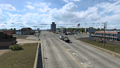
| Burlington | 260 | 419 | Phoenix Truck Stop | ||
| 264 | 426 | Eastern terminus of I-70; southern terminus of I-70 BL concurrency; I-70 exit 437; I-70 eastbound is inaccessible | |||
| 267 | 430 | Burlington Sunshine Crops Garage | |||
| 267 | 430 | TOTSO; southern terminus of US 24 concurrency; US 24 westbound is inaccessible | |||
| 267 | 430 | Burlington Drake Car Dealer Dealership | |||
| 267 | 430 | Ninth Street | Inaccessible | ||
| 267 | 431 | TOTSO; northern terminus of I-70 BL and US 24 concurrencies; I-70 BL and US 24 eastbound are inaccessible | |||
| 268 | 432 | Burlington NAMIQ Storage | |||
| 268 | 432 | Burlington Sunshine Crops Farm | |||
| Wray | 313 | 504 | Access to Sterling Bushnell Farms farm; US 34 eastbound is inaccessible | ||
| 354 | 571 | Sterling Sunshine Crops Farm | |||
| 366 | 590 | Sterling Sunshine Crops Farm | |||
| Julesburg | 383 | 617 | Cemetery Road | Inaccessible | |
| 385 | 620 | Northern terminus in-game; eastern terminus of I-76; I-76 exit 180; I-76 eastbound is inaccessible; US 385 continues north inaccessibly | |||
History
- In the initial version of the Colorado map expansion DLC, US 385 began at US 50 and US 287 in Lamar and ended at Interstate 76 in Julesburg.
- In the initial version of the Texas map expansion DLC, the sections of US 385 from US 285 in Fort Stockton to Interstate 20 in Odessa, from Loop 338 north of Odessa to US 62 and US 180 in Seminole, and in Dalhart, were added.
- In update 1.47, a short section of US 385 in Lamar, concurrent with US 287, was added, slightly extending the route south of US 50.
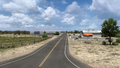
Gallery
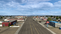
Fort Stockton
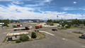
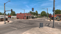
McCamey
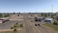
Odessa
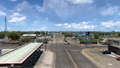
Seminole
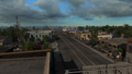
Dalhart
Lamar
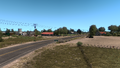
Granada
Bristol
Sheridan Lake
Cheyenne Wells
Burlington
Wray
Julesburg


Trivia

- A route marker of State Highway 385 (SH-385) was added to the game files in the update 1.47 open beta. In real life, the designation of SH-385 does not exists anywhere in the state of Oklahoma as a state highway, however it is actually a route marker of US 385, which is mislabeling the highway as an Oklahoma State Highway even though US 385 is still part of the United States Numbered Highway System.
- These mislabeling route markers, however, are not so common across the United States and globally. Some particular examples of route marker mislabeling in the US is this guide sign in western Kentucky on I-24—The Western Kentucky Parkway was mislabeled as Interstate 100 (this sign was taken down possibly by weather afterwards). Another example is these groups of route markers in northwestern Vermont—VT 207 and VT 235 are mislabeled as US 207 and US 235 respectively.
See also
| Cities | Alamosa (Alamosa East, Monte Vista) • Burlington • Colorado Springs • Denver (Aurora) • Durango • Fort Collins (Loveland) • Grand Junction (Fruita) - Lamar • Montrose • Pueblo • Rangely • Steamboat Springs • Sterling |
|---|---|
| Highways | |
| See also | |