US 83

|
This article needs a clean-up.
You can help Truck Simulator Wiki by re-organizing parts of the article, checking grammar / spelling, and doing other helpful things to correct the article.
|
U.S. Route 83 (US 83) is a north–south United States Highway in American Truck Simulator. It runs from SH 4 in Brownsville, Texas, to US 36 in Oberlin, Kansas.
In real life, US 83 spans a total length of 1,885 miles (3,034 km) from the Mexican border in Brownsville, Texas to the Canadian border near Westhope, North Dakota.
Course
US 83, along with US 77, begins at an intersection with SH 4 in southern Brownsville. The two highways head north, concurrent with Interstate 69E, until it breaks off of I-69E and US 77 in Harlingen. The highway then runs concurrent with the entire length of Interstate 2 from Harlingen to northeast McAllen as it runs parallel with Mexico to the southwest while it traverses across the South Texas Plain. The highway runs through Garceno, and soon afterwards, it tuns to the north in Roma. US 83 divides into a four-lane divided highway as it approaches Laredo; there, it intersects SH 359 in the southeast, traces west through downtown, and then it turns north again before it starts its concurrency with Interstate 35 at the southern terminus of the latter route. Between the termini of the concurrency, the highway intersects Interstate 69W, US 59, and Loop 20 at an incomplete stack interchange north of the city. The 83 breaks off of I-35 in Botines and continues northward across the northwestern-most portion of the South Texas Plain. It serves the town of Catania, intersects several other highways including Loop 517 (which also serves US 277) in Carrizo Springs, US 57 in La Pryor, and US 90 in Uvalde. The highway ascends onto the Edwards Plateau as it gradually continues to the north and runs a concurrency with Interstate 10 for 32 miles (52 km) east and north of Junction. Entering the Central Great Plains ecoregion, the highway overlaps with US 67 in Ballinger, and for another distance, it enters Abilene, where it overlaps with US 84 for a short distance around the city's downtown, intersects Interstate 20, and overlaps US 277 right afterwards. The highway branches off of the 277 in Anson and traces across the Western Short Grasslands in northwestern Texas; soon afterwards, it intersects the overlapped routes of US 82 and SH 114 in Guthrie. Continuing north through the temperate grassland, the highway overlaps US 62 from the inaccessible road of FM 164 and intersects with US 287 at Childress. North of Childress, US 83 breaks from the 62, and continues to Shamrock, where it crosses paths with Interstate 40. US 83 continues up the Panhandle through Canadian, and on to Oklahoma.
Shortly after entering Oklahoma, US 83 intersects with US 412 at Bryan's Corner, and soon after leaves the state, having crossed its narrow Panhandle. US 83 enters Kansas at the town of Liberal, where it intersects with US 54, and moves on to Garden City, where it crosses paths (and briefly runs concurrent) with US 50; between Liberal and Garden City, on the east side of the highway, is a secret road leading to a "Wizard of Oz"-themed tourist attraction. North of Garden City, the 83 continues across the stark prairie to Oakley, where it meets US 40 and Interstate 70; between Garden City and Oakley is another secret road, another on the east side of the highway, this one providing access to the Monument Rocks, a cluster of rock formations that features a viewpoint required for the "Wheat State Explorer" achievement. North of Oakley, US 83 meets US 24 just east of Colby, and continues to its current northern terminus at US 36 in Oberlin, where it awaits continuation into Nebraska.
Cities
Texas
Kansas
Scenery towns
Texas
- Harlingen
- Garceno
- Roma
- Botines
- Catarina
- Carrizo Springs
- La Pryor
- Uvalde
- Ballinger
- Anson
- Guthrie
- Childress
- Shamrock
Oklahoma
Kansas
Junction list
| Location | mi | km | Destinations | Facilities | Notes |
|---|---|---|---|---|---|
| Brownsville | 0 | 0 | Southern terminus in-game; southern terminus of I-69E and US 77 concurrencies; I-69E exit 1; SH 4 westbound is inaccessible | ||
| See | |||||
| Harlingen | 25 | 40 | TOTSO; northern terminus of I-69E and US 83 concurrencies; southern terminus of I-2 concurrency; I-2 exit 176; I-69E exit 26 | ||
| See | |||||
| McAllen | 77 | 125 | Northern terminus of I-2 concurrency; I-2 exit 138 | ||
| Garceno | 112 | 181 | Gallon Oil Gas Station | ||
| Roma | 120 | 194 | Minor road | ||
| 121 | 195 | Bravo Avenue – International Bridge | Brave Avenue towards International Bridge is inaccessible | ||
| 137 | 220 | Picnic Area | |||
| 158 | 254 | Rest Stop | Rest stop has no southbound exit; secret road | ||
| Laredo | 169 | 273 | Inaccessible | ||
| 176 | 284 | Eastern terminus of SH 359 concurrency | |||
| 185 | 298 | Minor road | |||
| 185 | 299 | Minor road | |||
| 186 | 299 | San Enduardo Avenue | One-way street; northbound access only | ||
| 186 | 299 | The city of Laredo | Southbound only | ||
| 186 | 299 | Houston Street / Santa Ursula Street – International Bridge No. 1, International Bridge No. 2 | TOTSO; western terminus of SH 359 concurrency; Houston and Santa Ursula Streets are inaccessible beyond US 83's course | ||
| 186 | 300 | Victoria Avenue | Southern terminus of I-35 concurrency | ||
| See | |||||
| Botines | 210 | 339 | TOTSO; northern terminus of I-35 concurrency; I-35 exit 18 | ||
| 232 | 374 | Inspection Station | Northbound only; closed | ||
| Carrizo Springs | 269 | 433 | Inaccessible | ||
| 273 | 439 | Aron Truck Stop | |||
| 273 | 440 | Inaccessible | |||
| 275 | 443 | Both roads are inaccessible | |||
| 278 | 447 | Access to US 277 northbound | |||
| La Pryor | 292 | 470 | Southern terminus of US 57; US 57 southbound is inaccessible | ||
| 305 | 491 | Picnic Area | |||
| Uvalde | 324 | 522 | |||
| 344 | 553 | Inaccessible | |||
| 349 | 563 | Picnic Area | |||
| 394 | 635 | Inaccessible | |||
| 410 | 660 | TOTSO; southern terminus of I-10 concurrency; I-10 exit 462 | |||
| Junction | 424 | 682 | I-10 exit 457 | ||
| 442 | 712 | TOTSO; southern terminus of I-10 concurrency; I-10 exit 456 | |||
| 470 | 756 | Picnic Area | |||
| Ballinger | 535 | 861 | Northern terminus of US 67 concurrency | ||
| 543 | 875 | FM 382's direction is mislabeled as South on northbound signage | |||
| 547 | 881 | TOTSO; northern terminus of US 67 concurrency | |||
| 553 | 890 | FM 382 northbound is inaccessible | |||
| Abilene | 576 | 927 | Southern terminus of Loop 322; southern terminus of US 84 concurrency; US 83 Bus. is inaccessible | ||
| 596 | 960 | Northern terminus of US 84 concurrency; southern terminus of US 277 concurrency; I-20 exits 283 A-B | |||
| Anson | 623 | 1,003 | Northern terminus of FM 707 | ||
| 642 | 1,033 | TOTSO; northern terminus of US 277 concurrency | |||
| 672 | 1,082 | Picnic Area | |||
| Guthrie | 678 | 1,092 | |||
| 693 | 1,115 | Inaccessible | |||
| 700 | 1,127 | Abilene Nielsen Roads Roadworks | Dynamic prefab | ||
| 733 | 1,180 | Southern terminus of US 62 concurrency; FM 164 is inaccessible | |||
| Childress | 744 | 1,198 | |||
| 746 | 1,201 | Gallon Oil Truck Stop | Northern terminus in-game; northern terminus of US 62 concurrency | ||
History
- In the initial version of the Texas map expansion DLC, US 83 began at SH 4 in Brownsville and ended at US 62 due north of US 287 in Childress.
- In update 1.48, the section of US 83 from US 62 in Childress to Interstate 40 in Shamrock was added.
- In the initial version of the Oklahoma map expansion DLC, US 83 from Shamrock to US 412 at Bryan's Corner was added.
- In the initial version of the Kansas map expansion DLC, US 83 from Bryan's Corner to US 36 at Oberlin was added.
Gallery
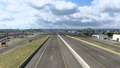
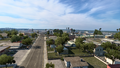
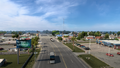
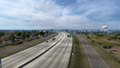
Brownsville
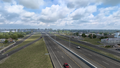
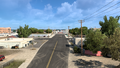
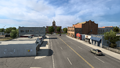
Harlingen
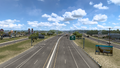
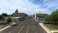
McAllen
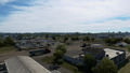
Garceno
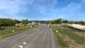
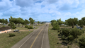
Roma
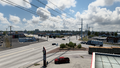
Laredo
Botines
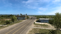
Catarina
Carrizo Springs
Uvalde
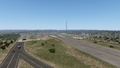
Junction
Ballinger
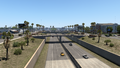
Abilene
Anson
Guthrie
Childress


