US 69

|
This article needs a clean-up.
You can help Truck Simulator Wiki by re-organizing parts of the article, checking grammar / spelling, and doing other helpful things to correct the article.
|
U.S. Route 69 (US 69) is a north–south United States Highway in eastern Texas in American Truck Simulator. The route is separated into four sections: The first section runs from Interstate 10, US 96, and US 287 in Beaumont to Loop 323 in southern Tyler. The second section runs from Loop 323 in northern Tyler to Loop 564 in Mineola. The third section runs from Loop 564 in Mineola to US 82 in Bells. The fourth section runs from US 75 and US 82 in Sherman to Interstate 44, US 59, and US 60 in Miami.
In real life, US 69 spans a total length of 1,136 miles (1,828 km) from Port Arthur, Texas to Albert Lea, Minnesota.
Course
US 69 begins at its southern terminus (as well as those of US 96 and US 287) with Interstate 10 and US 90 in western Beaumont. The highways follow the latter as a concurrency, along with US 96 and 287, until I-10 and US 90 turns to the east towards Louisiana. There, the highway continues to follow concurrently with US 96 and 287 towards Lumberton to the north, where US 96 branches off of US 69 and US 287 to Jasper to the north. The highway continues to follow US 287 to the northwest through the Piney Woods in southeastern Texas. It runs through Kountze, and shortly afterwards, the highway enters Woodville, intersecting US 190. It is here that a designated section of US 287 ends, while the highway continues its course. The highway passes by a Chuck & Jack's timber harvest site and crosses the Neches River; soon afterwards, it runs through Huntington, and then it enters Lufkin from the southeast. There, the highway is concurrent with US 59 and Loop 287 around the east and north of the city. North of Lufkin, the 59 branches off of US 69 and Loop 287 to Tenaha to the north. The highway ends its concurrency with Loop 287 northwest of the city and heads north across the western fringes of the Piney Woods and reaches Tyler. There, the highway is separated into two distinct sections in-game, which are both served by the city's truck route (Loop 323) around the city to the west. The highway resumes north of Tyler and heads north to intersect Interstate 20 in Lindale; soon afterwards, the highway reaches Mineola, where another gap in the route is presented. Here, Loop 564 connects the gap and is the truck route of the 69 through the center of the town, as well as serving US 80. At the counter-clockwise terminus of the loop, US 69 resumes once again and travels north to Greenville, where it intersects Interstate 30 and US 67. The highway traverses into the northern part of Texas' blackland prairies as it approaches the town of Bells and intersects US 82; yet another gap begins here.
After resuming at US 75 (as a concurrency) at Sherman, US 69 crosses the Red River into Oklahoma, which is then immediately greeted by a weigh station; soon afterwards, the 69 passes by Calera and into Durant, where it intersects US 70 and its concurrency with the 75 ends. The highway travels northeast through the Choctaw Nation, crosses the North Boggy Creek, and intersects the Indian Nation Turnpike (SH-375) into McAlester. US 69 bypasses the city center to the west, while its business route serves downtown McAlester, and it also intersects the overlapped routes of US 270, SH-1, and SH-31. US 69 approaches Lake Eufaula, as well as the Canadian and North Canadian rivers, and the town of Eufaula as it enters the Muscogee Nation; soon afterwards, it passes by the town of Checotah, where it intersects Interstate 40. The 69 begins to trace across the Cherokee Platform as it continues to travel north as it then passes through Muskogee and crosses the Arkansas River before reaching its current northern terminus at US 412 in Chouteau, where it will eventually continue into Kansas.
Cities
Texas
Scenery towns
Oklahoma
Junction list
Texas
| Location | mi | km | Exit | Destinations | Facilities | Notes |
|---|---|---|---|---|---|---|
| Beaumont | 0 | 0 | Southern terminus in-game; southern terminus of I-10, US 96, and US 287 concurrencies; road continues as I-10 | |||
| 851 | Southern terminus of US 90 concurrency | |||||
| 11 | 18 | TOTSO; northern terminus of I-10 and US 90 concurrencies; US 69 northbound follows exit 853 | ||||
| Lumberton | 21 | 34 | ---- | Northern terminus of US 96 concurrency | ||
| Kountze | 51 | 83 | Aron Truck Stop | |||
| Woodville | 65 | 104 | Northern terminus of US 287 concurrency | |||
| 79 | 128 | Rest Stop | ||||
| 80 | 130 | Lufkin Chuck & Jack's Timber Harvest Site | ||||
| Lufkin | 100 | 162 | Lufkin X-Tech Machinery Depot | |||
| 102 | 165 | Driverse Truck Stop | ||||
| 105 | 169 | TOTSO; northern terminus of US 59 and Loop 287 concurencies; US 69 Bus. is inaccessible | ||||
| 110 | 177 | Minor road | ||||
| 121 | 195 | 386 | No exit number southbound; northern terminus of US 59 concurrency; US 69 southbound has no access to US 59 Bus.; US 59 Bus. southbound is inaccessible | |||
| 132 | 213 | Truck Route | Access to Lufkin NAMIQ depot and Wallbert warehouse | |||
| 138 | 222 | ---- | Northern terminus of Loop 287 concurrency; US 69 Bus. is not rendered at this interchange; FM 2680 is inaccessible | |||
| Tyler | 187 | 302 | US 69 continues north inaccessibly | |||
| End first section; start second section | ||||||
| Tyler | 187 | 302 | US 69 continues south inaccessibly | |||
| 188 | 304 | Tyler Farmer's Barn Market | ||||
| Lindale | 193 | 311 | I-20 exit 556 | |||
| 196 | 316 | Gallon Oil Truck Stop | ||||
| 197 | 318 | Tyler NAMIQ Quarry | ||||
| 207 | 334 | Clockwise terminus of Loop 564; US 69 continues north inaccessibly | ||||
| End second section; start third section | ||||||
| Mineola | 207 | 334 | Counter-clockwise terminus of Loop 564; US 69 continues south inaccessibly | |||
| 219 | 354 | Inaccessible | ||||
| Greenville | 236 | 381 | Facilities are accessed via frontage roads; I-30 exit 94 | |||
| 280 | 452 | US 82 exit 653 | ||||
| End third section; start fourth section | ||||||
| Sherman | 280 | 452 | 62 | Southern terminus of US 75 concurrency; road continues as US 75; US 82 exit 642 | ||
Oklahoma
| Location | mi | km | Exit | Destinations | Facilities | Notes |
|---|---|---|---|---|---|---|
| 290 | 467 | ---- | Weigh Station | |||
| Durant | 302 | 487 | 11 | Choctaw Road / Rose Hill Lane | No exit number northbound | |
| 312 | 503 | 12 A-B | ||||
| 327 | 528 | 14 | West Main Street | Northern terminus of US 75 concurrency | ||
| 358 | 578 | SH-375 exits 63 A-B | ||||
| McAlester | 364 | 588 | McAlester Deep Wells Oil Well | |||
| 365 | 588 | Frontage Road | Access to McAlester X-Tech Machinery depot | |||
| 365 | 589 | 87 | Northbound exit and southbound entrance; southern terminus of US 69 Bus. | |||
| 366 | 590 | Frontage Road | Access to McAlester Grand Pastures livestock auction | |||
| 368 | 593 | 90 | Peaceable Road / Comanche Avenue | No exit number southbound | ||
| 368 | 595 | 91 A-B | Eastern terminus of US 270, SH-1, and SH-31; US 270, SH-1, and SH-31 eastbound are inaccessible | |||
| Checotah | 399 | 643 | ---- | I-40 exits 264 A-B | ||
| Muskogee | 423 | 682 | Gallon Oil Truck Stop | |||
| 424 | 684 | Muskogee | ||||
| Chouteau | 455 | 733 | Phoenix Truck Stop | |||
| 461 | 743 | ---- | Eastern terminus of US 412; US 69 continues north inaccessibly; US 412 eastbound is inaccessible |
Special Route

- Main article: US 69 Business
U.S. Route 69 has one business route in Oklahoma, respectively in McAlester. There is also a second business route in Lufkin; however, that route is inaccessible to the player.
History
- In the intial version of the Texas map expansion DLC, US 69 was separated into two sections: The first section began at Interstate 10, US 96, and US 287 in Beaumont and ended at Loop 323 in southern Tyler. The second section began at Loop 323 in northern Tyler and ended at Loop 564 in Mineola.
- In update 1.49, the section of US 69 from Loop 564 north of US 80 to US 82 east of Sherman was added.
- In the intial version of the Oklahoma map expansion DLC, the section of US 69 from US 75 and US 82 in Sherman to US 412 in Chouteau was added.
- In update 1.49, the section of US 69 from US 412 in Chouteau to Interstate 44, US 59, and US 60 in Miami was added.
Trivia
- In the initial release of the Texas map expansion DLC, a small network of roads was discovered in the northeastern portion of the state beyond Dallas, Tyler and Longview, including an unfinished section of US 69 between US 80 and US 82 in northeastern Texas. This indicated that a future update would extend US 69 from its northern terminus further north near Oklahoma, ending at US 82.[1] The system of roads was later removed in update 1.47.
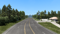
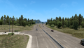
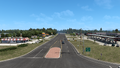
Gallery
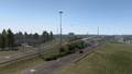
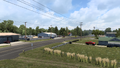
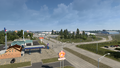
Beaumont
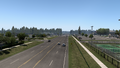
Lumberton
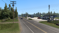
Kountze
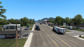
Woodville
Huntington
Lufkin
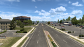
Tyler
Lindale
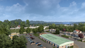
Mineola
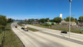
Greenville
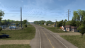
Bells
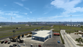
Calera
Durant
McAlester
Eufaula
Checotah
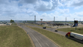
Muskogee
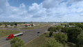
Chouteau


See also
References
- ↑ Texas Discussion Thread, Page 790, Message #7896 in SCS Forums, 2022-11-15 (accessed 2022-11-16)
| Cities | |
|---|---|
| Highways | Interstate 35 • Interstate 40 • Interstate 44 • Interstate 235 • Interstate 244 • US 54 • US 56 • US 59 • US 60 • US 62 • US 64 • US 69 • US 70 • US 75 • US 77 • US 81 • US 83 • US 183 • US 259 • US 270 • US 271 • US 277 • US 281 • US 287 • US 377 • US 385 • US 412 • SH-1 • SH-3 • SH-7 • SH-8 • SH-9 • SH-15 • SH-31 • SH-34 • SH-66 • SH-99 • SH-136 • SH-142 • SH-259A • SH-375 |
| See also | List of scenery towns in Oklahoma • List of landmarks in Oklahoma - List of Truck Stops in Oklahoma |