US 60
U.S. Route 60 (US 60) is an east–west United States Highway in central Arizona, New Mexico, northern Texas, and Oklahoma in American Truck Simulator. The route is separated into six sections: The first section runs from US 93 in Wickenburg to SR 303 in Phoenix. The second section runs entirely concurrent with Interstate 17, from exit 201 to exit 199, in Phoenix. The third section runs from Interstate 10 and AZ 51 in Phoenix to Interstate 25 in Socorro. The fourth section runs from US 54 and US 285 in Vaughn to US 87 in Amarillo. The fourth section runs from US 83 between Shamrock and Canadian to US 83 north of Canadian, concurrent with the latter route. The fifth section runs from US 412 and SH-8 east of Enid to northwestern Enid, concurrent with US 412 and US 81.
In real life, US 60 spans a total length of 2,655 miles (4,273 km) from Interstate 10 east of Quartzsite, Arizona to Virginia Beach, Virginia.
Course
US 60 begins at its junction with US 93 in Wickenburg and runs a short distance through the Sonoran Desert to AZ 303, where its westernmost segment ends. The highway resumes unsigned, at exit 201 of Interstate 17 in Phoenix, and follows I-17 to the south, intersecting Interstate 10 and ending its unsigned section at exit 199 of the same highway designation within the same name of the city. The signed portion of the highway resumes at Interstate 10 in eastern Phoenix, where it climbs between the red buttes of the Superstition Mountains to Globe. There, it meets US 70 at its western terminus, SR 77 and following a concurrency with SR 77 to the north, where it soon crosses the Salt River Canyon, a section of road with steep grades and tight switchbacks. In the south of the Colorado Plateau, the highway reaches Show Low, where it resumes its eastward trend; it is here that AZ 77 ends its concurrency with the highway, heading north to Holbrook. The highway soon intersects with US 191, which begins a short concurrency that ends in Springerville, the middle of this concurrency featuring a weigh station.
Out of Springerville, the highway enters New Mexico, where it soon passes through the town of Quemado, which offers travel services. Passing through the forest, the highway crosses the Great Continental Divide, and descends into a broad, open valley, where it passes through the Very Large Array, a massive grouping of 28 radio telescopes used to make observations of the universe. Passing Box Canyon, the highway descends to Socorro and Interstate 25, where there currently exists a gap between the interstate and Vaughn. After intersecting with US 54 and 285, the highway proceeds through the plains past Yeso (which features a rest area), and intersects with US 84 at Fort Sumner. After another rest area, the highway reaches Clovis, where it intersects with US 70 and follows a concurrency with this designated highway to Texico.
As soon as the highway crosses into Texas, it runs through Farwell to the north and heads northeast across the Llano Estacado in the northern part of the state. The highway soon passes through Bovina, and as it continues northeast, it enters Canyon, where it intersects Interstate 27 and US 87 altogether; soon afterwards, the three highways run concurrently together into Amarillo, intersecting Interstate 40 and US 287. The northern terminus of I-27 is met here, while US 87 and 287 follow US 60 into downtown Amarillo. The highways experience a left-driving configuration as they enter downtown; however, eastbound US 60 ends here, while the westbound portion follows Pierce Street with traffic directed towards the south on the one-way street. US 60 reaches another gap in the route after passing by a railway complex to the west; where US 87 leaves the concurrency and heads northwest to Dalhart. The highway resumes at the junction with US 83 and SH 33 and follows a concurrency with the 83 north into Canadian; north of town, a fifth gap is in the course of the highway.
At the Cimarron River in northern Oklahoma, near the Petrolucent oil well to the north and Gloss Mountain State Park to the west, US 60 resumes its course on US 412, following a concurrency with the latter route, into the city of Enid. In Enid, the 60 then follows US 81 to the north until reaching its current eastern terminus at West Willow Road, in the northeastern part of the city. Eventually, US 60 will continue into Missouri, with yet another gap in the route.
Cities
Arizona
Scenery towns
New Mexico
Texas
Oklahoma
Junction list
Arizona
| Location | mi | km | Destinations | Facilities | Notes |
|---|---|---|---|---|---|
| Wickenburg | 0 | 0 | Western terminus in-game; southern terminus of US 93 | ||
| 3 | 6 | NAF Gas Station | |||
| 29 | 48 | Loop 303 exit 119 | |||
| End first section; start second section | |||||
| Phoenix | 29 | 48 | Thomas Road | Western terminus of I-17 concurrency; I-17 exit 201 | |
| 34 | 55 | I-10 exits 143 A-B; I-17 exit 200 | |||
| 46 | 75 | Buckeye Road | Eastern terminus of I-17 concurrency; I-17 exit 199 | ||
| End second section; start third section | |||||
| Phoenix | 46 | 75 | Southern terminus of SR 51; I-10 exits 147 A-B and 148 | ||
| Globe | 115 | 186 | Minor road | Access to Aron gas station | |
| 117 | 188 | TOTSO; western terminus of US 70; western terminus of SR 77 concurrency | |||
| 141 | 227 | Salt River Canyon Rest Area | |||
| 149 | 240 | Gas station | |||
| Show Low | 219 | 352 | Western terminus of SR 260 concurrency; SR 260 westbound is inaccessible | ||
| 220 | 354 | Eastern terminus of SR 260 concurrency | |||
| 221 | 355 | Show Low Voltison Motors Dealer | |||
| 221 | 356 | ||||
| 221 | 356 | Minor road | |||
| 256 | 412 | Western terminus of US 180 and US 191 concurrencies | |||
| Springerville | 263 | 424 | Weigh Station | Westbound only | |
| 271 | 436 | Eastern terminus of US 180 and US 191 concurrency | |||
New Mexico
| Location | mi | km | Destinations | Facilities | Notes |
|---|---|---|---|---|---|
| Quemado | 312 | 502 | Truck Parking | ||
| 313 | 504 | Gallon Oil Gas Station | |||
| 315 | 507 | Aron Gas Station | |||
| 405 | 653 | Socorro NAMIQ Quarry | |||
| Socorro | 412 | 664 | TOTSO; western terminus of I-25 BL concurrency | ||
| 413 | 665 | Manzanares Avenue | |||
| 413 | 665 | San Miguel Street / Otero Avenue | San Miguel Street is inaccessible | ||
| 413 | 665 | Socorro Wallbert Market / Motel | |||
| 414 | 666 | Gallon Oil Gas Station | |||
| 414 | 667 | Eastern terminus of I-25 BL concurrency; I-25 exit 150 | |||
| End third section; start fourth section | |||||
| Vaughn | 414 | 667 | Western terminus of US 54 and US 285 concurrencies | ||
| 420 | 677 | Gallon Oil Truck Stop | |||
| 421 | 678 | TOTSO; eastern terminus of US 285 concurrency | |||
| 426 | 686 | TOTSO; eastern terminus of US 54 concurrency | |||
| 457 | 736 | Truck Parking | |||
| 472 | 759 | Roswell | Inaccessible | ||
| Fort Sumner | 480 | 773 | Western terminus of US 84 concurrency | ||
| 508 | 818 | Rest Stop | |||
| Clovis | 534 | 859 | Minor road | ||
| 534 | 860 | Minor road | |||
| 534 | 860 | Minor road | |||
| 535 | 861 | Minor road | |||
| 535 | 862 | Western terminus of US 70 concurrency | |||
| 536 | 863 | Gallon Oil Truck Stop | |||
| 536 | 863 | Minor road | |||
| Texico | 547 | 881 | Northern terminus of NM 348 | ||
| 548 | 883 | Gallon Oil Truck Stop | |||
| 550 | 886 | TOTSO; eastern terminus of US 70 and US 84 concurrencies | |||
Texas
| Location | mi | km | Destinations | Facilities | Notes |
|---|---|---|---|---|---|
| Farwell | 558 | 898 | Northern terminus of FM 292 | ||
| Bovina | 579 | 932 | Amarillo Global Mills Grain Elevator | ||
| 581 | 936 | Inaccessible | |||
| 601 | 957 | Rest Stop | Eastbound only | ||
| Canyon | 617 | 994 | TOTSO; western terminus of I-27 and US 87 concurrencies; I-27 exit 110 | ||
| Amarillo | 622 | 1,002 | I-27 exit 116; no exit number eastbound; Loop 335 westbound is inaccessible | ||
| 633 | 1,019 | Eastern terminus of I-27 concurrency; western terminus of US 287 concurrency; I-27 exit 123; I-40 exit 70 | |||
| 643 | 1,035 | Eastbound exit and westbound entrance; eastern terminus of US 287 concurrency; US 60 eastbound (Buchanan Street) is inaccessible | |||
| 643 | 1,035 | Southeast 11th Avenue | Westbound only | ||
| 643 | 1,036 | Southeast 6th Avenue | Westbound only | ||
| 644 | 1,036 | Southeast 5th Avenue | Westbound only | ||
| 644 | 1,036 | Southeast 2nd Avenue | Westbound only | ||
| 644 | 1,037 | Northeast 3rd Avenue | Eastern terminus in Texas DLC; eastern terminus of US 87 concurrency; road continues as US 87 | ||
| End fourth section; start fifth section | |||||
| 644 | 1,037 | Western terminus of US 83 concurrency; US 60 continues southwest inaccessibly; SH 33 is inaccessible | |||
| Canadian | 656 | 1,057 | Inaccessible | ||
| 666 | 1,072 | Gallon Oil Truck Stop | |||
| 667 | 1,075 | Eastern terminus of US 83 concurrency; US 60 continues north inaccessibly | |||
| End fifth section | |||||
Oklahoma
| Location | mi | km | Destinations | Facilities | Notes |
|---|---|---|---|---|---|
| Start sixth section | |||||
| 667 | 1,075 | Enid Petrolucent Oil Well | Western terminus in Oklahoma DLC; western terminus of US 412 and SH-8 concurrencies; road continues as US 412 | ||
| 673 | 1,084 | Eastern terminus of SH-8 concurrency; SH-8 northbound is inaccessible | |||
| Enid | 693 | 1,116 | TOTSO; eastern terminus of US 412 concurrency; western terminus of US 81 concurrency; US 81 southbound is inaccessible | ||
| 694 | 1,117 | Randolph Avenue | Inaccessible | ||
| 695 | 1,119 | Minor road | Access to Enid Johnson & Smith and X-Tech Machinery depots | ||
| 696 | 1,120 | West Willow Road | Eastern terminus in-game; eastern terminus of US 81 concurrency; US 60 continues north inaccessibly; US 81 northbound is inaccessible | ||
History
- In the initial version of the Arizona map expansion DLC, US 60 began at a four-way stack interchange with Interstate 10 and Interstate 17 in eastern Phoenix and ended in Show Low.
- In update 1.5, as part of the 1:35 to 1:20 map rescale, the eastern terminus of US 60 in eastern Phoenix now only terminates with Interstate 10. On the rest of the route, a gas station was added in the Salt River Canyon.
- In update 1.29, the separate section of US 60 from US 93 in Wickenburg to Loop 303 was added.
- In the initial version of the New Mexico map expansion DLC, the section of US 60 from Show Low to Interstate 25 in Socorro and from US 54 in Vaughn to Clovis was added.
- In update 1.31, the junction with US 84 in Fort Sumner was added.
- In update 1.32, Springerville and a junction with US 191 was added.
- In update 1.35, SR 51 was added at the four-way stack interchange with Interstate 10 in Phoenix.
- In update 1.38, the junction with US 180 and US 191 east of Springerville was added.
Gallery
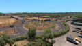
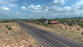
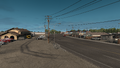
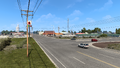
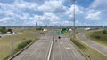
Wickenburg
Phoenix
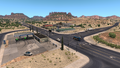
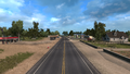
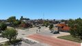
Globe
Salt River Canyon
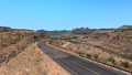
Springerville
Quemado
Omega
Socorro
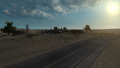
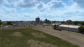
Vaughn
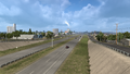
Yeso
Fort Sumner
Clovis
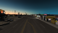
Texico
Farwell
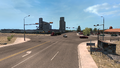
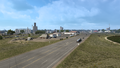
Bovina
Canyon
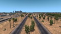
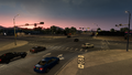
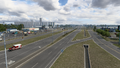
Amarillo
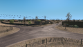
Canadian
Enid


See also
| Cities | |
|---|---|
| Highways | Interstate 8 • Interstate 10 • Interstate 15 • Interstate 17 • Interstate 19 • Interstate 40 • US 60 • US 64 • US 70 • US 89 • US 89A • US 93 • US 95 • US 160 • US 163 • US 180 • US 191 • SR 51 • SR 61 • SR 64 • SR 66 • SR 77 • SR 85 • SR 89 • SR 90 • SR 92 • SR 98 • SR 260 • SR 303 • SR 389 |
| See also | |
| Cities | Alamogordo • Albuquerque • Artesia • Carlsbad • Clovis • Farmington • Gallup • Hobbs • Las Cruces • Raton • Roswell • Santa Fe • Socorro • Tucumcari |
|---|---|
| Highways | |
| See also | |
| Cities | |
|---|---|
| Highways | Interstate 35 • Interstate 40 • Interstate 44 • Interstate 235 • Interstate 244 • US 54 • US 56 • US 59 • US 60 • US 62 • US 64 • US 69 • US 70 • US 75 • US 77 • US 81 • US 83 • US 183 • US 259 • US 270 • US 271 • US 277 • US 281 • US 287 • US 377 • US 385 • US 412 • SH-1 • SH-3 • SH-7 • SH-8 • SH-9 • SH-15 • SH-31 • SH-34 • SH-66 • SH-99 • SH-136 • SH-142 • SH-259A • SH-375 |
| See also | List of scenery towns in Oklahoma • List of landmarks in Oklahoma - List of Truck Stops in Oklahoma |