US 54
U.S. Route 54 (US 54) is an east–west United States Highway in the El Paso metropolitan area in western Texas, eastern New Mexico, the Texas panhandle, and the Oklahoma panhandle in American Truck Simulator. It runs from Interstate 10 and US 180 in El Paso near the Mexican border to northeastern Guymon.
US 54 in New Mexico is signed north–south throughout the state despite being nationally an east–west highway due to its physical orientation from the Texas state line between El Paso and Alamogordo to the Texas state line between Tucumcari and Dalhart, although some signs along the route are signed east–west from Vaughn to the Texas state line northeast of Tucumcari. The highway, along with US 62 and US 180, also travels through two portions of Texas, separated by the portion in New Mexico.
In real life, US 54 spans a total length of 1,197 miles (1,926 km) from El Paso, Texas to Griggsville, Illinois.
Course
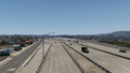
US 54 beings in El Paso, Texas, as a controlled access highway at a complex interchange with Interstate 10 and US 180 known as El Paso's "Spaghetti Bowl". The route travels north while it leaves the city, serving several major streets. At 37 miles (59 kilometers) north from its western terminus, US 54 passes by the neighborhood of Newman in the far northeast of El Paso, where the known landmark of "The Edge of Texas" is located.
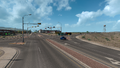
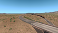
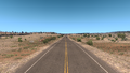
Right after passing by Newman, US 54 enters New Mexico and traces through the Chihuahuan Desert as the runs towards the north and reaches the city of Alamogordo. There, it runs a short concurrency with US 70, bypassing the city to the east, and intersects US 82 to the north. US 54 continues north and enters Tularosa, where the 70 ends its concurrency with the route. The highway runs withing the central portion of the state, passing through Carrizozo and intersecting US 380. The route then travels a northeast-ward course across the central portion of the state, passes through Corona, and enters Vaughn. Just west of Vaughn, US 54 runs a concurrency with US 60 and US 285 through the city; soon afterwards, the 285 ends the concurreny at the southern limits of Vaughn, and a weigh station is also presented there. The 54 traces east, while it still follows US 60 for a short distance until it ends its concurreny with the highway east of the city. US 54 resumes its northeasterly run across the state, passes by Pastura to the east, and enters Santa Rosa, where it starts its concurrency with Interstate 40. The route also follows a short concurrency with US 84 through the city. As the 54 runs with I-40, the route passes by the Pajarito Rest Area, and then it runs through Tucumcari. In the city, US 54 ends its concurrency with I-40 and runs northeast through the town of Logan.
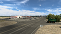
As it enters Texas for the second time, the surrounding terrain of US 54 transitions to the Great Plains as it enters Dalhart through several farmlands in the Texas panhandle. The route enters the city of Dalhart and intersects US 87 and US 385 altogether. Beyond the city limits, US 54 approaches Spur 24 northeast of Dalhart and continues to travel to the northeast towards the border town of Texhoma.
Half way through Texhoma, US 54 enters the panhandle of Oklahoma, expanding into a four-lane highway across the region; soon afterwards, it enters the city of Guymon, where it intersects US 64, US 412, SH-3, and SH-136 (along with their truck routes), all of which run a concurrency with US 54 through the city. Northeast of the city, the 54 runs a concurrency with the 64 for the rest of its course upon approaching its current eastern terminus at a service shop, in the northeastern part of Guymon, and will in time continue into Kansas.
Cities
Texas (El Paso)
New Mexico
Texas (Panhandle)
Scenery towns
Oklahoma
Scenery towns
Junction list
Texas (El Paso)
| Location | mi | km | Exit | Destinations | Facilities | Notes |
|---|---|---|---|---|---|---|
| El Paso | 0 | 0 | 21 A-B | Western terminus in-game; I-10 exit 22 B | ||
| 9 | 15 | US 54 Distributor Ramp West | Westbound exit only; exit has no number nor control signs | |||
| 14 | 23 | Pershing Drive / Altura Avenue | Westbound exit only; inaccessible | |||
| 21 | 34 | 31 | FM 3255 is inaccessible | |||
| 37 | 59 | 32 | State Line Road | East end of freeway; secret road to The Edge of Texas |
New Mexico
| Location | mi | km | Exit | Destinations | Facilities | Notes |
|---|---|---|---|---|---|---|
| 68 | 109 | Inspection Station | Eastbound only; closed | |||
| Alamogordo | 84 | 135 | TOTSO; western terminus of US 70 concurrency | |||
| 103 | 166 | TOTSO; western terminus of US 82 | ||||
| Tularosa | 107 | 172 | Eastern terminus of US 70 concurrency; US 70 eastbound is inaccessible | |||
| 107 | 172 | Gallon Oil Truck Stop | ||||
| Carrizozo | 146 | 235 | Gallon Oil Gas Station, Motel | |||
| 147 | 236 | |||||
| 147 | 237 | NAF Gas Station, Gallon Oil Gas Station | ||||
| 203 | 327 | Rest Stop | ||||
| Vaughn | 224 | 361 | TOTSO; western terminus of US 60 and US 285 concurrencies; US 60 westbound is inaccessible; US 285 northbound is inaccessible | |||
| 230 | 370 | Gallon Oil Truck Stop | ||||
| 231 | 372 | TOTSO; eastern terminus of US 285 concurrency | ||||
| 235 | 379 | Eastern terminus of US 60 concurrency | ||||
| 248 | 399 | Rest Stop | ||||
| Santa Rosa | 268 | 432 | TOTSO; western terminus of I-40 BL and US 84 concurrencies | |||
| 273 | 439 | TOTSO; western terminus of I-40 and US 84 concurrencies; eastern terminus of I-40 BL concurrency; I-40 exit 275 | ||||
| 281 | 452 | 277 | Eastern terminus of US 84 concurrency | |||
| 299 | 482 | ---- | Pajarito Rest Area | |||
| Tucumcari | 326 | 526 | 332 | |||
| 333 | 536 | TOTSO; eastern terminus of I-40 concurrency; I-40 exit 333 | ||||
| 337 | 543 | Gallon Oil Truck Stop | ||||
| 338 | 544 | |||||
| 338 | 544 | Eastern terminus of US 54 Bus. and NM 237 | ||||
| Logan | 384 | 618 | Aron Gas Station |
Texas (Panhandle)
| Location | mi | km | Destinations | Facilities | Notes |
|---|---|---|---|---|---|
| 398 | 641 | Rest Stop | |||
| 409 | 659 | Minor road | Access to Dalhart Grand Pastures livestock auction | ||
| 411 | 661 | Dalhart Grand Pastures Livestock Auction | |||
| 413 | 664 | Access to Dalhart Grand Pastures farm via FM 3489 | |||
| Dalhart | 422 | 679 | TOTSO; western terminus of US 87 Bus. concurrency; US 87 Bus. southbound is inaccessible | ||
| 422 | 680 | Police Department, Downtown | Inaccessible | ||
| 423 | 681 | Eastern terminus of US 87 Bus. concurrency | |||
| 423 | 681 | Inaccessible | |||
| 423 | 682 | Dalhart Golden Meadows Garage | |||
| 436 | 703 | Eastern terminus in Texas DLC; eastern terminus of Spur 24 | |||
| 456 | 736 | Picnic Area |
Oklahoma
| Location | mi | km | Destinations | Facilities | Notes |
|---|---|---|---|---|---|
| Texhoma | 465 | 750 | Minor road | Western terminus in Oklahoma DLC; access to Guymon Global Mills grain elevator | |
| 467 | 753 | Inaccessible | |||
| 469 | 756 | Guymon Grand Pastures Livestock Auction | |||
| 471 | 760 | Phoenix Truck Stop | |||
| Guymon | 488 | 787 | Western terminus of US 412, SH-3, and SH-136 concurrencies; US 412 and SH-3 westbound, and SH-136 northbound is a secret road; access to Guymon Faraday power network service | ||
| 489 | 788 | Minor road | Access to Gallon Oil Truck Stop | ||
| 489 | 789 | Gallon Oil Truck Stop | |||
| 489 | 789 | Eastern terminus of US 412, SH-3, and SH-136 concurrencies; western terminus of US 412 Truck, SH-3 Truck, and SH-136 Truck concurrencies | |||
| 490 | 790 | Aron Truck Stop | |||
| 490 | 790 | Eastern terminus of US 412 Truck, SH-3 Truck, and SH-136 Truck concurrencies; western terminus of US 64 concurrency | |||
| 491 | 791 | Hurliman Road | Access to Guymon Equos Power depot and Farmer's Barn feed mill | ||
| 492 | 793 | Minor road / Gas Station | Access to Guymon Global Mills food plant; gas station is hidden | ||
| 492 | 793 | Minor road | Access to Guymon Grand Pastures farm | ||
| 492 | 794 | Service Shop | Eastern terminus in-game |
Special Route

- Main article: US 54 Business and NM 237
U.S. Route 54 has one business route in New Mexico, respectively in Tucumcari.
History
- In the initial version of the New Mexico map expansion DLC, US 54 began at an intersection in southwestern Alamogordo and ended in Tucumcari.
- In the initial version of the Texas map expansion DLC, the sections of US 54 from Interstate 10 and US 180 in El Paso to US 70 in Alamogordo and from Tucumcari to Spur 24 northeast of Dalhart were added.
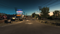
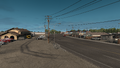
Gallery
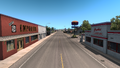
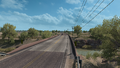
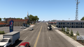
El Paso
Alamogordo
Tularosa
Near Tularosa
Carrizozo
Between Carrizozo and Corona
Corona
Vaughn
Near Santa Rosa
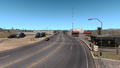
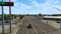
Santa Rosa
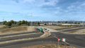
Tucumcari
Logan
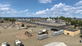
Dalhart
Texhoma
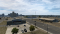
Guymon


See also
| Cities | Alamogordo • Albuquerque • Artesia • Carlsbad • Clovis • Farmington • Gallup • Hobbs • Las Cruces • Raton • Roswell • Santa Fe • Socorro • Tucumcari |
|---|---|
| Highways | |
| See also | |
| Cities | |
|---|---|
| Highways | Interstate 35 • Interstate 40 • Interstate 44 • Interstate 235 • Interstate 244 • US 54 • US 56 • US 59 • US 60 • US 62 • US 64 • US 69 • US 70 • US 75 • US 77 • US 81 • US 83 • US 183 • US 259 • US 270 • US 271 • US 277 • US 281 • US 287 • US 377 • US 385 • US 412 • SH-1 • SH-3 • SH-7 • SH-8 • SH-9 • SH-15 • SH-31 • SH-34 • SH-66 • SH-99 • SH-136 • SH-142 • SH-259A • SH-375 |
| See also | List of scenery towns in Oklahoma • List of landmarks in Oklahoma - List of Truck Stops in Oklahoma |