TX 36
State Highway 36 (SH 36) is a north–south state highway in central Texas in American Truck Simulator. It runs almost entirely within Cameron, concurrent with US 77 and US 190.
In real life, SH 36 spans a total length of 343.1 miles (552.2 km) from Freeport to Abilene, Texas. It is the third-longest Texas state highway, following SH 6 (the second-longest state highway; not rendered in ATS) and SH 16 (the longest state highway; rendered in ATS as an inaccessible road at US 59 and SH 44 in Freer).
Course
The featured accessible section of SH 36 begins just west of Cameron at a T-intersection with US 77 and US 190. The highway follows a concurrency with the two highways as they cross the Little River into town, passing under a railroad, and ends where the 77 breaks away and head north towards Waco. Further northwest, SH 36 is also featured as an inaccessible highway at US 67 and US 377 in Comanche and is seen on guide signs on Interstate 20 in Abilene; however, the highway in ATS is not featured where its northern terminus is located in real life.
Cities
Junction list
| Location | mi | km | Destinations | Notes |
|---|---|---|---|---|
| 0 | 0 | Southern terminus in-game; eastern terminus of US 77 and US 190 concurrencies; road continues as US 190 | ||
| Cameron | 17 | 28 | Northern terminus in-game; western terminus of US 77 and US 190 concurrencies; US 190 and SH 36 continue west inaccessibly |
Gallery
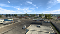
Cameron
