Interstate 20
Interstate 20 (I-20) is an east–west Interstate Highway in Texas in American Truck Simulator. It runs from Interstate 10 in Scroggins Draw to US 59 in Marshall.
In real life, Interstate 20 spans a total length of 1,539 miles (2,477 km) from Scroggins Draw, Texas to Florence, South Carolina.
Course
Interstate 20 begins at its junction with Interstate 10 in the unincorporated community of Scroggins Draw in the Chihuahuan Desert. Trending northeast through the desert, the highway passes through Pecos and intersects US 285; soon afterwards, I-20 continues to trend across the westernmost portion of the Chihuahuan Desert until it eventually reaches the city of Odessa in the southernmost portion of the Great Plains. In Odessa, the highway has interchanges with US 385 and Loop 338. After leaving the Midland–Odessa combined statistical area, I-20 reaches Big Spring, where it intersects US 87. Entering the Central Plains of Texas, the highway passes through Abilene, where it crosses paths with US 83 and 277. I-20 continues to trace across the central plains and passes the rest areas through the hilly terrain of Eastland County. Leaving Eastland County, I-20 passes through the Dallas–Fort Worth metroplex, beginning with an intersection of Interstate 30's western terminus, followed by running to the south of Downtown Fort Worth, intersecting Interstate 35W, passing south of Arlington, crossing Interstate 35E to the south of Dallas, and ending with an intersection with Interstate 45 before leaving the metroplex. Entering the woodlands in northeastern Texas, east and westbound weigh stations are first passed; soon afterwards, the highway intersects with US 69 in Lindale to the north of Tyler. Before running south of Longview, I-20 traces through wetlands and crosses the Sabine River there. Entering the southern portion of Longview, I-20 intersects US 259 and SH 149; soon afterwards, I-20 ends at its intersection with US 59 at Marshall, to eventually continue into Louisiana.
Cities
Scenery towns
Exit List
| Location | mi | km | Exit | Destinations | Facilities | Notes |
|---|---|---|---|---|---|---|
| Scroggins Draw | 0 | 0 | Western terminus; I-10 exit 187 | |||
| Pecos | 36 | 58 | 42 | |||
| 59 | 95 | ---- | Ward County Safety Rest Area | |||
| 79 | 127 | ---- | CMV Inspection Station | |||
| Odessa | 101 | 162 | 113 | |||
| 113 | 182 | 116 | US 385 northbound is inaccessible | |||
| 129 | 208 | 121 | ||||
| Midland | 147 | 238 | 135 | Cotton Flat Road, Garfield Street | Eastbound exit and westbound entrance | |
| 160 | 259 | 173 | Western terminus of US 87 concurrency | |||
| Big Spring | 180 | 290 | 177 | Eastern terminus of US 87 concurrency | ||
| 230 | 371 | 256 | Stink Creek Road | Access to Abilene Vitas Power construction site | ||
| 245 | 394 | ---- | Nolan County Rest Area | |||
| Tye | 258 | 415 | 277 | |||
| Abilene | 272 | 437 | 282 | Frontage Road | Eastbound exit and westbound entrance | |
| 274 | 441 | 283 A-B | Southern terminus of US 277 | |||
| 291 | 469 | 288 | SH 351 westbound is inaccessible | |||
| 309 | 498 | 290 | Eastbound exit and westbound entrance | |||
| 317 | 510 | 308 | ||||
| 334 | 538 | ---- | Eastland County Eastbound Rest Area | Eastbound only | ||
| 354 | 570 | (no name) | Westbound exit and eastbound entrance; Inaccessible | |||
| 366 | 589 | ---- | Eastland County Westbound Rest Area | Westbound only | ||
| 383 | 617 | 350 | Gilbert Pit Road | Access to Fort Worth NAMIQ depots | ||
| 407 | 655 | 421 | Eastbound exit and westbound entrance; Western terminus of I-30 | |||
| Fort Worth | 423 | 680 | 436 | Westbound exit and eastbound entrance; Inaccessible | ||
| 428 | 690 | 437 | I-35W exits 45 A-B | |||
| Dallas | 445 | 716 | 458 | Mount Creek Parkway | ||
| 455 | 732 | 467 A-B | I-35E exits 418 A-B | |||
| 471 | 758 | 473 A-B | I-45 exits 276 A-B | |||
| 483 | 778 | 506 | Eastbound exit and westbound entrance; Inaccessible | |||
| 505 | 813 | 509 | Hiram Road | Westbound exit and eastbound entrance; Inaccessible | ||
| 517 | 832 | ---- | CMV Inspection Station | |||
| Lindale | 528 | 850 | 554 | Harvey Road | Inaccessible | |
| 542 | 873 | 556 | ||||
| Longview | 586 | 943 | 596 | Southern terminus of US 259; SH 149 southbound is inaccessible | ||
| Marshall | 604 | 972 | 617 | Eastern terminus in-game |
Business Route

- Main article: Business Interstate 20
Interstate 20 has one business route along its route in Texas, respectively east of Abilene. There is also a second business route in Tye; however, that route is inaccessible to the player.
Gallery
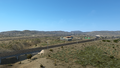
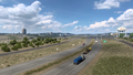
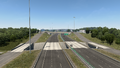
Scroggins Draw
Pecos
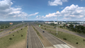
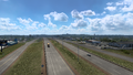
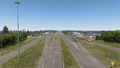
Odessa
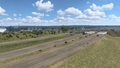
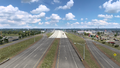
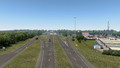
Midland
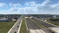
Big Spring
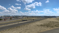
Tye
Abilene
Fort Worth
Dallas
Lindale
Longview

Marshall


