US 191

|
This article needs a clean-up.
You can help Truck Simulator Wiki by re-organizing parts of the article, checking grammar / spelling, and doing other helpful things to correct the article.
|
U.S. Route 191 (US 191) is a north–south US Highway in eastern Arizona (though shown as partially in New Mexico on the game map) and Utah, western Wyoming, and central Montana in American Truck Simulator. It runs from US 70 between San Simon and Lordsburg, AZ, to US 2 in Malta, MT, with a gap between Bozeman and Lewistown. In real life, US 191 runs a total of 1624 miles (2613.5 km) from the Mexican border in Douglas, AZ, to the Canadian border north of Malta, MT. It is split into two segments by Yellowstone National Park, where US Highways are unsigned and not officially continuous.
Course
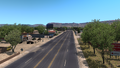
US 191 in ATS begins at its intersection with US 70 in southeastern Arizona. It winds its way to Clifton, where it begins following Coronado's Trail, the scenic route the highway takes across the White Mountains. The 191 switchbacks its way up to the Morenci Mine, one of the largest copper deposits in the world, managed in the game by Coastline Mining. After running through the sprawling mine, the highway enters the forest, where it passes landmarks such as the Arrow Tree and H L Saddle. The highway winds down past Nelson Reservoir to the Colorado Plateau and Springerville, where it intersects with US 60, which it follows for a short concurrency. The 191 then passes by Lyman Reservoir and runs through St. Johns, where it crosses the Little Colorado River. The highway then continues across the red desert to Sanders and Interstate 40, and proceeds across the Navajo Nation in what is, in the game, a very straight route between Black Mesa to the west and the Defiance Plateau and the Chuska Mountains to the east. At the northern part of this stretch is a gas station (possibly representing Many Farms) and a butte likely representing Round Rock. After passing Kayenta's mine, the highway intersects with US 160 and continues into Utah.
Across the state line, the highway crosses the San Juan River, and, after meeting US 163, passes through Bluff. Continuing through the Colorado Plateau, the highway passes SR 95 and Recapture Reservoir before climbing up the eastern feet of the Abajo Mountains to Monticello and US 491. Out of Monticello the 191 comes within sight of the La Sal Mountains, and after passing by the Hole 'N' the Rock (a tourist trap with rest stops and a viewpoint) runs through Moab. After crossing the Colorado River, the 191 runs between high escarpments to Crescent Junction, where it joins the concurrent Interstate 70 and US 6. The 191 follows the 6, which parts from I-70 after about 20 miles, as far as Price Canyon, where, after passing the Castle Gate power station, it crosses the Tavaputs Plateau and heads for Duchesne. At Duchesne the 191 runs concurrent with US 40 to Vernal, where it continues north.
After leaving Vernal, US 191 climbs the Uinta Mountains along a steep grade with a large switchback. After cresting this unnamed pass, the highway passes to the south of the Flaming Gorge Reservoir and crosses the Green River via the Flaming Gorge Dam, a 502 ft (153 m) high thin-arch dam built from 1958-64. Here the highway crosses Red Canyon, which it also runs along the rim of for a short ways to an overlook, which features a viewpoint. From here the highway follows a climbing, winding route that takes it into Wyoming via Minnie's Gap, a natural gap between two monoclines called the Glades. Continuing upwards, the highway runs high over the Red Creek Basin along a grade with phenomenal views. From there the highway heads straight north to Rock Springs, where it runs along Interstate 80 for a brief distance. Out of Rock Springs, the 191 runs north through the valley of Killdecker Creek, a spacious, scenic valley bordered by the rim of the North Baxter Basin to the east and the banded cliffs of a large mesa called White Mountain to the west. Turning west, the highway passes through a gap in White Mountain and heads north to Farson, where it meets WYO 28. From there the 191 continues across the arid Green River Basin, passing oil fields to the west, to Daniel Junction, where US 189 begins running concurrent with the 191 (the 189, in real life, breaks from I-80 east of Evanston; this section of the highway is not represented in ATS). After passing under a couple livestock bridges, the scenery begins to change, with the highway entering pine forests in the foothills of the Gros Ventres and Wyoming Ranges (to the north and west, respectively). The highway begins running along the Hoback River, and weaves through Hoback Canyon, a scenic gorge with areas of colorful and jagged rock, to Hoback Junction, where the 191 begins running concurrent with US 89 and US 26. The highways pass through Jackson, where US 189 terminates, and up Jackson Hole to Moran, where US 26 breaks away and US 287 joins the route. The three highways continue through Grand Teton and Yellowstone National Parks; in the latter, at West Thumb, US 20 comes in from the east and becomes the fourth highway in this concurrency. The highways proceed up the Yellowstone Plateau to the ranger village and maintenance facility at Old Faithful, which provides a rest area. Between Yellowstone's south gate and this point, US 191 (and, for that matter, US 89 and 287) cross the Great Continental Divide three times. Out of Old Faithful Village, the highways run along the east side of the Lower Geyser Basin and the colorful Fountain Paint Pots, along the Firehole River, and over the Madison River to Madison Junction, where US 89 breaks away. The 191 trends westward along the Madison and exit the park just across the Montana border at the West Gate.
Out of Yellowstone National Park, US 191 passes through the tourist town of West Yellowstone, where US 20 ends its concurrency and the 191 continues northward. Just north of town, US 287 breaks away as well, and the 191 continues between the Gallatin Mountains to the east and the Madisons to the west, through the narrow and scenic Gallatin Canyon, where there is a rest stop. Out of the canyon, the 191 enters the Gallatin Valley, where it passes through Four Corners and Bozeman. In the east of Bozeman, US 191 meets I-90; in real life, the highways run concurrent as far east as Big Timber, although the eastern end of this concurrency, and the segment of the highway between there and Lewistown, is currently missing. US 191 resumes at US 87 and MT 200 in Eddies Corner, and runs concurrent with these highways to Lewistown, where the 191 breaks to the north. After curving around the Judith Mountains, the 191 intersects with MT 19, and continues northward over the Missouri River and across the Great Plains to US 2 at Malta. US 191 currently ends in the western limits of town, where it extends a very short distance north of the 2 to provide access to the truck stop at that location. From there it's a very short distance to the Canadian border.
Cities
Arizona
- San Simon (via US 70 and Interstate 10)
- Clifton
- Show Low (via US 60)
- Holbrook (via Interstate 40)
- Kayenta (via US 160 or US 163)
Scenery towns
Utah
Scenery towns
Wyoming
Scenery towns
Montana
Scenery towns
Junction list
Arizona
| Location | mi | km | Destinations | Facilities | Notes |
|---|---|---|---|---|---|
| San Simon | 0 | 0 |
|
South terminus
South End of Overlap with US 180 | |
| Clifton | 57 | Downtown Clifton Tidbit Market | |||
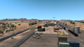
| 88 | Coastline Mining Morenci Mine | ||||
| 89 | Tunnel | ||||
| 105 | Tunnel | ||||
| 139 | Rest Area | ||||
| 184 | Rest Area | ||||
| Springerville | 190 | TOTSOEnd of First Section
East End of Overlap with US 60 Start of Second Section | |||
| 198 | Weigh Station | ||||
| 201 | TOTSO
West End of Overlap with US 60 | ||||
| St. Johns | 221 | AZ 61 West - Show Low AZ 61 East - Holbrook |
TOTSO
North End of Overlap with US 180 West End of Overlap with AZ 61 | ||
| 262 | AZ 61 East - Zuni | TOTSO
East End of overlap with AZ 61 | |||
| Holbrook | 274 | Rail Export Holbrook Rail Yard | TOTSOStart of Third Section | ||
| 278 | Road to Coastline Mining Depot | TOTSO | |||
| 290 | |||||
| 296 | Road to Bushnell Farms Depot | ||||
| Many Farms | 380 | Chemron Gas Station | |||
| Rock Point | 407 | Road to Coastline Mining Depot Black Mesa Coal Mine | |||
| Mexican Water | 415 | TOTSO
West End of Overlap with US 160 | |||
| 419 | TOTSO
East End of Overlap with US 160 |
Utah
| Location | mi | km | Destinations | Facilities | Notes |
|---|---|---|---|---|---|
| Bluff | 442 | TOTSO
Junction with US 163 | |||
| 452 | Downtown Bluff and Bluff Fort | ||||
| 455 | Navajo Twin Rocks, UT 162 Montezuma | ||||
| Monticello | 476 | UT 95 Hanksville, Lake Powell | |||
| 483 | Recapture Dam | ||||
| 501 | Inaccessible until Colorado | ||||
| Moab | 536 | Hole N The Rock | |||
| 540 | Kane Springs Rest Area | ||||
| 549 | Downtown Moab | ||||
| 557 | Road to Coastline Mining Potash Mine | ||||
| 564 | Canyonlands Road Gallon Oil Rigs #1 and #2 | ||||
| Crescent Junction | 576 | TOTSO
Beginning of overlap with Interstate 70, US 50, and US 6 | |||
| Interstate 70 Exit 157 | 600 | TOTSO
End of overlap with Interstate 70 and US 50 | |||
| Price | 638 | Charged Distribution Center | |||
| 642 | Downtown Price Exit 243 | ||||
| 653 | Exit 241 Carbon Ave |
||||
| 662 | Exit 240 100 North |
||||
| 673 | Carbonville Road return to Price and Sunshine Crops Farm | ||||
| 677 | Weigh station (Southbound Only) | ||||
| 680 | Castle Gate Junction |
TOTSO
End of overlap with US 6 | |||
| Duchesne | 709 | Cemetery Road | |||
| 725 | Downtown Duchesne |
TOTSO Beginning of overlap with US 40 | |||
| Fort Duchesne | 767 | Downtown Fort Duchesne Pelican Lake Road Gallon Oil Rigs #3 and #4 | |||
| 774 | Pelican Lake Road Gallon Oil Rigs #3 and #4 | ||||
| Vernal | 784 | Road to Chemso Terminal and Coastline Mining Gravel Pit, Home Store Entrance | |||
| 785 | Downtown Vernal |
TOTSO End of US 40 overlap | |||
| 786 | Garage, Road to Chemso Terminal, and Coastline Mining Pit | End Of Road |
Wyoming
| Location | mi | km | Destinations | Facilities | Notes |
|---|
History
- In the initial version of the Arizona map expansion DLC, US 191 began at a diamond interchange with Interstate 40 in Holbrook and ended at an at-grade four-way junction with US 160 in Kayenta.
- In update 1.5, as part of the 1:35 to 1:20 map rescale, new sections were added to the existing route to accommodate the new map scale, including the gas station between Interstate 40 and US 160. The junction with US 160 was moved to a new at-grade three-way junction with US 64 in Mexican Water.
- In update 1.32, the section of US 191 from US 70 to US 60 in Springerville was added.
- In update 1.35, the junction with US 160 and US 64 in Mexican Water was rebuilt and changed from one to two at-grade three-way junctions, with US 191 extending north to Utah from the second junction.
- In the initial version of the Utah map expansion DLC, the section of US 191 from US 64 and US 160 east of Kayenta to Vernal was added.
- In update 1.38, the section of US 191 from US 60 and US 180 in Springerville to Interstate 40 in Sanders was added.
- In update 1.39, the section of US 64 intersecting US 191 in Mexican Water was redesignated as an eastward extension of US 160.
- In the initial version of the Wyoming map expansion DLC, the section of US 191 from Vernal to US 20, US 89, and US 287 in Yellowstone National Park was added.
- With the Montana DLC, US 191 from Old Faithful Village to Bozeman, and from Eddies Corner to US 2 at Malta, was added.
Gallery
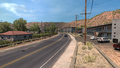
Clifton
Morenci
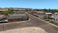
Springerville
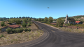
St. Johns
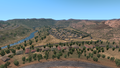
Sanders
Moab


See also
| Cities | |
|---|---|
| Highways | Interstate 8 • Interstate 10 • Interstate 15 • Interstate 17 • Interstate 19 • Interstate 40 • US 60 • US 64 • US 70 • US 89 • US 89A • US 93 • US 95 • US 160 • US 163 • US 180 • US 191 • SR 51 • SR 61 • SR 64 • SR 66 • SR 77 • SR 85 • SR 89 • SR 90 • SR 92 • SR 98 • SR 260 • SR 303 • SR 389 |
| See also | |
| Cities | Cedar City • Logan • Moab • Ogden (Roy) • Price • Provo (Mapleton, Orem, Spanish Fork) • Salina - Salt Lake City (Garfield, Herriman, Sandy, West Valley City) • St. George • Vernal |
|---|---|
| Highways | |
| See also | |
| Cities | Casper (Brookhurst, Mills) • Cheyenne (Fox Farm-College, South Greeley) • Cody • Evanston • Gillette • Jackson • Laramie • Rawlins (Sinclair) • Riverton • Rock Springs • Sheridan |
|---|---|
| Highways | Interstate 25 • Interstate 80 • Interstate 90 • Interstate 180 • US 14 • US 14 Alternate • US 16 • US 18 • US 20 • US 26 • US 30 • US 85 • US 87 • US 89 • US 189 • US 191 • US 287 • US 310 • WYO 22 • WYO 28 • WYO 50 • WYO 51 • WYO 59 • WYO 76 • WYO 89 • WYO 94 • WYO 110 • WYO 120 • WYO 135 • WYO 150 • WYO 210 • WYO 212 • WYO 220 • WYO 222 • WYO 258 • WYO 339 • WYO 351 • WYO 374 • WYO 450 • WYO 487 • WYO 789 |
| See also | |