Utah is a state of the United States, which is featured in American Truck Simulator as a map expansion DLC that was released on November 7th, 2019. It is the fifth map of DLC involving map expansions, but the fourth paid one.
Utah is located in the Western region of the United States. It is bordered by Nevada to the west, Arizona to the south, Colorado to the east, Idaho to the northwest, Wyoming to the northeast, and touches New Mexico to the southeast at the Four Corners. Referred to as "Four Corners," this is the only place in the United States where four states meet. Utah cover an area of 84,899 square miles (219,890 km2), the state's physical features range from arid deserts to pine forests. Only three U.S. states (Utah, Colorado, and Wyoming) have exclusively latitude and longitude lines as boundaries.
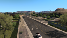
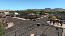
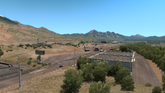
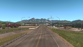
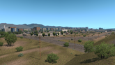
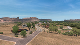
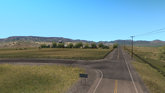
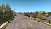
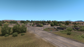
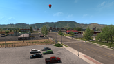
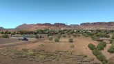
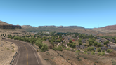
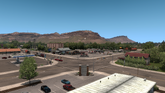
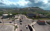
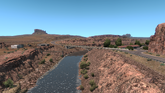
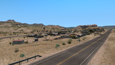
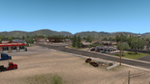
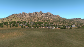
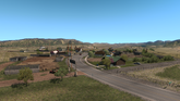
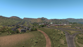
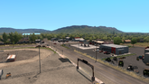
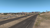
Geographically, the state can be divided into three regions: the Rocky Mountains, the Basin and Range Province, and the Colorado Plateau. The Rocky Mountains are an imposing presence in many of the western states. There are two ranges of Rocky Mountains that run in the state of Utah. These are the Uinta Range and the Wasatch Range. Wasatch Range runs down to the northern center of the state whereas the Uinta Range lies in the northeastern region. It is home to the highest point in the state, Kings Peak. It has many ski resorts and attracts many visitors every year. The Basin and Range Province lies in western Utah. Its topography is characterized by deserts, mountains and basins and sand dunes. The lowest and the warmest part of the state, “Utah’s Dixie” is located in the southwestern corner of this region. The Colorado Plateau is located in the southern and eastern region of the state. The topography of this region is characterized by deep canyons and valleys. Plateaus such as Fish Lake are as high as 11,000 feet (3,352 m) above the sea level. The Colorado River passes through Utah. The state has five national parks: Arches, Bryce Canyon, Canyonlands, Capitol Reef, and Zion National Park. Great Salt Lake, Utah Lake, Sevier Lake, and Rush Lake are major water bodies in the state. Significant rivers in Utah include the Green River, San Juan River, Logan River, and White River. With an elevation of 13,534 feet (4,125 m), Kings Peak is the highest point in Utah. The majority of the state's population lives around the Great Salt Lake, with the principal city being Salt Lake City. Another population hub is St. George to the southwest of the state. Most of the state is remote with very little population.
Climate
The climate of Utah features a dry, semi-arid to desert climate, although its many mountains feature a large variety of climates, with the highest points in the Uinta Mountains being above the timberline. The dry weather is a result of the state's location in the rain shadow of the Sierra Nevada in California. The eastern half of the state lies in the rain shadow of the Wasatch Mountains. The primary source of precipitation for the state is the Pacific Ocean, with the state usually lying in the path of large Pacific storms from October to May. In summer, the state, especially southern and eastern Utah, lies in the path of monsoon moisture from the Gulf of California.
“
Welcome to 'Beehive State' Utah. Visit the great Salt Lake City, tourist-favorite Moab or historic St. George cities and see how rich the local architecture and lifestyle are. Venture into crude-oil digging sites in remote areas away from the urban noise and enjoy the challenges hauling crude oil has to offer!
The cover of the DLC features a silver Volvo VNL 2014 with a Reefer Trailer attached to the truck, and there is also a car (assuming to be a Dodge Charger from the design of the rear end) which travels the opposite direction. The cover takes place at the San Rafael Swell in the Colorado Plateau on Interstate 70, with the famous rock formation in the swell, known as The Thumb, visible in the distance. The extensive Colorado Plateau can also be seen further behind, under a sky where the sun beats down the earth's surface, while the horizon breaks the maximum visible distance at the Colorado Plateau; although the weather may be judged by the shadows, the exact weather conditions in the cover is unknown. The logo of the DLC sits on the right side of the cover.
For early adopters of the DLC, having a profile connected to your World of Trucks account and making any delivery using the External Contracts or External Market to or from Salt Lake City will earn a Bee cabin toy.[2]
Since the release of the DLC, new major content has been added to it for free in game updates (not including road connections to new neighboring states).
23 November 2023: Mountains reworked around Salt Lake City in update 1.49.
4 July 2019: First official blog post confirmed Utah will be the next state with a few new screenshots + trailer[17] and added to Steam Store.[18]
28 June 2019: Teaser images from Utah appear on the blog.[19]
20 June 2019: A mysterious teaser video is posted on SCS's YouTube channel and in their blog showing a bee. Utah is also called "The Beehive State".[20]
30 April 2019: 1.35 Experimental Beta added some new roads that lead towards Utah.
4 February 2019: During a live stream, when asked to hint about the state following Washington, mentions that the state has "some big red rocks," heavily associated with Utah (as seen on the entrance sign).
21 December 2018: SCS gives hint at a possible Utah map expansion in their Christmas stream by showing a postcard of Monument Valley in Utah.[21]
5 November 2018: Near the end of SCS Software's Volvo VNL trailer, the truck was heading towards Utah on US 163. The GPS also showed that the road was accessible.[22]