User:Technology With Pro/US 66
[Infobox - TX 144–? mi (232–? km) - 35–65 mi]
U.S. Route 66 (US 66 or Route 66) was one of the original United States Highways, which is now a national scenic byway by the name Historic US 66 or Historic Route 66. The historic route, featured in American Truck Simulator, is separated into 12 sections, most of which are signed as state higwhays, business routes, marked as minor roads or secret roads: The first section runs from Interstate 40 and US 93 in Kingman to Interstate 40 Business in Seligman, mostly signed as SR 66. The second section runs entirely within Ash Fork, due north of Interstate 40. The third section runs entirely within Flagstaff, from Interstate 17 and US 180 to US 89, mostly signed as Interstate 40 Business. The fourth section runs entirely within Holbrook, signed as the first half of Interstate 40 Business. The fifth section runs from Tucumcari, west of US 491 and south of Interstate 40, to east of the said city, near a Chemso plant. The sixth section runs east of Albuquerque, paralleling Interstate 40 as a secret road from exit 176. The seventh section runs entirely within Santa Rosa, concurrent with US 54 and US 84. The eighth section runs from Tucumcari to Glenrio, partially signed as Interstate 40 Business and mostly marked as a secret road (with the section through Glenrio signed as Interstate 40 Business). The ninth section runs entirely within Adrian, signed as Interstate 40 Business. The tenth section runs entirely within Shamrock, signed as Interstate 40 Business. The eleventh section runs entirely within Clinton, partially signed as Interstate 40 Business. The twelfth section runs entirely within Tulsa as Southwest Boulevard, paralleling Interstate 244.
Summary
Route 66 was established on November 11, 1926, with road signs erected the following year. The highway, which became one of the most famous roads in the United States, ran from Chicago, Illinois, through the states of central Missouri, southeastern Kansas, central Oklahoma, northern Texas, central New Mexico and Arizona before terminating in Santa Monica in Los Angeles County, California, covering a total of 2,448 miles (3,940 km). The highway was recognized in popular culture by both the 1946 hit song "(Get Your Kicks on) Route 66" and the Route 66 television series, which aired on CBS from 1960 to 1964. It was also featured in the Disney/Pixar animated feature film franchise Cars. In John Steinbeck's 1939 novel The Grapes of Wrath, the highway symbolizes escape, loss, and the hope of a new beginning; Steinbeck dubbed it the Mother Road. Other designations and nicknames include the Will Rogers Highway and the Main Street of America.
The highway was a primary route for those who migrated west, especially during the Dust Bowl of the 1930s, and it supported the economies of the communities through which it passed. People doing business along the route became prosperous, and they later fought to keep it alive in the face of the growing threat of being bypassed by the more advanced controlled-access highways of the Interstate Highway System in the 1960s and 70s. US 66 underwent many improvements and realignments over its lifetime, but it was officially removed from the United States Highway System in 1985 after it was entirely replaced by segments of the Interstate Highway System. Portions of the road that passed through Illinois, Missouri, Oklahoma, New Mexico, and Arizona have been communally designated a National Scenic Byway by the name "Historic Route 66", returning the name to some maps. After its decertification, the first associations of Route 66, founded in Arizona in 1987 and Missouri in 1989 (incorporated in 1990), followed up to revive the highway as a "State Historic Route". The first "Historic Route 66" marker in Missouri was erected on Kearney Street at Glenstone Avenue in Springfield, Missouri, which is now replaced; the original sign has been placed at Route 66 State Park near Eureka. Other historic markers now line, at times sporadically, the entire 2,400-mile (3,900 km) length of the road. In many communities, local groups have painted or stenciled the "66" and U.S. Route shield or outline directly onto the road surface, along with the state's name. Several states have also adopted significant bypassed sections of the former US 66 into their state road networks as State Route 66 (such examples in American Truck Simulator include SR 66 in Arizona and SH-66 in Oklahoma) and much of the former route within the San Bernardino County, California, is designated as County Route 66. The corridor is also being redeveloped into U.S. Bicycle Route 66, a part of the United States Bicycle Route System that was developed in the 2010s.
Course
Cities
Arizona
New Mexico
Scenery towns
Texas
Oklahoma
Junction list
Arizona
| Location | mi | km | Destinations | Facilities | Notes | |
|---|---|---|---|---|---|---|
| Kingman | 0 | 0 | Western terminus in-game; I-40 exit 48 | |||
| 2 | 4 | Minor road | ||||
| 3 | 5 | Minor road | ||||
| 3 | 5 | Beale Street | TOTSO; inaccessible | |||
| 3 | 6 | Oak Street | ||||
| 3 | 6 | Service Shop | ||||
| 4 | 6 | Spring Street | ||||
| 5 | 9 | Western terminus of SR 66 concurrency; I-40 exit | ||||
| 7 | 12 | Kingman Wallbert Market | ||||
| 7 | 12 | Kingman Wallbert Warehouse | ||||
| 17 | 28 | Kingman Bitumen Roadworks | ||||
| Peach Springs | 35 | 56 | Grand Canyon Caverns | |||
| Seligman | 77 | 124 | Flagstaff HMS Machinery Depot | |||
| 78 | 126 | Eastern terminus of I-40 BL; eastern terminus of SR 66 concurrency; Historic US 66 continues east inaccessibly; SR 66 eastbound is inaccessible | ||||
| End first section; start second section | ||||||
| Ash Fork | 78 | 126 | Minor road | Historic US 66 continues west inaccessibly | ||
| 0+78 | 1+126 | Gallon Oil Gas Station / Rest Area | ||||
| 4 | 7 | Road continues as SR 89; I-40 exit 146 | ||||
| End second section; start third section | ||||||
| Flagstaff | 3-3 | 5-3 | Western terminus of US 180 concurrency | |||
| 3-3 | 5-3 | Minor road | ||||
| 3-3 | 6-3 | Leroux Street | ||||
| 4-3 | 7-3 | TOTSO; southern terminus of US 89 | ||||
| End third section; start fourth section | ||||||
| Holbrook | 0 | 0 | Minor road | Western terminus in-game | ||
| 0 | 0 | Wigwam Motel | ||||
| 0 | 0 | Tidbit Market | ||||
| 0 | 0 | Minor road | ||||
| 0 | 1 | TOTSO; western terminus of US 180 concurrency; western terminus of SR 77 concurrency | ||||
| 1 | 1 | Minor road | ||||
| 1 | 2 | West Buffalo Street | ||||
| 1 | 2 | Florida Street | ||||
| 5 | 9 | Northern terminus of SR 77; eastern terminus of US 180 concurrency; I-40 exit 286 | ||||
| 5 | 9 | Gallon Oil Truck Stop | Eastern terminus of I-40 BL concurrency; Historic US 66 continues east inaccessibly | |||
| End fourth section | ||||||
New Mexico
| Location | mi | km | Destinations | Facilities | Notes | |
|---|---|---|---|---|---|---|
| Start fifth section | ||||||
| 0 | 0 | Minor road | Western terminus in-game | |||
| 0 | 0 | Minor road | Access to I-40 and US 491 via Muñoz Boulevard | |||
| 0 | 1 | Fusion Travel Plaza | ||||
| 0 | 1 | Secret road | ||||
| 1 | 1 | Minor road | Access to I-40 and US 491 via Muñoz Boulevard | |||
| 1 | 2 | Service Shop | ||||
| 1 | 2 | Minor road | ||||
| 1 | 2 | Minor road | Access to US 491 | |||
| Gallup | 78+? | 126+? | Eastern terminus of I-40 BL; I-40 exit 26 | |||
| 79 | 128 | NAF Truck Stop / Starlite Inn | ||||
| 85 | 137 | Gallup Chemso Chemical Plant | Historic US 66 continues east inaccessibly | |||
| End fifth section; start sixth section | ||||||
| Albuquerque | 85 | 137 | Tramway Boulevard | Historic US 66 continues west into a parking lot inaccessibly; no entry to I-40 | ||
| 103 | 166 | |||||
| End sixth section; start seventh section | ||||||
| 0 | 0 | Western terminus; I-40 exit 273 | ||||
| 5 | 9 | Western terminus of US 54 concurrency | ||||
| 10 | 17 | I-40 exit 275 | ||||
| 16 | 26 | Rest Stop | ||||
| 18 | 29 | Eastern terminus of US 54 concurrency; I-40 exit 277 | ||||
| Eastern terminus | ||||||
| End seventh section; start eighth section | ||||||
| 0 | 0 | Minor road | Western terminus in-game | |||
| 0 | 0 | |||||
| 0 | 0 | Minor road | ||||
| 0 | 1 | Minor road | ||||
| 1 | 1 | Some I-40 route shields are mislabeled as I-40 BL | ||||
| 1 | 2 | Eddy's Market | ||||
| Tucumcari | 103 | 166 | Eastern terminus of I-40 BL concurrency; I-40 exit 335 | |||
| 105 | 170 | Minor road | TOTSO; inaccessible | |||
Texas
| Location | mi | km | Destinations | Facilities | Notes | |
|---|---|---|---|---|---|---|
| 10+? | 17+? | I-40 Service Road | Eastern terminus in-game | |||
| End eighth section; start ninth section | ||||||
| 0 | 0 | Western terminus; I-40 exit 22 | ||||
| 6 | 9 | Minor road has access to Amarillo Vitas Power construction site to the north; I-40 exit 22 | ||||
| Adrian | 6 | 10 | The city of Adrian | |||
| 7 | 12 | Minor road | ||||
| 13 | 21 | I-40 Service Road | Eastern terminus; I-40 provides a westbound exit to this point towards Adrian | |||
| End ninth section; start tenth section | ||||||
| 0 | 0 | I-40 Eastbound Exit | Western terminus; inbound access only | |||
| Shamrock | 6 | 10 | ||||
| 13 | 21 | Eastern terminus | ||||
| End tenth section | ||||||
Oklahoma
| Location | mi | km | Destinations | Facilities | Notes | |
|---|---|---|---|---|---|---|
| Start eleventh section | ||||||
| Clinton | 144 | 232 | Western terminus of I-40 BL concurrency | |||
| 145 | 233 | |||||
| End eleventh section; start twelfth section | ||||||
| Tulsa | 145 | 233 | Minor road | Historic US 66 continues south inaccessibly; access to Tulsa MWM waste transfer station | ||
| 145 | 234 | Minor road | Secret road to the east | |||
| 146 | 235 | I-244 exit 3 | ||||
| 146 | 236 | Eastern terminus in-game; Historic US 66 continues north inaccessibly | ||||
History
- In the initial version of the Arizona map expansion DLC, Historic US 66 began from Interstate 40 and US 93 in Kingman to Seligman, in Flagstaff and Holbrook.
- In the initial version of the New Mexico map expansion DLC, the sections of Historic US 66 in Gallup, east of Albuquerque, in Santa Rosa and Tucumcari, were added.
- In update 1.44, the section of Historic US 66 east of Albuquerque, paralleling Interstate 40, was converted into a secret road.
- In the initial version of the Texas map expansion DLC, the sections of Historic US 66 from Tucumcari to Glenrio, as a secret road, and in Adrian, were added.
- In update 1.48, the section of Historic US 66 in Shamrock was added.
Gallery
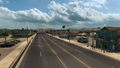
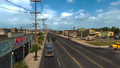
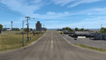
Kingman
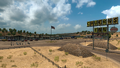
Grand Canyon Caverns
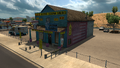
Historic Seligman Sundries Building
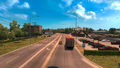
Flagstaff
Holbrook
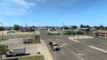
Gallup
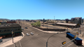
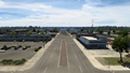
Tucumcari
Glenrio
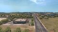
Adrian
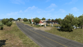
Shamrock
Clinton
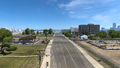
Tulsa


